* The alternate cell identity is an alternate identifier, apart from the
* globally unique cell identifier, which can be used to identify the cell.
*
* Subclasses for network families that use alternate identifiers must
* override this method to provide a string in the following form:
*
* {@code network:text-id[-id]*}
*
* {@code network} is a string which uniquely identifies the network family.
* It is followed by a colon and a {@code text} which marks the identifier
* as an alternate identifier, a dash and a sequence of {@code id}s in
* hierarchical order (top to bottom), separated by dashes. Leading zeroes
* are stripped from {@code id}s. The {@code id} structure is specific to
* the network family.
*
* Network families that do not use alternate identifiers should inherit
* the default implementation, which returns {@code null}.
*/
public String getAltText() {
return null;
}
public int getDbm() {
return dbm;
}
public int getGeneration() {
return generation;
}
/**
* Returns the network generation of a phone network type.
* @param networkType The network type as returned by {@link TelephonyManager.getNetworkType}
* @return 2, 3 or 4 for 2G, 3G or 4G; 0 for unknown
*/
public static int getGenerationFromNetworkType(int networkType) {
switch (networkType) {
case TelephonyManager.NETWORK_TYPE_CDMA:
case TelephonyManager.NETWORK_TYPE_EDGE:
case TelephonyManager.NETWORK_TYPE_GPRS:
case TelephonyManager.NETWORK_TYPE_IDEN:
return 2;
case TelephonyManager.NETWORK_TYPE_1xRTT:
case TelephonyManager.NETWORK_TYPE_EHRPD:
case TelephonyManager.NETWORK_TYPE_EVDO_0:
case TelephonyManager.NETWORK_TYPE_EVDO_A:
case TelephonyManager.NETWORK_TYPE_EVDO_B:
case TelephonyManager.NETWORK_TYPE_HSDPA:
case TelephonyManager.NETWORK_TYPE_HSPA:
case TelephonyManager.NETWORK_TYPE_HSPAP:
case TelephonyManager.NETWORK_TYPE_HSUPA:
case TelephonyManager.NETWORK_TYPE_UMTS:
return 3;
case TelephonyManager.NETWORK_TYPE_LTE:
return 4;
default:
return 0;
}
}
/**
* Returns the cell identity in text form.
*
* Subclasses must override this method to provide a string in the following form:
*
* {@code network:id[-id]*}
*
* {@code network} is a string which uniquely identifies the network family.
* It is followed by a colon and a sequence of {@code id}s in hierarchical
* order (top to bottom), separated by dashes. Leading zeroes are stripped
* from {@code id}s. The {@code id} structure is specific to the network
* family.
*/
public abstract String getText();
/**
* Whether the cell was included in the last update from any of the sources.
*
* When an update is received from a source, cells that were received in an
* earlier update from the same source have the flag for that source reset
* but are still kept in the list until the next update. Such cells should
* be considered stale and not be displayed in any list of active cells.
* @return {@code true} if the cell has its flag for at least one source set, {@code false} if not
*/
public boolean hasSource() {
return (source >= 0);
}
public boolean isCellInfo() {
return ((source & SOURCE_CELL_INFO) == SOURCE_CELL_INFO);
}
public boolean isCellLocation() {
return ((source & SOURCE_CELL_LOCATION) == SOURCE_CELL_LOCATION);
}
public boolean isNeighboringCellInfo() {
return ((source & SOURCE_NEIGHBORING_CELL_INFO) == SOURCE_NEIGHBORING_CELL_INFO);
}
/**
* Whether the device is currently registered with this cell.
*
* If the cell was updated through a {@link android.telephony.CellLocation},
* this method will always return {@code true}.
*/
public boolean isServing() {
return (serving || ((this.source & SOURCE_CELL_LOCATION) != 0));
}
/**
* Determines a "loose match" for two parts of a cell ID.
*
* A "loose match" will return true if one of its two arguments is {@link #UNKNOWN}, or if both
* arguments are truly equal.
*
* Any part of a cell identification (e.g. MCC, MNC, any area ID, cell ID, scrambling code) can
* be compared in this manner as long as it assigns a value of {@link #UNKNOWN} to values which
* are not known, and only to those.
*
* @param l
* @param r
* @return True for a match, false otherwise
*/
public static boolean matches(int l, int r) {
if ((l == UNKNOWN) || (r == UNKNOWN))
return true;
return (l == r);
}
public void setCellInfo(boolean value) {
if (value)
this.source = this.source | SOURCE_CELL_INFO;
else
this.source = this.source & ~SOURCE_CELL_INFO;
}
public void setCellLocation(boolean value) {
if (value)
this.source = this.source | SOURCE_CELL_LOCATION;
else
this.source = this.source & ~SOURCE_CELL_LOCATION;
}
public void setDbm(int dbm) {
this.dbm = dbm;
}
public void setGeneration(int generation) {
if (this instanceof CellTowerLte)
Log.d(this.getClass().getSimpleName(), String.format("Setting network type to %d for cell %s (%s)", generation, this.getText(), this.getAltText()));
this.generation = generation;
}
public void setNeighboringCellInfo(boolean value) {
if (value)
this.source = this.source | SOURCE_NEIGHBORING_CELL_INFO;
else
this.source = this.source & ~SOURCE_NEIGHBORING_CELL_INFO;
}
/**
* Sets the network generation based on the phone network type.
*
* The value set here cannot be retrieved directly, but subsequent calls to
* {@link #getGeneration()} will return the corresponding generation.
* @param networkType The network type as returned by {@link TelephonyManager.getNetworkType}
*/
public void setNetworkType(int networkType) {
if (this instanceof CellTowerLte)
Log.d(this.getClass().getSimpleName(), String.format("Changing network type for cell %s (%s)", this.getText(), this.getAltText()));
this.generation = getGenerationFromNetworkType(networkType);
}
public void setServing(boolean serving) {
this.serving = serving;
}
}
================================================
FILE: src/com/vonglasow/michael/satstat/data/CellTowerCdma.java
================================================
package com.vonglasow.michael.satstat.data;
public class CellTowerCdma extends CellTower {
public static final String FAMILY = "cdma";
private int bsid;
private int nid;
private int sid;
public CellTowerCdma(int sid, int nid, int bsid) {
super();
this.setSid(sid);
this.setNid(nid);
this.setBsid(bsid);
}
public int getBsid() {
return bsid;
}
public int getNid() {
return nid;
}
public int getSid() {
return sid;
}
/**
* Returns the cell identity in text form.
*
* For CDMA-like networks this string has the following form:
*
* {@code cdma:sid-nid-bsid}
*
* The first is a string which uniquely identifies the network family.
* It is followed by a colon and a sequence of System ID, Network ID and
* Base Station ID, separated by dashes and with no leading zeroes.
*/
@Override
public String getText() {
return getText(sid, nid, bsid);
}
/**
* Converts a SID/NID/BSID tuple to an identity string, or {@code null}
* if BSID is invalid.
*/
public static String getText(int sid, int nid, int bsid) {
int iSid = ((sid == -1) || (sid == Integer.MAX_VALUE)) ? CellTower.UNKNOWN : sid;
int iNid = ((nid == -1) || (nid == Integer.MAX_VALUE)) ? CellTower.UNKNOWN : nid;
if ((bsid == -1) || (bsid == Integer.MAX_VALUE))
return null;
else
return String.format("%s:%d-%d-%d", FAMILY, iSid, iNid, bsid);
}
public void setBsid(int bsid) {
if ((bsid != Integer.MAX_VALUE) && (bsid != -1))
this.bsid = bsid;
else
this.bsid = CellTower.UNKNOWN;
}
public void setNid(int nid) {
if ((nid != Integer.MAX_VALUE) && (nid != -1))
this.nid = nid;
else
this.nid = CellTower.UNKNOWN;
}
public void setSid(int sid) {
if ((sid != Integer.MAX_VALUE) && (sid != -1))
this.sid = sid;
else
this.sid = CellTower.UNKNOWN;
}
}
================================================
FILE: src/com/vonglasow/michael/satstat/data/CellTowerGsm.java
================================================
package com.vonglasow.michael.satstat.data;
public class CellTowerGsm extends CellTower {
public static final String ALT_ID = "pci";
public static final String FAMILY = "gsm";
public static final int MAX_2G_CID = 65535;
private int cid;
private int lac;
private int mcc;
private int mnc;
private int psc;
public CellTowerGsm(int mcc, int mnc, int lac, int cid, int psc) {
super();
this.setMcc(mcc);
this.setMnc(mnc);
this.setLac(lac);
this.setCid(cid);
this.setPsc(psc);
}
/**
* Returns the alternate cell identity in text form.
*
* For UMTS networks this string has the following form:
*
* {@code gsm:psc-nnn}
*
* The first is a string which uniquely identifies the network family.
* It is followed by a colon, the string {@code psc} to denote an alternate
* cell identity, a dash and the primary scrambling code (PSC) with no
* leading zeroes.
*
* A result is only returned for UMTS (3G) cells with a valid PSC. In all
* other cases, {@code null} is returned.
*/
public String getAltText() {
return getAltText(this.psc);
}
/**
* Converts a PSC to an alternate identity string, or {@code null} if the
* PSC is invalid.
*/
public static String getAltText(int psc) {
if ((psc == CellTower.UNKNOWN) || (psc == Integer.MAX_VALUE))
return null;
return String.format("%s:%s-%d", FAMILY, ALT_ID, psc);
}
public int getCid() {
return this.cid;
}
public int getLac() {
return this.lac;
}
public int getMcc() {
return this.mcc;
}
public int getMnc() {
return this.mnc;
}
public int getPsc() {
return this.psc;
}
/**
* Returns the cell identity in text form.
*
* For GSM-like networks this string has the following form:
*
* {@code gsm:mcc-mnc-lac-cid}
*
* The first is a string which uniquely identifies the network family.
* It is followed by a colon and a sequence of country code, network code,
* Local Area Code and Cell ID, separated by dashes and with no leading
* zeroes.
*/
@Override
public String getText() {
return getText(mcc, mnc, lac, cid);
}
/**
* Converts a MCC/MNC/LAC/CID tuple to an identity string, or
* {@code null} if CID is invalid.
*/
public static String getText(int mcc, int mnc, int lac, int cid) {
int iMcc = ((mcc == -1) || (mcc == Integer.MAX_VALUE)) ? CellTower.UNKNOWN : mcc;
int iMnc = ((mnc == -1) || (mnc == Integer.MAX_VALUE)) ? CellTower.UNKNOWN : mnc;
int iLac = ((lac == -1) || (lac == Integer.MAX_VALUE)) ? CellTower.UNKNOWN : lac;
if ((cid == -1) || (cid == Integer.MAX_VALUE))
return null;
else
return String.format("%s:%d-%d-%d-%d", FAMILY, iMcc, iMnc, iLac, cid);
}
/**
* Sets signal strength dBm based on ASU.
*
* ASU can be converted into dBm with the formula:
* {@code dBm = -113 + 2 * asu}. The reporting range is from -113 dBm to
* -51 dBm (0 to 31). Values outside this range will be ignored. Refer to
* 3GPP TS 27.007 (Ver 10.3.0) Sec 8.69
*/
// or 3GPP TS 27.007 8.5
public void setAsu(int asu){
if ((asu >= 0) || (asu <= 31))
this.setDbm(-113 + 2 * asu);
}
public void setCid(int cid) {
if ((cid != Integer.MAX_VALUE) && (cid != -1))
this.cid = cid;
else
this.cid = CellTower.UNKNOWN;
if (this.cid > MAX_2G_CID)
this.generation = 3;
}
/**
* Sets signal strength dBm based on CPICH RSCP.
*
* RSCP is Received Signal Code Power. This value can be converted into dBm
* with the formula: {@code dBm = rscp - 116}. The reporting range for
* CPICH RSCP is from -120 dBm to -25 dBm (-5 to 91, with the two extremes
* indicating any RSCP outside the reporting range). Values outside this
* range will be ignored. Refer to 3GPP TS 25.133 (Ver 10.2.0) 9.1.1.3.
*
* Note: It seems that at least on some devices
* {@link android.telephony.NeighboringCellInfo#getRssi()} returns RSCP in
* dBm rather than the index specified in the document. This method
* attempts to guess the unit and set signal strength to the correct value
* in either case. See
* http://stackoverflow.com/questions/26620378/android-neighboringcellinfo-getrssi-returning-weird-data-for-umts-cells
*/
public void setCpichRscp(int rscp){
if ((rscp >= -5) && (rscp <= 91))
this.setDbm(rscp - 116);
else if ((rscp >= -121) && (rscp <=-25))
this.setDbm(rscp);
}
public void setLac(int lac) {
if ((lac != Integer.MAX_VALUE) && (lac != -1))
this.lac = lac;
else
this.lac = CellTower.UNKNOWN;
}
public void setMcc(int mcc) {
if ((mcc != Integer.MAX_VALUE) && (mcc != -1))
this.mcc = mcc;
else
this.mcc = CellTower.UNKNOWN;
}
public void setMnc(int mnc) {
if ((mcc != Integer.MAX_VALUE) && (mcc != -1))
this.mnc = mnc;
else
this.mnc = CellTower.UNKNOWN;
}
public void setPsc(int psc) {
if ((psc != Integer.MAX_VALUE) && (psc != -1)) {
this.psc = psc;
this.generation = 3;
} else
this.psc = CellTower.UNKNOWN;
}
}
================================================
FILE: src/com/vonglasow/michael/satstat/data/CellTowerList.java
================================================
package com.vonglasow.michael.satstat.data;
import java.util.ArrayList;
import java.util.HashMap;
import java.util.HashSet;
import java.util.Set;
public abstract class CellTowerList extends HashMap {
/**
* Returns all entries in the list.
*
* This method returns all entries in the list, with duplicates eliminated.
* It is preferred over {@link #values()}, which may return duplicates.
* @return
*/
public Set getAll() {
Set result = new HashSet(this.values());
return result;
}
/**
* Removes cells of the specified source.
*
* This method clears the flags corresponding to {@code source} in the
* internal source field of all entries, and removes entries whose source
* field is null. Call this method prior to adding new data from a source,
* to tell the list that any cell information previously supplied by this
* source is no longer current.
* @param source Any combination of
* {@link com.michael.vonglasow.satstat.data.CellTower#SOURCE_CELL_LOCATION},
* {@link com.michael.vonglasow.satstat.data.CellTower#SOURCE_NEIGHBORING_CELL_INFO}
* or {@link com.michael.vonglasow.satstat.data.CellTower#SOURCE_CELL_INFO}.
*/
public void removeSource(int source) {
ArrayList toDelete = new ArrayList();
for (String entry : this.keySet()) {
CellTower ct = this.get(entry);
ct.source = ct.source & ~source;
if (ct.source == 0)
toDelete.add(entry);
}
for (String entry : toDelete)
this.remove(entry);
}
}
================================================
FILE: src/com/vonglasow/michael/satstat/data/CellTowerListCdma.java
================================================
package com.vonglasow.michael.satstat.data;
import java.util.List;
import android.annotation.TargetApi;
import android.os.Build;
import android.telephony.CellIdentityCdma;
import android.telephony.CellInfo;
import android.telephony.CellInfoCdma;
import android.telephony.cdma.CdmaCellLocation;
public class CellTowerListCdma extends CellTowerList {
/**
* Returns the cell tower with the specified data, or {@code null} if it is not in the list.
*/
public CellTowerCdma get(int sid, int nid, int bsid) {
String entry = CellTowerCdma.getText(sid, nid, bsid);
if (entry == null)
return null;
else
return this.get(entry);
}
/**
* Adds or updates a cell tower.
*
* If the cell tower is already in the list, it is replaced; if not, a new
* entry is created.
*
* This method will set the cell's identity data. After this call,
* {@link #isServing()} will return {@code true} for this cell.
* @return The new or updated entry.
*/
public CellTowerCdma update(CdmaCellLocation location) {
CellTowerCdma result = this.get(location.getSystemId(), location.getNetworkId(), location.getBaseStationId());
if (result == null) {
result = new CellTowerCdma(location.getSystemId(), location.getNetworkId(), location.getBaseStationId());
this.put(result.getText(), result);
}
result.setCellLocation(true);
return result;
}
/**
* Adds or updates a cell tower.
*
* If the cell tower is already in the list, it is replaced; if not, a new
* entry is created.
*
* This method will set the cell's identity data, its signal strength and
* whether it is the currently serving cell. If the API level is 18 or
* higher, it will also set the generation.
* @return The new or updated entry.
*/
@TargetApi(Build.VERSION_CODES.JELLY_BEAN_MR1)
public CellTowerCdma update(CellInfoCdma cell) {
if (Build.VERSION.SDK_INT < Build.VERSION_CODES.JELLY_BEAN_MR1)
return null;
CellIdentityCdma cid = cell.getCellIdentity();
CellTowerCdma result = this.get(cid.getSystemId(), cid.getNetworkId(), cid.getBasestationId());
if (result == null) {
result = new CellTowerCdma(cid.getSystemId(), cid.getNetworkId(), cid.getBasestationId());
this.put(result.getText(), result);
}
result.setCellInfo(true);
result.setDbm(cell.getCellSignalStrength().getDbm());
result.setServing(cell.isRegistered());
return result;
}
/**
* Adds or updates a list of cell towers.
*
* This method first calls {@link #removeSource(int)} with
* {@link com.vonglasow.michael.satstat.data.CellTower#SOURCE_CELL_INFO} as
* its argument. Then it iterates through all entries in {@code cells} and
* updates each entry that is of type {@link android.telephony.CellInfoCdma}
* by calling {@link #update(CellInfoCdma)}, passing that entry as the
* argument.
*/
@TargetApi(Build.VERSION_CODES.JELLY_BEAN_MR1)
public void updateAll(List cells) {
if (Build.VERSION.SDK_INT < Build.VERSION_CODES.JELLY_BEAN_MR1)
return;
this.removeSource(CellTower.SOURCE_CELL_INFO);
if (cells == null)
return;
for (CellInfo cell : cells)
if (cell instanceof CellInfoCdma)
this.update((CellInfoCdma) cell);
}
}
================================================
FILE: src/com/vonglasow/michael/satstat/data/CellTowerListGsm.java
================================================
package com.vonglasow.michael.satstat.data;
import java.util.List;
import android.annotation.TargetApi;
import android.os.Build;
import android.telephony.CellIdentityGsm;
import android.telephony.CellIdentityWcdma;
import android.telephony.CellInfo;
import android.telephony.CellInfoGsm;
import android.telephony.CellInfoWcdma;
import android.telephony.NeighboringCellInfo;
import android.telephony.TelephonyManager;
import android.telephony.gsm.GsmCellLocation;
import android.util.Log;
public class CellTowerListGsm extends CellTowerList {
/**
* Returns the cell tower with the specified data, or {@code null} if it is not in the list.
*/
public CellTowerGsm get(int psc) {
String entry = CellTowerGsm.getAltText(psc);
if (entry == null)
return null;
else
return this.get(entry);
}
/**
* Returns the cell tower with the specified data, or {@code null} if it is not in the list.
*/
public CellTowerGsm get(int mcc, int mnc, int lac, int cid) {
String entry = CellTowerGsm.getText(mcc, mnc, lac, cid);
if (entry == null)
return null;
else
return this.get(entry);
}
/**
* Adds or updates a cell tower.
*
* If the cell tower is already in the list, its data is updated; if not, a
* new entry is created.
*
* This method will set the cell's identity data. After this call,
* {@link #isServing()} will return {@code true} for this cell.
* @param networkOperator The network operator, as returned by {@link android.telephony.TelephonyManager#getNetworkOperator()}.
* @param location The {@link android.telephony.GsmCellLocation}, as returned by {@link android.telephony.TelephonyManager#getCellLocation()}.
* @return The new or updated entry.
*/
public CellTowerGsm update(String networkOperator, GsmCellLocation location) {
int mcc = CellTower.UNKNOWN;
int mnc = CellTower.UNKNOWN;
if (networkOperator.length() > 3) {
mcc = Integer.parseInt(networkOperator.substring(0, 3));
mnc = Integer.parseInt(networkOperator.substring(3));
}
CellTowerGsm result = null;
CellTowerGsm cand = this.get(mcc, mnc, location.getLac(), location.getCid());
if ((cand != null) && CellTower.matches(location.getPsc(), cand.getPsc()))
result = cand;
if (result == null) {
cand = this.get(location.getPsc());
if ((cand != null)
&& CellTower.matches(mcc, cand.getMcc())
&& CellTower.matches(mnc, cand.getMnc())
&& CellTower.matches(location.getLac(), cand.getLac())
&& CellTower.matches(location.getCid(), cand.getCid()))
result = cand;
}
if (result == null)
result = new CellTowerGsm(mcc, mnc, location.getLac(), location.getCid(), location.getPsc());
if (result.getMcc() == CellTower.UNKNOWN)
result.setMcc(mcc);
if (result.getMnc() == CellTower.UNKNOWN)
result.setMnc(mnc);
if (result.getLac() == CellTower.UNKNOWN)
result.setLac(location.getLac());
if (result.getCid() == CellTower.UNKNOWN)
result.setCid(location.getCid());
if (result.getPsc() == CellTower.UNKNOWN)
result.setPsc(location.getPsc());
this.put(result.getText(), result);
this.put(result.getAltText(), result);
if ((result.getText() == null) && (result.getAltText() == null))
Log.d(this.getClass().getSimpleName(), String.format("Added %d G cell with no data from GsmCellLocation", result.getGeneration()));
result.setCellLocation(true);
return result;
}
/**
* Adds or updates a cell tower.
*
* If the cell tower is already in the list, its data is updated; if not, a
* new entry is created. Cells whose network type is not a flavor of GSM or
* UMTS will be rejected.
*
* This method will set the cell's identity data, generation and its signal
* strength.
* @return The new or updated entry, or {@code null} if the cell was rejected
*/
public CellTowerGsm update(String networkOperator, NeighboringCellInfo cell) {
int mcc = CellTower.UNKNOWN;
int mnc = CellTower.UNKNOWN;
if (networkOperator.length() > 3) {
mcc = Integer.parseInt(networkOperator.substring(0, 3));
mnc = Integer.parseInt(networkOperator.substring(3));
}
CellTowerGsm result = null;
CellTowerGsm cand = this.get(mcc, mnc, cell.getLac(), cell.getCid());
if ((cand != null) && CellTower.matches(cell.getPsc(), cand.getPsc()))
result = cand;
if (result == null) {
cand = this.get(cell.getPsc());
if ((cand != null)
&& CellTower.matches(mcc, cand.getMcc())
&& CellTower.matches(mnc, cand.getMnc())
&& CellTower.matches(cell.getLac(), cand.getLac())
&& CellTower.matches(cell.getCid(), cand.getCid()))
result = cand;
}
if (result == null)
result = new CellTowerGsm(mcc, mnc, cell.getLac(), cell.getCid(), cell.getPsc());
result.setNeighboringCellInfo(true);
int networkType = cell.getNetworkType();
switch (networkType) {
case TelephonyManager.NETWORK_TYPE_UMTS:
case TelephonyManager.NETWORK_TYPE_HSDPA:
case TelephonyManager.NETWORK_TYPE_HSUPA:
case TelephonyManager.NETWORK_TYPE_HSPA:
/*
* for details see TS 25.133 section 9.1.1.3
* http://www.3gpp.org/DynaReport/25133.htm
*/
result.setCpichRscp(cell.getRssi());
break;
case TelephonyManager.NETWORK_TYPE_EDGE:
case TelephonyManager.NETWORK_TYPE_GPRS:
result.setAsu(cell.getRssi());
break;
default:
// not a GSM or UMTS cell, return
return null;
// result.setDbm(CellTower.DBM_UNKNOWN);
// not needed because this is the default value; setting it
// here might overwrite valid data obtained from a different
// source
}
result.setNetworkType(networkType);
if (result.getMcc() == CellTower.UNKNOWN)
result.setMcc(mcc);
if (result.getMnc() == CellTower.UNKNOWN)
result.setMnc(mnc);
if (result.getLac() == CellTower.UNKNOWN)
result.setLac(cell.getLac());
if (result.getCid() == CellTower.UNKNOWN)
result.setCid(cell.getCid());
if (result.getPsc() == CellTower.UNKNOWN)
result.setPsc(cell.getPsc());
this.put(result.getText(), result);
this.put(result.getAltText(), result);
if ((result.getText() == null) && (result.getAltText() == null))
Log.d(this.getClass().getSimpleName(), String.format("Added %d G cell with no data from NeighboringCellInfo", result.getGeneration()));
return result;
}
/**
* Adds or updates a cell tower.
*
* If the cell tower is already in the list, its data is updated; if not, a
* new entry is created.
*
* This method will set the cell's identity data, its signal strength and
* whether it is the currently serving cell. If the API level is 18 or
* higher, it will also set the generation.
* @return The new or updated entry.
*/
@TargetApi(Build.VERSION_CODES.JELLY_BEAN_MR1)
public CellTowerGsm update(CellInfoGsm cell) {
if (Build.VERSION.SDK_INT < Build.VERSION_CODES.JELLY_BEAN_MR1)
return null;
CellIdentityGsm cid = cell.getCellIdentity();
CellTowerGsm result = null;
CellTowerGsm cand = this.get(cid.getMcc(), cid.getMnc(), cid.getLac(), cid.getCid());
if ((cand != null) && CellTower.matches(cid.getPsc(), cand.getPsc()))
result = cand;
if (result == null) {
cand = this.get(cid.getPsc());
if ((cand != null)
&& ((cid.getMcc() == Integer.MAX_VALUE) || CellTower.matches(cid.getMcc(), cand.getMcc()))
&& ((cid.getMnc() == Integer.MAX_VALUE) || CellTower.matches(cid.getMnc(), cand.getMnc()))
&& ((cid.getLac() == Integer.MAX_VALUE) || CellTower.matches(cid.getLac(), cand.getLac()))
&& ((cid.getCid() == Integer.MAX_VALUE) ||CellTower.matches(cid.getCid(), cand.getCid())))
result = cand;
}
if (result == null)
result = new CellTowerGsm(cid.getMcc(), cid.getMnc(), cid.getLac(), cid.getCid(), cid.getPsc());
if (result.getMcc() == CellTower.UNKNOWN)
result.setMcc(cid.getMcc());
if (result.getMnc() == CellTower.UNKNOWN)
result.setMnc(cid.getMnc());
if (result.getLac() == CellTower.UNKNOWN)
result.setLac(cid.getLac());
if (result.getCid() == CellTower.UNKNOWN)
result.setCid(cid.getCid());
if (result.getPsc() == CellTower.UNKNOWN)
result.setPsc(cid.getPsc());
this.put(result.getText(), result);
this.put(result.getAltText(), result);
result.setCellInfo(true);
result.setDbm(cell.getCellSignalStrength().getDbm());
if (Build.VERSION.SDK_INT >= Build.VERSION_CODES.JELLY_BEAN_MR2)
result.setGeneration(2);
result.setServing(cell.isRegistered());
if ((result.getText() == null) && (result.getAltText() == null))
Log.d(this.getClass().getSimpleName(), String.format("Added %d G cell with no data from CellInfoGsm", result.getGeneration()));
return result;
}
/**
* Adds or updates a cell tower.
*
* If the cell tower is already in the list, its data is updated; if not, a
* new entry is created.
*
* This method will set the cell's identity data and generation, its signal
* strength and whether it is the currently serving cell.
* @return The new or updated entry.
*/
@TargetApi(Build.VERSION_CODES.JELLY_BEAN_MR2)
public CellTowerGsm update(CellInfoWcdma cell) {
if (Build.VERSION.SDK_INT < Build.VERSION_CODES.JELLY_BEAN_MR2)
return null;
CellIdentityWcdma cid = cell.getCellIdentity();
CellTowerGsm result = null;
CellTowerGsm cand = this.get(cid.getMcc(), cid.getMnc(), cid.getLac(), cid.getCid());
if ((cand != null) && CellTower.matches(cid.getPsc(), cand.getPsc()))
result = cand;
if (result == null) {
cand = this.get(cid.getPsc());
if ((cand != null)
&& ((cid.getMcc() == Integer.MAX_VALUE) || CellTower.matches(cid.getMcc(), cand.getMcc()))
&& ((cid.getMnc() == Integer.MAX_VALUE) || CellTower.matches(cid.getMnc(), cand.getMnc()))
&& ((cid.getLac() == Integer.MAX_VALUE) || CellTower.matches(cid.getLac(), cand.getLac()))
&& ((cid.getCid() == Integer.MAX_VALUE) ||CellTower.matches(cid.getCid(), cand.getCid())))
result = cand;
}
if (result == null)
result = new CellTowerGsm(cid.getMcc(), cid.getMnc(), cid.getLac(), cid.getCid(), cid.getPsc());
if (result.getMcc() == CellTower.UNKNOWN)
result.setMcc(cid.getMcc());
if (result.getMnc() == CellTower.UNKNOWN)
result.setMnc(cid.getMnc());
if (result.getLac() == CellTower.UNKNOWN)
result.setLac(cid.getLac());
if (result.getCid() == CellTower.UNKNOWN)
result.setCid(cid.getCid());
if (result.getPsc() == CellTower.UNKNOWN)
result.setPsc(cid.getPsc());
this.put(result.getText(), result);
this.put(result.getAltText(), result);
result.setCellInfo(true);
result.setDbm(cell.getCellSignalStrength().getDbm());
result.setGeneration(3);
result.setServing(cell.isRegistered());
if ((result.getText() == null) && (result.getAltText() == null))
Log.d(this.getClass().getSimpleName(), String.format("Added %d G cell with no data from CellInfoWcdma", result.getGeneration()));
return result;
}
/**
* Adds or updates a list of cell towers.
*
* This method first calls {@link #removeSource(int)} with
* {@link com.vonglasow.michael.satstat.data.CellTower#SOURCE_CELL_INFO} as
* its argument. Then it iterates through all entries in {@code cells} and
* updates each entry that is of type {@link android.telephony.CellInfoGsm}
* or {@link android.telephony.CellInfoWcdma} by calling
* {@link #update(CellInfoGsm)} or {@link #update(CellInfoWcdma)}
* (depending on type), passing that entry as the argument.
*/
public void updateAll(List cells) {
if (Build.VERSION.SDK_INT < Build.VERSION_CODES.JELLY_BEAN_MR1)
return;
this.removeSource(CellTower.SOURCE_CELL_INFO);
if (cells == null)
return;
for (CellInfo cell : cells)
if (cell instanceof CellInfoGsm)
this.update((CellInfoGsm) cell);
else if (Build.VERSION.SDK_INT >= Build.VERSION_CODES.JELLY_BEAN_MR2)
if (cell instanceof CellInfoWcdma)
this.update((CellInfoWcdma) cell);
}
/**
* Adds or updates a list of cell towers.
*
* This method first calls {@link #removeSource(int)} with
* {@link com.vonglasow.michael.satstat.data.CellTower#SOURCE_NEIGHBORING_CELL_INFO}
* as its argument. Then it iterates through all entries in {@code cells}
* and updates each entry by calling {@link #update(NeighboringCellInfo)},
* passing that entry as the argument.
*/
public void updateAll(String networkOperator, List cells) {
this.removeSource(CellTower.SOURCE_NEIGHBORING_CELL_INFO);
if (cells != null)
for (NeighboringCellInfo cell : cells)
this.update(networkOperator, cell);
}
}
================================================
FILE: src/com/vonglasow/michael/satstat/data/CellTowerListLte.java
================================================
package com.vonglasow.michael.satstat.data;
import java.util.List;
import android.annotation.TargetApi;
import android.os.Build;
import android.telephony.CellIdentityLte;
import android.telephony.CellInfo;
import android.telephony.CellInfoLte;
import android.telephony.NeighboringCellInfo;
import android.telephony.TelephonyManager;
import android.telephony.gsm.GsmCellLocation;
import android.util.Log;
public class CellTowerListLte extends CellTowerList {
/**
* Returns the cell tower with the specified data, or {@code null} if it is not in the list.
*/
public CellTowerLte get(int pci) {
String entry = CellTowerLte.getAltText(pci);
if (entry == null)
return null;
else
return this.get(entry);
}
/**
* Returns the cell tower with the specified data, or {@code null} if it is not in the list.
*/
public CellTowerLte get(int mcc, int mnc, int tac, int ci) {
String entry = CellTowerLte.getText(mcc, mnc, tac, ci);
if (entry == null)
return null;
else
return this.get(entry);
}
/**
* Adds or updates a cell tower.
*
* If the cell tower is already in the list, its data is updated; if not, a
* new entry is created.
*
* This method will set the cell's identity data. After this call,
* {@link #isServing()} will return {@code true} for this cell.
* @param networkOperator The network operator, as returned by {@link android.telephony.TelephonyManager#getNetworkOperator()}.
* @param location The {@link android.telephony.GsmCellLocation}, as returned by {@link android.telephony.TelephonyManager#getCellLocation()}.
* @return The new or updated entry.
*/
public CellTowerLte update(String networkOperator, GsmCellLocation location) {
int mcc = CellTower.UNKNOWN;
int mnc = CellTower.UNKNOWN;
if (networkOperator.length() > 3) {
mcc = Integer.parseInt(networkOperator.substring(0, 3));
mnc = Integer.parseInt(networkOperator.substring(3));
}
CellTowerLte result = null;
CellTowerLte cand = this.get(mcc, mnc, location.getLac(), location.getCid());
if ((cand != null) && CellTower.matches(location.getPsc(), cand.getPci()))
result = cand;
if (result == null) {
cand = this.get(location.getPsc());
if ((cand != null)
&& CellTower.matches(mcc, cand.getMcc())
&& CellTower.matches(mnc, cand.getMnc())
&& CellTower.matches(location.getLac(), cand.getTac())
&& CellTower.matches(location.getCid(), cand.getCi()))
result = cand;
}
if (result == null)
result = new CellTowerLte(mcc, mnc, location.getLac(), location.getCid(), location.getPsc());
if (result.getMcc() == CellTower.UNKNOWN)
result.setMcc(mcc);
if (result.getMnc() == CellTower.UNKNOWN)
result.setMnc(mnc);
if (result.getTac() == CellTower.UNKNOWN)
result.setTac(location.getLac());
if (result.getCi() == CellTower.UNKNOWN)
result.setCi(location.getCid());
if (result.getPci() == CellTower.UNKNOWN)
result.setPci(location.getPsc());
this.put(result.getText(), result);
this.put(result.getAltText(), result);
result.setCellLocation(true);
Log.d(this.getClass().getSimpleName(), String.format("Added GsmCellLocation for %s, %d G", result.getText(), result.getGeneration()));
return result;
}
/**
* Adds or updates a cell tower.
*
* If the cell tower is already in the list, its data is updated; if not, a
* new entry is created. Cells whose network type is not LTE will be
* rejected.
*
* This method will set the cell's identity data, generation and its signal
* strength.
* @return The new or updated entry, or {@code null} if the cell was rejected
*/
public CellTowerLte update(String networkOperator, NeighboringCellInfo cell) {
int mcc = CellTower.UNKNOWN;
int mnc = CellTower.UNKNOWN;
if (networkOperator.length() > 3) {
mcc = Integer.parseInt(networkOperator.substring(0, 3));
mnc = Integer.parseInt(networkOperator.substring(3));
}
CellTowerLte result = null;
CellTowerLte cand = this.get(mcc, mnc, cell.getLac(), cell.getCid());
if ((cand != null) && CellTower.matches(cell.getPsc(), cand.getPci()))
result = cand;
if (result == null) {
cand = this.get(cell.getPsc());
if ((cand != null)
&& CellTower.matches(mcc, cand.getMcc())
&& CellTower.matches(mnc, cand.getMnc())
&& CellTower.matches(cell.getLac(), cand.getTac())
&& CellTower.matches(cell.getCid(), cand.getCi()))
result = cand;
}
if (result == null)
result = new CellTowerLte(mcc, mnc, cell.getLac(), cell.getCid(), cell.getPsc());
result.setNeighboringCellInfo(true);
int networkType = cell.getNetworkType();
switch (networkType) {
case TelephonyManager.NETWORK_TYPE_LTE:
result.setAsu(cell.getRssi());
break;
default:
// not an LTE cell, return
return null;
}
result.setNetworkType(networkType);
if (result.getMcc() == CellTower.UNKNOWN)
result.setMcc(mcc);
if (result.getMnc() == CellTower.UNKNOWN)
result.setMnc(mnc);
if (result.getTac() == CellTower.UNKNOWN)
result.setTac(cell.getLac());
if (result.getCi() == CellTower.UNKNOWN)
result.setCi(cell.getCid());
if (result.getPci() == CellTower.UNKNOWN)
result.setPci(cell.getPsc());
this.put(result.getText(), result);
this.put(result.getAltText(), result);
Log.d(this.getClass().getSimpleName(), String.format("Added NeighboringCellInfo for %s, %d G, %d dBm",
result.getText(),
result.getGeneration(),
result.getDbm()));
return result;
}
/**
* Adds or updates a cell tower.
*
* If the cell tower is already in the list, its data is updated; if not, a
* new entry is created.
*
* This method will set the cell's identity data, its signal strength and
* whether it is the currently serving cell.
* @return The new or updated entry.
*/
@TargetApi(Build.VERSION_CODES.JELLY_BEAN_MR1)
public CellTowerLte update(CellInfoLte cell) {
if (Build.VERSION.SDK_INT < Build.VERSION_CODES.JELLY_BEAN_MR1)
return null;
CellIdentityLte cid = cell.getCellIdentity();
CellTowerLte result = null;
CellTowerLte cand = this.get(cid.getMcc(), cid.getMnc(), cid.getTac(), cid.getCi());
if ((cand != null) && CellTower.matches(cid.getPci(), cand.getPci()))
result = cand;
if (result == null) {
cand = this.get(cid.getPci());
if ((cand != null)
&& ((cid.getMcc() == Integer.MAX_VALUE) || CellTower.matches(cid.getMcc(), cand.getMcc()))
&& ((cid.getMnc() == Integer.MAX_VALUE) || CellTower.matches(cid.getMnc(), cand.getMnc()))
&& ((cid.getTac() == Integer.MAX_VALUE) || CellTower.matches(cid.getTac(), cand.getTac()))
&& ((cid.getCi() == Integer.MAX_VALUE) ||CellTower.matches(cid.getCi(), cand.getCi())))
result = cand;
}
if (result == null)
result = new CellTowerLte(cid.getMcc(), cid.getMnc(), cid.getTac(), cid.getCi(), cid.getPci());
if (result.getMcc() == CellTower.UNKNOWN)
result.setMcc(cid.getMcc());
if (result.getMnc() == CellTower.UNKNOWN)
result.setMnc(cid.getMnc());
if (result.getTac() == CellTower.UNKNOWN)
result.setTac(cid.getTac());
if (result.getCi() == CellTower.UNKNOWN)
result.setCi(cid.getCi());
if (result.getPci() == CellTower.UNKNOWN)
result.setPci(cid.getPci());
this.put(result.getText(), result);
this.put(result.getAltText(), result);
result.setCellInfo(true);
result.setDbm(cell.getCellSignalStrength().getDbm());
result.setServing(cell.isRegistered());
Log.d(this.getClass().getSimpleName(), String.format("Added CellInfoLte for %s, %d G, %d dBm",
result.getText(),
result.getGeneration(),
result.getDbm()));
return result;
}
/**
* Adds or updates a list of cell towers.
*
* This method first calls {@link #removeSource(int)} with
* {@link com.vonglasow.michael.satstat.data.CellTower#SOURCE_CELL_INFO} as
* its argument. Then it iterates through all entries in {@code cells} and
* updates each entry that is of type {@link android.telephony.CellInfoLte}
* by calling {@link #update(CellInfoLte)}, passing that entry as the
* argument.
*/
@TargetApi(Build.VERSION_CODES.JELLY_BEAN_MR1)
public void updateAll(List cells) {
if (Build.VERSION.SDK_INT < Build.VERSION_CODES.JELLY_BEAN_MR1)
return;
this.removeSource(CellTower.SOURCE_CELL_INFO);
if (cells == null)
return;
for (CellInfo cell : cells)
if (cell instanceof CellInfoLte)
this.update((CellInfoLte) cell);
}
/**
* Adds or updates a list of cell towers.
*
* This method first calls {@link #removeSource(int)} with
* {@link com.vonglasow.michael.satstat.data.CellTower#SOURCE_NEIGHBORING_CELL_INFO}
* as its argument. Then it iterates through all entries in {@code cells}
* and updates each entry by calling {@link #update(NeighboringCellInfo)},
* passing that entry as the argument.
*/
public void updateAll(String networkOperator, List cells) {
this.removeSource(CellTower.SOURCE_NEIGHBORING_CELL_INFO);
if (cells != null)
for (NeighboringCellInfo cell : cells)
this.update(networkOperator, cell);
}
}
================================================
FILE: src/com/vonglasow/michael/satstat/data/CellTowerLte.java
================================================
package com.vonglasow.michael.satstat.data;
public class CellTowerLte extends CellTower {
public static final String ALT_ID = "pci";
public static final String FAMILY = "lte";
private int ci;
private int tac;
private int mcc;
private int mnc;
private int pci;
public CellTowerLte(int mcc, int mnc, int tac, int ci, int pci) {
super();
this.setMcc(mcc);
this.setMnc(mnc);
this.setTac(tac);
this.setCi(ci);
this.setPci(pci);
this.generation = 4;
}
/**
* Returns the alternate cell identity in text form.
*
* For UMTS networks this string has the following form:
*
* {@code lte:pci-nnn}
*
* The first is a string which uniquely identifies the network family.
* It is followed by a colon, the string {@code pci} to denote an alternate
* cell identity, a dash and the physical cell identity (PCI) with no
* leading zeroes.
*
* A result is only returned for cells with a valid PCI. In all other
* cases, {@code null} is returned.
*/
public String getAltText() {
return getAltText(this.pci);
}
/**
* Converts a PSC to an alternate identity string, or {@code null} if the
* PSC is invalid.
*/
public static String getAltText(int pci) {
if ((pci == CellTower.UNKNOWN) || (pci == Integer.MAX_VALUE))
return null;
return String.format("%s:%s-%d", FAMILY, ALT_ID, pci);
}
public int getCi() {
return this.ci;
}
public int getTac() {
return this.tac;
}
public int getMcc() {
return this.mcc;
}
public int getMnc() {
return this.mnc;
}
public int getPci() {
return this.pci;
}
/**
* Returns the cell identity in text form.
*
* For LTE networks this string has the following form:
*
* {@code lte:mcc-mnc-tac-ci}
*
* The first is a string which uniquely identifies the network family.
* It is followed by a colon and a sequence of country code, network code,
* Tracking Area Code and Cell ID, separated by dashes and with no leading
* zeroes.
*/
@Override
public String getText() {
return getText(mcc, mnc, tac, ci);
}
/**
* Converts a MCC/MNC/TAC/CI tuple to an identity string, or
* {@code null} if CI is invalid.
*/
public static String getText(int mcc, int mnc, int tac, int ci) {
int iMcc = ((mcc == -1) || (mcc == Integer.MAX_VALUE)) ? CellTower.UNKNOWN : mcc;
int iMnc = ((mnc == -1) || (mnc == Integer.MAX_VALUE)) ? CellTower.UNKNOWN : mnc;
int iTac = ((tac == -1) || (tac == Integer.MAX_VALUE)) ? CellTower.UNKNOWN : tac;
if ((ci == -1) || (ci == Integer.MAX_VALUE))
return null;
else
return String.format("%s:%d-%d-%d-%d", FAMILY, iMcc, iMnc, iTac, ci);
}
/**
* Sets signal strength dBm based on ASU.
*
* This helper function formats any item of cell information data, such as
* the cell ID, PSC or similar. For valid data a string with the properly
* formatted value will be returned. If the input value is
* {@link com.vonglasow.michael.satstat.data.CellTower#UNKNOWN}, then the
* {@code value_none} resource string will be returned.
* @param context the context of the caller
* @param format a format string, which must contain placeholders for exactly one variable, or {@code null}.
* @param raw the value to format
* @return
*/
public static String formatCellData(Context context, String format, int raw) {
if (raw == CellTower.UNKNOWN)
return context.getResources().getString(R.string.value_none);
else {
String fmt = (format != null) ? format : "%d";
return String.format(fmt, raw);
}
}
/**
* Formats cell signal strength for display.
*
* This helper function formats the signal strength for a cell. For valid
* data a string with the properly formatted value will be returned. If the
* input value is
* {@link com.vonglasow.michael.satstat.data.CellTower#DBM_UNKNOWN}, then
* the {@code value_none} resource string will be returned.
* @param context the context of the caller
* @param format a format string, which must contain placeholders for exactly one variable, or {@code null}.
* @param raw the signal strength in dBm
* @return
*/
public static String formatCellDbm(Context context, String format, int raw) {
if (raw == CellTower.DBM_UNKNOWN)
return context.getResources().getString(R.string.value_none);
else {
String fmt = (format != null) ? format : "%d";
return String.format(fmt, raw);
}
}
/**
* Gets the WiFi channel number for a frequency
* @param frequency The frequency in MHz
* @return The channel number corresponding to {@code frequency}
*/
public static String getChannelFromFrequency(int frequency) {
if (channelsFrequency.containsKey(frequency)) {
return String.valueOf(channelsFrequency.get(frequency));
}
else {
return "?";
}
}
/**
* Gets the display color for a phone network generation.
* @param generation The network generation, i.e. {@code 2}, {@code 3} or {@code 4} for any flavor of 2G, 3G or 4G, or {@code 0} for unknown
* @return The color in which to display the indicator. If {@code generation} is {@code 0} or not a valid generation, the color returned will be transparent.
*/
public static int getColorFromGeneration(int generation) {
switch (generation) {
case 2:
return(R.color.gen2);
case 3:
return(R.color.gen3);
case 4:
return(R.color.gen4);
default:
return(android.R.color.transparent);
}
}
@TargetApi(Build.VERSION_CODES.JELLY_BEAN_MR1)
@Override
public View onCreateView(LayoutInflater inflater, ViewGroup container,
Bundle savedInstanceState) {
mainActivity = (MainActivity) this.getContext();
View rootView = inflater.inflate(R.layout.fragment_main_radio, container, false);
// Initialize controls
rilGsmLayout = (LinearLayout) rootView.findViewById(R.id.rilGsmLayout);
rilCells = (TableLayout) rootView.findViewById(R.id.rilCells);
rilCdmaLayout = (LinearLayout) rootView.findViewById(R.id.rilCdmaLayout);
rilCdmaCells = (TableLayout) rootView.findViewById(R.id.rilCdmaCells);
rilLteLayout = (LinearLayout) rootView.findViewById(R.id.rilLteLayout);
rilLteCells = (TableLayout) rootView.findViewById(R.id.rilLteCells);
wifiAps = (LinearLayout) rootView.findViewById(R.id.wifiAps);
rilGsmLayout.setVisibility(View.GONE);
rilCdmaLayout.setVisibility(View.GONE);
rilLteLayout.setVisibility(View.GONE);
networkTimehandler = new Handler();
networkTimeRunnable = new Runnable() {
@Override
public void run() {
int newNetworkType = mainActivity.telephonyManager.getNetworkType();
if (CellTower.getGenerationFromNetworkType(newNetworkType) != mLastNetworkGen)
onNetworkTypeChanged(newNetworkType);
else
networkTimehandler.postDelayed(this, NETWORK_REFRESH_DELAY);
}
};
wifiComparator = new WifiScanResultComparator();
wifiComparator.setCriterion(mainActivity.prefWifiSort);
wifiTimehandler = new Handler();
wifiTimeRunnable = new Runnable() {
@Override
public void run() {
mainActivity.wifiManager.startScan();
wifiTimehandler.postDelayed(this, WIFI_REFRESH_DELAY);
}
};
//get current phone info (first update won't fire until the cell actually changes)
if (ContextCompat.checkSelfPermission(mainActivity, Manifest.permission.ACCESS_FINE_LOCATION) == PackageManager.PERMISSION_GRANTED)
updateCellData(null, null, null);
else
mainActivity.permsRequested[Const.PERM_REQUEST_CELL_INFO] = true;
//and make sure we have the correct network type
onNetworkTypeChanged(mainActivity.telephonyManager.getNetworkType());
mainActivity.wifiManager.startScan();
mainActivity.radioSectionFragment = this;
return rootView;
}
@Override
public void onDestroyView() {
super.onDestroyView();
if (mainActivity.radioSectionFragment == this)
mainActivity.radioSectionFragment = null;
}
/**
* Updates the network type indicator for the current cell. Called by
* {@link networkTimeRunnable.run()} or
* {@link android.telephony.PhoneStateListener#onDataConnectionStateChanged(int, int)}.
*
* @param networkType One of the NETWORK_TYPE_xxxx constants defined in {@link android.telephony.TelephonyManager}
*/
protected void onNetworkTypeChanged(int networkType) {
Log.d("MainActivity", "Network type changed to " + Integer.toString(networkType));
int newNetworkGen = CellTower.getGenerationFromNetworkType(networkType);
int oldNetworkGen = mLastNetworkGen;
if (newNetworkGen != mLastNetworkGen) {
networkTimehandler.removeCallbacks(networkTimeRunnable);
mLastNetworkGen = newNetworkGen;
/*
* Network type changes occur slightly before or after cell changes. Therefore, we may have
* stored cells in the wrong list when switching from or to LTE.
*/
if ((newNetworkGen == 4) || (oldNetworkGen == 4))
updateCellData(null, null, null);
else if (mServingCell != null) {
mServingCell.setNetworkType(networkType);
Log.d(MainActivity.class.getSimpleName(), String.format("Setting network type to %d for cell %s (%s)", mServingCell.getGeneration(), mServingCell.getText(), mServingCell.getAltText()));
}
}
showCells();
}
@Override
public void onResume() {
super.onResume();
wifiTimehandler.postDelayed(wifiTimeRunnable, WIFI_REFRESH_DELAY);
}
@Override
public void onStop() {
networkTimehandler.removeCallbacks(networkTimeRunnable);
wifiTimehandler.removeCallbacks(wifiTimeRunnable);
// we'll just skip that so locations will get invalidated in any case
//providerInvalidationHandler.removeCallbacksAndMessages(null);
super.onStop();
}
private final void onWifiEntryClick(String BSSID) {
selectedBSSID = BSSID;
refreshWifiResults();
}
final void refreshWifiResults() {
if (scanResults != null) {
wifiAps.removeAllViews();
wifiComparator.setCriterion(mainActivity.prefWifiSort);
Collections.sort(scanResults, wifiComparator);
//add the selected network first
for (ScanResult result : scanResults) {
if (result.BSSID.equals(selectedBSSID)) {
addWifiResult(result);
}
}
for (ScanResult result : scanResults) {
if (!result.BSSID.equals(selectedBSSID)) {
addWifiResult(result);
}
}
}
}
/**
* Updates the list of cells in range.
*
* This function returns the position at which the SNR bar for the
* satellite with the given {@code nmeaID} will appear in the grid, taking
* into account the visibility of NMEA ID ranges.
*
* @param nmeaID The NMEA ID of the satellite, as returned by {@link android.location.GpsSatellite#getPrn()}.
* @return The position of the SNR bar in the grid. The position of the first visible bar is 1. If {@code nmeaID} falls within a hidden range, -1 is returned.
*/
private int getGridPos(int nmeaID) {
if (nmeaID < 1) return -1;
int skip = 0;
if (nmeaID > 32) {
if (!draw_1_32) skip+=32;
if (nmeaID > 54) {
if (!draw_33_54) skip+=22;
if (nmeaID > 64) {
if (!draw_55_64) skip+=10;
if (nmeaID > 88) {
if (!draw_65_88) skip+=24;
if (nmeaID > 96) {
if (!draw_89_96) skip+=8;
if (nmeaID > 192) {
if (!draw_97_192) skip+=96;
if (nmeaID > 195) {
if (!draw_193_195) skip+=3;
if (nmeaID > 200) {
if (!draw_196_200) skip+=5;
if (nmeaID > 235) {
if (!draw_201_235) skip+=35;
if (nmeaID > 300) {
if (nmeaID > MAX_NMEA_ID) return -1;
else if (!draw_301_336) return -1;
else if (!draw_236_300) skip+=65;
} else {
// 235 < nmeaID <= 300
if (!draw_236_300) return -1;
}
} else {
// 200 < nmeaID <= 235
if (!draw_201_235) return -1;
}
} else {
// 195 < nmeaID <= 200
if (!draw_196_200) return -1;
}
} else {
// 192 < nmeaID <= 195
if (!draw_193_195) return -1;
}
} else {
// 96 < nmeaID <= 192
if (!draw_97_192) return -1;
}
} else {
// 88 < nmeaID <= 96
if (!draw_89_96) return -1;
}
} else {
// 64 < nmeaID <= 88
if (!draw_65_88) return -1;
}
} else {
// 54 < nmeaID <= 64
if (!draw_55_64) return -1;
}
} else {
// 32 < nmeaID <= 54
if (!draw_33_54) return -1;
}
} else {
// nmeaID <= 32
if (!draw_1_32) return -1;
}
return nmeaID - skip;
}
/**
* Returns the number of SNR bars to draw
*
* The number of bars to draw varies depending on the systems supported by the device. Common
* numbers are 32 for a GPS-only receiver, 56 for a combined GPS/GLONASS receiver or 91 for a
* combined GPS/GLONASS/Beidou receiver. Another 36 bars are needed for Galileo; some receivers
* require additional bars for regional GNSS or assistance systems.
*
* @return The number of bars to draw
*/
private int getNumBars() {
return (draw_1_32 ? 32 : 0)
+ (draw_33_54 ? 22 : 0)
+ (draw_55_64 ? 10 : 0)
+ (draw_65_88 ? 24 : 0)
+ (draw_89_96 ? 8 : 0)
+ (draw_97_192 ? 96 : 0)
+ (draw_193_195 ? 3 : 0)
+ (draw_196_200 ? 5 : 0)
+ (draw_201_235 ? 35 : 0)
+ (draw_236_300 ? 65 : 0)
+ (draw_301_336 ? 36 : 0);
}
/**
* Initializes the SNR grid.
*
* This method iterates through {@link #mSats} to determine which ranges of
* NMEA IDs will be drawn.
*/
protected void initializeGrid() {
// iterate through list to find out how many bars to draw
if (mSats != null)
for (GpsSatellite sat : mSats) {
int prn = sat.getPrn();
if (prn < 1) {
Log.wtf(TAG, String.format("Got satellite with invalid NMEA ID %d", prn));
} else if (prn <= 32) {
draw_1_32 = true;
} else if (prn <= 54) {
draw_33_54 = true;
} else if (prn <= 64) {
// most likely an extended SBAS range, display the lower range, too
draw_33_54 = true;
draw_55_64 = true;
} else if (prn <= 88) {
draw_65_88 = true;
} else if (prn <= 96) {
// most likely an extended GLONASS range, display the lower range, too
draw_65_88 = true;
draw_89_96 = true;
} else if (prn <= 192) {
draw_97_192 = true; // TODO: do we really want to enable this huge 96-sat block?
Log.w(TAG, String.format("Got satellite with NMEA ID %d (from the huge unassigned 97-192 range)", prn));
} else if (prn <= 195) {
draw_193_195 = true;
} else if (prn <= 200) {
// most likely an extended QZSS range, display the lower range, too
draw_193_195 = true;
draw_196_200 = true;
} else if (prn <= 235) {
draw_201_235 = true;
} else if (prn <= 300) {
draw_236_300 = true; // TODO: same as above, do we really want to enable this?
} else if (prn <= 336) {
draw_301_336 = true;
} else {
Log.w(TAG, String.format("Got satellite with NMEA ID %d, possibly unsupported system", prn));
}
}
/*
* If we didn't get any valid ranges, display at least the GPS range.
* No need to check for extended ranges here - if they get drawn, so
* will their corresponding base range.
*/
if (!(draw_1_32 || draw_33_54 || draw_65_88 || draw_97_192 || draw_193_195 || draw_201_235
|| draw_236_300 || draw_301_336))
draw_1_32 = true;
}
/**
* Redraws the SNR view.
*
* This method is called whenever the view needs to be redrawn. Besides the
* usual cases of view creation/recreation, this also occurs when the
* {@link #showSats(Iterable)} has been called to indicate new SNR data is
* available.
*/
@Override
protected void onDraw(Canvas canvas) {
initializeGrid();
// draw the SNR bars
if (mSats != null)
for (GpsSatellite sat : mSats)
drawSat(canvas, sat.getPrn(), sat.getSnr(), sat.usedInFix());
// draw the grid on top
drawGrid(canvas);
}
@Override
protected void onMeasure (int widthMeasureSpec, int heightMeasureSpec) {
setMeasuredDimension(MeasureSpec.getSize(widthMeasureSpec), preferredHeight);
}
/**
* Refreshes the SNR view with current data.
*
* Note, that all ids must be unique. IDs are used to find nodes in the whole
* tree, so they cannot repeat even if they are in different
* sub-trees.
*
* @param
*/
public class TreeBuilder {
private static final String TAG = TreeBuilder.class.getSimpleName();
private final TreeStateManager manager;
private T lastAddedId = null;
private int lastLevel = -1;
public TreeBuilder(final TreeStateManager manager) {
this.manager = manager;
}
public void clear() {
manager.clear();
lastAddedId = null;
lastLevel = -1;
}
/**
* Adds new relation to existing tree. Child is set as the last child of the
* parent node. Parent has to already exist in the tree, child cannot yet
* exist. This method is mostly useful in case you add entries layer by
* layer - i.e. first top level entries, then children for all parents, then
* grand-children and so on.
*
* @param parent
* parent id
* @param child
* child id
*/
public synchronized void addRelation(final T parent, final T child) {
//Log.d(TAG, "Adding relation parent:" + parent + " -> child: " + child);
manager.addAfterChild(parent, child, null);
lastAddedId = child;
lastLevel = manager.getLevel(child);
}
/**
* Adds sequentially new node. Using this method is the simplest way of
* building tree - if you have all the elements in the sequence as they
* should be displayed in fully-expanded tree. You can combine it with add
* relation - for example you can add information about few levels using
* {@link addRelation} and then after the right level is added as parent,
* you can continue adding them using sequential operation.
*
* @param id
* id of the node
* @param level
* its level
*/
public synchronized void sequentiallyAddNextNode(final T id, final int level) {
//Log.d(TAG, "Adding sequentiall node " + id + " at level " + level);
if (lastAddedId == null) {
addNodeToParentOneLevelDown(null, id, level);
} else {
if (level <= lastLevel) {
final T parent = findParentAtLevel(lastAddedId, level - 1);
addNodeToParentOneLevelDown(parent, id, level);
} else {
addNodeToParentOneLevelDown(lastAddedId, id, level);
}
}
}
/**
* Find parent of the node at the level specified.
*
* @param node
* node from which we start
* @param levelToFind
* level which we are looking for
* @return the node found (null if it is topmost node).
*/
private T findParentAtLevel(final T node, final int levelToFind) {
T parent = manager.getParent(node);
while (parent != null) {
if (manager.getLevel(parent) == levelToFind) {
break;
}
parent = manager.getParent(parent);
}
return parent;
}
/**
* Adds note to parent at the level specified. But it verifies that the
* level is one level down than the parent!
*
* @param parent
* parent parent
* @param id
* new node id
* @param level
* should always be parent's level + 1
*/
private void addNodeToParentOneLevelDown(final T parent, final T id,
final int level) {
if (parent == null && level != 0) {
throw new TreeConfigurationException("Trying to add new id " + id
+ " to top level with level != 0 (" + level + ")");
}
if (parent != null && manager.getLevel(parent) != level - 1) {
throw new TreeConfigurationException("Trying to add new id " + id
+ " <" + level + "> to " + parent + " <"
+ manager.getLevel(parent)
+ ">. The difference in levels up is bigger than 1.");
}
manager.addAfterChild(parent, id, null);
setLastAdded(id, level);
}
private void setLastAdded(final T id, final int level) {
lastAddedId = id;
lastLevel = level;
}
}
================================================
FILE: src/pl/polidea/treeview/TreeConfigurationException.java
================================================
package pl.polidea.treeview;
/**
* Exception thrown when there is a problem with configuring tree.
*
*/
public class TreeConfigurationException extends RuntimeException {
private static final long serialVersionUID = 1L;
public TreeConfigurationException(final String detailMessage) {
super(detailMessage);
}
}
================================================
FILE: src/pl/polidea/treeview/TreeNodeInfo.java
================================================
package pl.polidea.treeview;
/**
* Information about the node.
*
* @param
* type of the id for the tree
*/
public class TreeNodeInfo {
private final T id;
private final int level;
private final boolean withChildren;
private final boolean visible;
private final boolean expanded;
/**
* Creates the node information.
*
* @param id
* id of the node
* @param level
* level of the node
* @param withChildren
* whether the node has children.
* @param visible
* whether the tree node is visible.
* @param expanded
* whether the tree node is expanded
*
*/
public TreeNodeInfo(final T id, final int level,
final boolean withChildren, final boolean visible,
final boolean expanded) {
super();
this.id = id;
this.level = level;
this.withChildren = withChildren;
this.visible = visible;
this.expanded = expanded;
}
public T getId() {
return id;
}
public boolean isWithChildren() {
return withChildren;
}
public boolean isVisible() {
return visible;
}
public boolean isExpanded() {
return expanded;
}
public int getLevel() {
return level;
}
@Override
public String toString() {
return "TreeNodeInfo [id=" + id + ", level=" + level
+ ", withChildren=" + withChildren + ", visible=" + visible
+ ", expanded=" + expanded + "]";
}
}
================================================
FILE: src/pl/polidea/treeview/TreeStateManager.java
================================================
package pl.polidea.treeview;
import java.io.Serializable;
import java.util.List;
import android.database.DataSetObserver;
/**
* Manages information about state of the tree. It only keeps information about
* tree elements, not the elements themselves.
*
* @param
* type of the identifier for nodes in the tree
*/
public interface TreeStateManager extends Serializable {
/**
* Returns array of integers showing the location of the node in hierarchy.
* It corresponds to heading numbering. {0,0,0} in 3 level node is the first
* node {0,0,1} is second leaf (assuming that there are two leaves in first
* subnode of the first node).
*
* @param id
* id of the node
* @return textual description of the hierarchy in tree for the node.
*/
Integer[] getHierarchyDescription(T id);
/**
* Returns level of the node.
*
* @param id
* id of the node
* @return level in the tree
*/
int getLevel(T id);
/**
* Returns information about the node.
*
* @param id
* node id
* @return node info
*/
TreeNodeInfo getNodeInfo(T id);
/**
* Returns children of the node.
*
* @param id
* id of the node or null if asking for top nodes
* @return children of the node
*/
List getChildren(T id);
/**
* Returns parent of the node.
*
* @param id
* id of the node
* @return parent id or null if no parent
*/
T getParent(T id);
/**
* Adds the node before child or at the beginning.
*
* @param parent
* id of the parent node. If null - adds at the top level
* @param newChild
* new child to add if null - adds at the beginning.
* @param beforeChild
* child before which to add the new child
*/
void addBeforeChild(T parent, T newChild, T beforeChild);
/**
* Adds the node after child or at the end.
*
* @param parent
* id of the parent node. If null - adds at the top level.
* @param newChild
* new child to add. If null - adds at the end.
* @param afterChild
* child after which to add the new child
*/
void addAfterChild(T parent, T newChild, T afterChild);
/**
* Removes the node and all children from the tree.
*
* @param id
* id of the node to remove or null if all nodes are to be
* removed.
*/
void removeNodeRecursively(T id);
/**
* Expands all children of the node.
*
* @param id
* node which children should be expanded. cannot be null (top
* nodes are always expanded!).
*/
void expandDirectChildren(T id);
/**
* Expands everything below the node specified. Might be null - then expands
* all.
*
* @param id
* node which children should be expanded or null if all nodes
* are to be expanded.
*/
void expandEverythingBelow(T id);
/**
* Collapse children.
*
* @param id
* id collapses everything below node specified. If null,
* collapses everything but top-level nodes.
*/
void collapseChildren(T id);
/**
* Returns next sibling of the node (or null if no further sibling).
*
* @param id
* node id
* @return the sibling (or null if no next)
*/
T getNextSibling(T id);
/**
* Returns previous sibling of the node (or null if no previous sibling).
*
* @param id
* node id
* @return the sibling (or null if no previous)
*/
T getPreviousSibling(T id);
/**
* Checks if given node is already in tree.
*
* @param id
* id of the node
* @return true if node is already in tree.
*/
boolean isInTree(T id);
/**
* Count visible elements.
*
* @return number of currently visible elements.
*/
int getVisibleCount();
/**
* Returns visible node list.
*
* @return return the list of all visible nodes in the right sequence
*/
List getVisibleList();
/**
* Registers observers with the manager.
*
* @param observer
* observer
*/
void registerDataSetObserver(final DataSetObserver observer);
/**
* Unregisters observers with the manager.
*
* @param observer
* observer
*/
void unregisterDataSetObserver(final DataSetObserver observer);
/**
* Cleans tree stored in manager. After this operation the tree is empty.
*
*/
void clear();
/**
* Refreshes views connected to the manager.
*/
void refresh();
}
================================================
FILE: src/pl/polidea/treeview/TreeViewList.java
================================================
package pl.polidea.treeview;
import com.vonglasow.michael.satstat.R;
import android.content.Context;
import android.content.res.TypedArray;
import android.graphics.drawable.Drawable;
import android.util.AttributeSet;
import android.view.Gravity;
import android.view.View;
import android.widget.AdapterView;
import android.widget.ListAdapter;
import android.widget.ListView;
/**
* Tree view, expandable multi-level.
*
*
*/
public class TreeViewList extends ListView {
private static final int DEFAULT_COLLAPSED_RESOURCE = R.drawable.collapsed;
private static final int DEFAULT_EXPANDED_RESOURCE = R.drawable.expanded;
private static final int DEFAULT_INDENT = 0;
private static final int DEFAULT_GRAVITY = Gravity.LEFT
| Gravity.CENTER_VERTICAL;
private Drawable expandedDrawable;
private Drawable collapsedDrawable;
private Drawable rowBackgroundDrawable;
private Drawable indicatorBackgroundDrawable;
private int indentWidth = 0;
private int indicatorGravity = 0;
private AbstractTreeViewAdapter< ? > treeAdapter;
private boolean collapsible;
private boolean handleTrackballPress;
public TreeViewList(final Context context, final AttributeSet attrs) {
this(context, attrs, R.style.treeViewListStyle);
}
public TreeViewList(final Context context) {
this(context, null);
}
public TreeViewList(final Context context, final AttributeSet attrs,
final int defStyle) {
super(context, attrs, defStyle);
parseAttributes(context, attrs);
}
private void parseAttributes(final Context context, final AttributeSet attrs) {
final TypedArray a = context.obtainStyledAttributes(attrs,
R.styleable.TreeViewList);
expandedDrawable = a.getDrawable(R.styleable.TreeViewList_src_expanded);
if (expandedDrawable == null) {
expandedDrawable = context.getResources().getDrawable(
DEFAULT_EXPANDED_RESOURCE);
}
collapsedDrawable = a
.getDrawable(R.styleable.TreeViewList_src_collapsed);
if (collapsedDrawable == null) {
collapsedDrawable = context.getResources().getDrawable(
DEFAULT_COLLAPSED_RESOURCE);
}
indentWidth = a.getDimensionPixelSize(
R.styleable.TreeViewList_indent_width, DEFAULT_INDENT);
indicatorGravity = a.getInteger(
R.styleable.TreeViewList_indicator_gravity, DEFAULT_GRAVITY);
indicatorBackgroundDrawable = a
.getDrawable(R.styleable.TreeViewList_indicator_background);
rowBackgroundDrawable = a
.getDrawable(R.styleable.TreeViewList_row_background);
collapsible = a.getBoolean(R.styleable.TreeViewList_collapsible, true);
handleTrackballPress = a.getBoolean(
R.styleable.TreeViewList_handle_trackball_press, true);
}
@Override
public void setAdapter(final ListAdapter adapter) {
if (!(adapter instanceof AbstractTreeViewAdapter)) {
throw new TreeConfigurationException(
"The adapter is not of TreeViewAdapter type");
}
treeAdapter = (AbstractTreeViewAdapter< ? >) adapter;
syncAdapter();
super.setAdapter(treeAdapter);
}
private void syncAdapter() {
treeAdapter.setCollapsedDrawable(collapsedDrawable);
treeAdapter.setExpandedDrawable(expandedDrawable);
treeAdapter.setIndicatorGravity(indicatorGravity);
treeAdapter.setIndentWidth(indentWidth);
treeAdapter.setIndicatorBackgroundDrawable(indicatorBackgroundDrawable);
treeAdapter.setRowBackgroundDrawable(rowBackgroundDrawable);
treeAdapter.setCollapsible(collapsible);
if (handleTrackballPress) {
setOnItemClickListener(new OnItemClickListener() {
@Override
public void onItemClick(final AdapterView< ? > parent,
final View view, final int position, final long id) {
treeAdapter.handleItemClick(view, view.getTag());
}
});
} else {
setOnClickListener(null);
}
}
public void setExpandedDrawable(final Drawable expandedDrawable) {
this.expandedDrawable = expandedDrawable;
syncAdapter();
treeAdapter.refresh();
}
public void setCollapsedDrawable(final Drawable collapsedDrawable) {
this.collapsedDrawable = collapsedDrawable;
syncAdapter();
treeAdapter.refresh();
}
public void setRowBackgroundDrawable(final Drawable rowBackgroundDrawable) {
this.rowBackgroundDrawable = rowBackgroundDrawable;
syncAdapter();
treeAdapter.refresh();
}
public void setIndicatorBackgroundDrawable(
final Drawable indicatorBackgroundDrawable) {
this.indicatorBackgroundDrawable = indicatorBackgroundDrawable;
syncAdapter();
treeAdapter.refresh();
}
public void setIndentWidth(final int indentWidth) {
this.indentWidth = indentWidth;
syncAdapter();
treeAdapter.refresh();
}
public void setIndicatorGravity(final int indicatorGravity) {
this.indicatorGravity = indicatorGravity;
syncAdapter();
treeAdapter.refresh();
}
public void setCollapsible(final boolean collapsible) {
this.collapsible = collapsible;
syncAdapter();
treeAdapter.refresh();
}
public void setHandleTrackballPress(final boolean handleTrackballPress) {
this.handleTrackballPress = handleTrackballPress;
syncAdapter();
treeAdapter.refresh();
}
public Drawable getExpandedDrawable() {
return expandedDrawable;
}
public Drawable getCollapsedDrawable() {
return collapsedDrawable;
}
public Drawable getRowBackgroundDrawable() {
return rowBackgroundDrawable;
}
public Drawable getIndicatorBackgroundDrawable() {
return indicatorBackgroundDrawable;
}
public int getIndentWidth() {
return indentWidth;
}
public int getIndicatorGravity() {
return indicatorGravity;
}
public boolean isCollapsible() {
return collapsible;
}
public boolean isHandleTrackballPress() {
return handleTrackballPress;
}
}
================================================
FILE: src/pl/polidea/treeview/overview.html
================================================
This is a small utility that provides quite configurable tree view list.
It is based on standard android list view. It separates out different
aspects of the tree: there is a separate list view, tree adapter, tree
state manager and tree state builder.
Tree view provides the frame to display the view.
Adapter allows to create visual representation of each tree
node.
State manager provides storage for tree state (connections
between parents and children, collapsed/expanded state). It provides
all the low-level tree manipulation methods.
Tree builder allows to build tree easily providing higher
level methods. The tree can be build either from prepared sequentially
prepared list of nodes (node id, level) or using (parent/child
relationships).
For now only in-memory state manager is provided, but Tree State
Manger interface is done in the way that database tree manager even for
large trees is potentially supported.
* This class is part of the Jcoord package. Visit the Jcoord website for more
* information.
*
*
*
* Superclass for classes defining co-ordinate systems.
*
*
*
* (c) 2006 Jonathan Stott
*
*
*
* Created on 02-Apr-2006
*
*
* @author Jonathan Stott
* @version 1.1
* @since 1.1
*/
public abstract class CoordinateSystem {
private Datum datum;
public CoordinateSystem(Datum datum) {
setDatum(datum);
}
/**
* Convert a co-ordinate in the co-ordinate system to a point represented
* by a latitude and longitude and a perpendicular height above (or below) a
* reference ellipsoid.
*
* @return a LatLng representation of a point in a co-ordinate system.
* @since 1.1
*/
public abstract LatLng toLatLng();
/**
* Set the datum.
*
* @param datum the datum.
* @since 1.1
*/
public void setDatum(Datum datum) {
this.datum = datum;
}
/**
* Get the datum.
*
* @return the datum.
* @since 1.1
*/
public Datum getDatum() {
return datum;
}
}
================================================
FILE: src/uk/me/jstott/jcoord/ECEFRef.java
================================================
package uk.me.jstott.jcoord;
import uk.me.jstott.jcoord.datum.Datum;
import uk.me.jstott.jcoord.datum.WGS84Datum;
import uk.me.jstott.jcoord.ellipsoid.Ellipsoid;
/**
*
* This class is part of the Jcoord package. Visit the Jcoord website for more
* information.
*
*
*
* ECEF (earth-centred, earth-fixed) Cartesian co-ordinates are used to define a
* point in three-dimensional space. ECEF co-ordinates are defined relative to
* an x-axis (the intersection of the equatorial plane and the plane defined by
* the prime meridian), a y-axis (at 90° to the x-axis and its intersection
* with the equator) and a z-axis (intersecting the North Pole). All the axes
* intersect at the point defined by the centre of mass of the Earth.
*
*
*
* (c) 2006 Jonathan Stott
*
*
*
* Created on 02-Apr-2006
*
*
* @author Jonathan Stott
* @version 1.1
* @since 1.1
*/
public class ECEFRef extends CoordinateSystem {
/**
* x co-ordinate in metres.
*/
private double x;
/**
* y co-ordinate in metres.
*/
private double y;
/**
* z co-ordinate in metres.
*/
private double z;
/**
* Create a new earth-centred, earth-fixed (ECEF) reference from the given
* parameters using the WGS84 reference ellipsoid.
*
* @param x
* the x co-ordinate.
* @param y
* the y co-ordinate.
* @param z
* the z co-ordinate.
*/
public ECEFRef(double x, double y, double z) {
this(x, y, z, new WGS84Datum());
}
/**
* Create a new earth-centred, earth-fixed (ECEF) reference from the given
* parameters and the given reference ellipsoid.
*
* @param x
* the x co-ordinate.
* @param y
* the y co-ordinate.
* @param z
* the z co-ordinate.
* @param datum
* the datum.
* @since 1.1
*/
public ECEFRef(double x, double y, double z, Datum datum) {
super(datum);
setX(x);
setY(y);
setZ(z);
}
/**
* Create a new earth-centred, earth-fixed reference from the given latitude
* and longitude.
*
* @param ll
* latitude and longitude.
* @since 1.1
*/
public ECEFRef(LatLng ll) {
super(ll.getDatum());
Ellipsoid ellipsoid = getDatum().getReferenceEllipsoid();
double phi = Math.toRadians(ll.getLatitude());
double lambda = Math.toRadians(ll.getLongitude());
double h = ll.getHeight();
double a = ellipsoid.getSemiMajorAxis();
double f = ellipsoid.getFlattening();
double eSquared = (2 * f) - (f * f);
double nphi = a / Math.sqrt(1 - eSquared * Util.sinSquared(phi));
setX((nphi + h) * Math.cos(phi) * Math.cos(lambda));
setY((nphi + h) * Math.cos(phi) * Math.sin(lambda));
setZ((nphi * (1 - eSquared) + h) * Math.sin(phi));
}
/**
* Convert this ECEFRef object to a LatLng object.
*
* @return the equivalent latitude and longitude.
* @since 1.1
*/
public LatLng toLatLng() {
Ellipsoid ellipsoid = getDatum().getReferenceEllipsoid();
double a = ellipsoid.getSemiMajorAxis();
double b = ellipsoid.getSemiMinorAxis();
double e2Squared = ((a * a) - (b * b)) / (b * b);
double f = ellipsoid.getFlattening();
double eSquared = (2 * f) - (f * f);
double p = Math.sqrt((x * x) + (y * y));
double theta = Math.atan((z * a) / (p * b));
double phi = Math.atan((z + (e2Squared * b * Util.sinCubed(theta)))
/ (p - eSquared * a * Util.cosCubed(theta)));
double lambda = Math.atan2(y, x);
double nphi = a / Math.sqrt(1 - eSquared * Util.sinSquared(phi));
double h = (p / Math.cos(phi)) - nphi;
return new LatLng(Math.toDegrees(phi), Math.toDegrees(lambda), h,
new uk.me.jstott.jcoord.datum.WGS84Datum());
}
/**
* Get the x co-ordinate.
*
* @return the x co-ordinate.
* @since 1.1
*/
public double getX() {
return x;
}
/**
* Get the y co-ordinate.
*
* @return the y co-ordinate.
* @since 1.1
*/
public double getY() {
return y;
}
/**
* Get the z co-ordinate.
*
* @return the z co-ordinate.
* @since 1.1
*/
public double getZ() {
return z;
}
/**
* Set the x co-ordinate.
*
* @param x
* the new x co-ordinate.
* @since 1.1
*/
public void setX(double x) {
this.x = x;
}
/**
* Set the y co-ordinate.
*
* @param y
* the y co-ordinate.
* @since 1.1
*/
public void setY(double y) {
this.y = y;
}
/**
* Set the z co-ordinate.
*
* @param z
* the z co-ordinate.
* @since 1.1
*/
public void setZ(double z) {
this.z = z;
}
/**
* Get a String representation of this ECEF reference.
*
* @return a String representation of this ECEF reference.
* @since 1.1
*/
public String toString() {
return "(" + x + "," + y + "," + z + ")";
}
}
================================================
FILE: src/uk/me/jstott/jcoord/IrishRef.java
================================================
package uk.me.jstott.jcoord;
import uk.me.jstott.jcoord.datum.Ireland1965Datum;
import uk.me.jstott.jcoord.ellipsoid.Ellipsoid;
/**
*
* This class is part of the Jcoord package. Visit the Jcoord website for more
* information.
*
*
*
* Class to represent an Irish National Grid reference.
*
*
*
* Irish National Grid
*
*
Projection: Transverse Mercator
*
Reference ellipsoid: Modified Airy
*
Units: metres
*
Origin: 53°30'N, 8°W
*
False co-ordinates of origin: 200000m east, 250000m north
*
*
*
*
* (c) 2006 Jonathan Stott
*
*
*
* Created on 11-02-2006
*
*
* @author Jonathan Stott
* @version 1.1
* @since 1.1
*/
public class IrishRef extends CoordinateSystem {
/**
* The easting in metres relative to the origin of the British National Grid.
*/
private double easting;
/**
* The northing in metres relative to the origin of the British National Grid.
*/
private double northing;
public static final double SCALE_FACTOR = 1.000035;
public static final double FALSE_ORIGIN_LATITUDE = 53.5;
public static final double FALSE_ORIGIN_LONGITUDE = -8.0;
public static final double FALSE_ORIGIN_EASTING = 200000.0;
public static final double FALSE_ORIGIN_NORTHING = 250000.0;
/**
* Create a new Ordnance Survey grid reference using a given easting and
* northing. The easting and northing must be in metres and must be relative
* to the origin of the British National Grid.
*
* @param easting
* the easting in metres. Must be greater than or equal to 0.0 and
* less than 800000.0.
* @param northing
* the northing in metres. Must be greater than or equal to 0.0 and
* less than 1400000.0.
* @throws IllegalArgumentException
* if either the easting or the northing are invalid.
* @since 1.1
*/
public IrishRef(double easting, double northing) throws IllegalArgumentException {
super(Ireland1965Datum.getInstance());
setEasting(easting);
setNorthing(northing);
}
/**
* Take a string formatted as a six-figure OS grid reference (e.g. "TG514131")
* and create a new OSRef object that represents that grid reference. The
* first character must be H, N, S, O or T. The second character can be any
* uppercase character from A through Z excluding I.
*
* @param ref
* a String representing a six-figure Ordnance Survey grid reference
* in the form XY123456
* @throws IllegalArgumentException
* if ref is not of the form XY123456
* @since 1.1
*/
public IrishRef(String ref) throws IllegalArgumentException {
super(Ireland1965Datum.getInstance());
// if (ref.matches(""))
// TODO 2006-02-05 : check format
char ch = ref.charAt(0);
// Thanks to Nick Holloway for pointing out the radix bug here
int east = Integer.parseInt(ref.substring(1, 4)) * 100;
int north = Integer.parseInt(ref.substring(4, 7)) * 100;
if (ch > 73)
ch--; // Adjust for no I
double nx = ((ch - 65) % 5) * 100000;
double ny = (4 - Math.floor((ch - 65) / 5)) * 100000;
setEasting(east + nx);
setNorthing(north + ny);
}
/**
* Create an IrishRef object from the given latitude and longitude.
*
* @since 1.1
*/
public IrishRef(LatLng ll) {
super(Ireland1965Datum.getInstance());
Ellipsoid ellipsoid = getDatum().getReferenceEllipsoid();
double N0 = FALSE_ORIGIN_NORTHING;
double E0 = FALSE_ORIGIN_EASTING;
double phi0 = Math.toRadians(FALSE_ORIGIN_LATITUDE);
double lambda0 = Math.toRadians(FALSE_ORIGIN_LONGITUDE);
double a = ellipsoid.getSemiMajorAxis() * SCALE_FACTOR;
double b = ellipsoid.getSemiMinorAxis() * SCALE_FACTOR;
double eSquared = ellipsoid.getEccentricitySquared();
double phi = Math.toRadians(ll.getLatitude());
double lambda = Math.toRadians(ll.getLongitude());
double E = 0.0;
double N = 0.0;
double n = (a - b) / (a + b);
double v = a
* Math.pow(1.0 - eSquared * Util.sinSquared(phi), -0.5);
double rho = a * (1.0 - eSquared)
* Math.pow(1.0 - eSquared * Util.sinSquared(phi), -1.5);
double etaSquared = (v / rho) - 1.0;
double M = b
* (((1 + n + ((5.0 / 4.0) * n * n) + ((5.0 / 4.0) * n * n * n)) * (phi - phi0))
- (((3 * n) + (3 * n * n) + ((21.0 / 8.0) * n * n * n))
* Math.sin(phi - phi0) * Math.cos(phi + phi0))
+ ((((15.0 / 8.0) * n * n) + ((15.0 / 8.0) * n * n * n))
* Math.sin(2.0 * (phi - phi0)) * Math.cos(2.0 * (phi + phi0))) - (((35.0 / 24.0)
* n * n * n)
* Math.sin(3.0 * (phi - phi0)) * Math.cos(3.0 * (phi + phi0))));
double I = M + N0;
double II = (v / 2.0) * Math.sin(phi) * Math.cos(phi);
double III = (v / 24.0) * Math.sin(phi) * Math.pow(Math.cos(phi), 3.0)
* (5.0 - Util.tanSquared(phi) + (9.0 * etaSquared));
double IIIA = (v / 720.0) * Math.sin(phi) * Math.pow(Math.cos(phi), 5.0)
* (61.0 - (58.0 * Util.tanSquared(phi)) + Math.pow(Math.tan(phi), 4.0));
double IV = v * Math.cos(phi);
double V = (v / 6.0) * Math.pow(Math.cos(phi), 3.0)
* ((v / rho) - Util.tanSquared(phi));
double VI = (v / 120.0)
* Math.pow(Math.cos(phi), 5.0)
* (5.0 - (18.0 * Util.tanSquared(phi)) + (Math.pow(Math.tan(phi), 4.0))
+ (14 * etaSquared) - (58 * Util.tanSquared(phi) * etaSquared));
N = I + (II * Math.pow(lambda - lambda0, 2.0))
+ (III * Math.pow(lambda - lambda0, 4.0))
+ (IIIA * Math.pow(lambda - lambda0, 6.0));
E = E0 + (IV * (lambda - lambda0)) + (V * Math.pow(lambda - lambda0, 3.0))
+ (VI * Math.pow(lambda - lambda0, 5.0));
setEasting(E);
setNorthing(N);
}
/**
* Return a String representation of this Irish grid reference showing the
* easting and northing in metres.
*
* @return a String represenation of this Irish grid reference
* @since 1.1
*/
public String toString() {
return "(" + easting + ", " + northing + ")";
}
/**
* Return a String representation of this Irish grid reference using the
* six-figure notation in the form X123456
*
* @return a String representing this Irish grid reference in six-figure
* notation
* @since 1.0
*/
public String toSixFigureString() {
int hundredkmE = (int) Math.floor(easting / 100000);
int hundredkmN = (int) Math.floor(northing / 100000);
int charOffset = 4 - hundredkmN;
int index = 65 + (5 * charOffset) + hundredkmE;
if (index >= 73)
index++;
String letter = Character.toString((char) index);
int e = (int) Math.floor((easting - (100000 * hundredkmE)) / 100);
int n = (int) Math.floor((northing - (100000 * hundredkmN)) / 100);
String es = "" + e;
if (e < 100)
es = "0" + es;
if (e < 10)
es = "0" + es;
String ns = "" + n;
if (n < 100)
ns = "0" + ns;
if (n < 10)
ns = "0" + ns;
return letter + es + ns;
}
/**
* Convert this Irish grid reference to a latitude/longitude pair using the
* Ireland 1965 datum. Note that, the LatLng object may need to be converted to the
* WGS84 datum depending on the application.
*
* @return a LatLng object representing this Irish grid reference using the
* Ireland 1965 datum
* @since 1.1
*/
public LatLng toLatLng() {
double N0 = FALSE_ORIGIN_NORTHING;
double E0 = FALSE_ORIGIN_EASTING;
double phi0 = Math.toRadians(FALSE_ORIGIN_LATITUDE);
double lambda0 = Math.toRadians(FALSE_ORIGIN_LONGITUDE);
double a = getDatum().getReferenceEllipsoid().getSemiMajorAxis();
double b = getDatum().getReferenceEllipsoid().getSemiMinorAxis();
double eSquared = getDatum().getReferenceEllipsoid()
.getEccentricitySquared();
double phi = 0.0;
double lambda = 0.0;
double E = this.easting;
double N = this.northing;
double n = (a - b) / (a + b);
double M = 0.0;
double phiPrime = ((N - N0) / (a * SCALE_FACTOR)) + phi0;
do {
M = (b * SCALE_FACTOR)
* (((1 + n + ((5.0 / 4.0) * n * n) + ((5.0 / 4.0) * n * n * n)) * (phiPrime - phi0))
- (((3 * n) + (3 * n * n) + ((21.0 / 8.0) * n * n * n))
* Math.sin(phiPrime - phi0) * Math.cos(phiPrime + phi0))
+ ((((15.0 / 8.0) * n * n) + ((15.0 / 8.0) * n * n * n))
* Math.sin(2.0 * (phiPrime - phi0)) * Math
.cos(2.0 * (phiPrime + phi0))) - (((35.0 / 24.0) * n * n * n)
* Math.sin(3.0 * (phiPrime - phi0)) * Math
.cos(3.0 * (phiPrime + phi0))));
phiPrime += (N - N0 - M) / (a * SCALE_FACTOR);
} while ((N - N0 - M) >= 0.001);
double v = a * SCALE_FACTOR
* Math.pow(1.0 - eSquared * Util.sinSquared(phiPrime), -0.5);
double rho = a * SCALE_FACTOR * (1.0 - eSquared)
* Math.pow(1.0 - eSquared * Util.sinSquared(phiPrime), -1.5);
double etaSquared = (v / rho) - 1.0;
double VII = Math.tan(phiPrime) / (2 * rho * v);
double VIII = (Math.tan(phiPrime) / (24.0 * rho * Math.pow(v, 3.0)))
* (5.0 + (3.0 * Util.tanSquared(phiPrime)) + etaSquared - (9.0 * Util
.tanSquared(phiPrime) * etaSquared));
double IX = (Math.tan(phiPrime) / (720.0 * rho * Math.pow(v, 5.0)))
* (61.0 + (90.0 * Util.tanSquared(phiPrime)) + (45.0 * Util
.tanSquared(phiPrime) * Util.tanSquared(phiPrime)));
double X = Util.sec(phiPrime) / v;
double XI = (Util.sec(phiPrime) / (6.0 * v * v * v))
* ((v / rho) + (2 * Util.tanSquared(phiPrime)));
double XII = (Util.sec(phiPrime) / (120.0 * Math.pow(v, 5.0)))
* (5.0 + (28.0 * Util.tanSquared(phiPrime)) + (24.0 * Util
.tanSquared(phiPrime) * Util.tanSquared(phiPrime)));
double XIIA = (Util.sec(phiPrime) / (5040.0 * Math.pow(v, 7.0)))
* (61.0 + (662.0 * Util.tanSquared(phiPrime))
+ (1320.0 * Util.tanSquared(phiPrime) * Util.tanSquared(phiPrime)) + (720.0
* Util.tanSquared(phiPrime) * Util.tanSquared(phiPrime) * Util
.tanSquared(phiPrime)));
phi = phiPrime - (VII * Math.pow(E - E0, 2.0))
+ (VIII * Math.pow(E - E0, 4.0)) - (IX * Math.pow(E - E0, 6.0));
lambda = lambda0 + (X * (E - E0)) - (XI * Math.pow(E - E0, 3.0))
+ (XII * Math.pow(E - E0, 5.0)) - (XIIA * Math.pow(E - E0, 7.0));
return new LatLng(Math.toDegrees(phi), Math.toDegrees(lambda));
}
/**
* Get the easting in metres relative the origin of the British National Grid.
*
* @return the easting in metres.
* @since 1.1
*/
public double getEasting() {
return easting;
}
/**
* Get the northing in metres relative to the origin of the British National
* Grid.
*
* @return the northing in metres.
* @since 1.1
*/
public double getNorthing() {
return northing;
}
/**
* Set the easting for this OSRef.
*
* @param easting
* the easting in metres. Must be greater than or equal to 0.0 and
* less than 400000.0.
* @throws IllegalArgumentException
* if the easting is invalid.
* @since 1.1
*/
public void setEasting(double easting) throws IllegalArgumentException {
if (easting < 0.0 || easting >= 400000.0) {
throw new IllegalArgumentException("Easting (" + easting
+ ") is invalid. Must be greather than or equal to 0.0 and "
+ "less than 400000.0.");
}
this.easting = easting;
}
/**
* Set the northing for this OSRef
*
* @param northing
* the northing in metres. Must be greater than or equal to 0.0 and
* less than or equal to 500000.0.
* @throws IllegalArgumentException
* if either the northing is invalid.
* @since 1.1
*/
public void setNorthing(double northing) throws IllegalArgumentException {
if (northing < 0.0 || northing > 500000.0) {
throw new IllegalArgumentException("Northing (" + northing
+ ") is invalid. Must be greather than or equal to 0.0 and less "
+ "than or equal to 500000.0.");
}
this.northing = northing;
}
}
================================================
FILE: src/uk/me/jstott/jcoord/LatLng.java
================================================
package uk.me.jstott.jcoord;
import uk.me.jstott.jcoord.datum.Datum;
import uk.me.jstott.jcoord.datum.WGS84Datum;
import uk.me.jstott.jcoord.ellipsoid.Airy1830Ellipsoid;
/**
*
* This class is part of the Jcoord package. Visit the Jcoord website for more
* information.
*
*
*
* Class to represent a latitude/longitude pair based on a particular datum.
*
*
*
* (c) 2006 Jonathan Stott
*
*
*
* Created on 11-02-2006
*
*
* @author Jonathan Stott
* @version 1.1
* @since 1.0
*/
public class LatLng {
/**
* Latitude in degrees.
*/
private double latitude;
/**
* Longitude in degrees.
*/
private double longitude;
/**
* Height.
*/
private double height;
/**
* Datum of this reference.
*/
private Datum datum = new WGS84Datum();
/**
* Latitude is north of the equator.
*/
public static final int NORTH = 1;
/**
* Latitude is south of the equator.
*/
public static final int SOUTH = -1;
/**
* Longitude is east of the prime meridian.
*/
public static final int EAST = 1;
/**
* Longitude is west of the prime meridian.
*/
public static final int WEST = -1;
/**
* Create a new LatLng object to represent a latitude/longitude pair using the
* WGS84 datum.
*
* @param latitude
* the latitude in degrees. Must be between -90.0 and 90.0 inclusive.
* -90.0 and 90.0 are effectively equivalent.
* @param longitude
* the longitude in degrees. Must be between -180.0 and 180.0
* inclusive. -180.0 and 180.0 are effectively equivalent.
* @throws IllegalArgumentException
* if either the given latitude or the given longitude are invalid.
* @since 1.0
*/
public LatLng(double latitude, double longitude) {
this(latitude, longitude, 0, new WGS84Datum());
}
/**
* Create a new LatLng object to represent a latitude/longitude pair using the
* WGS84 datum.
*
* @param latitude
* the latitude in degrees. Must be between -90.0 and 90.0 inclusive.
* -90.0 and 90.0 are effectively equivalent.
* @param longitude
* the longitude in degrees. Must be between -180.0 and 180.0
* inclusive. -180.0 and 180.0 are effectively equivalent.
* @param height
* the perpendicular height above the reference ellipsoid.
* @throws IllegalArgumentException
* if either the given latitude or the given longitude are invalid.
* @since 1.1
*/
public LatLng(double latitude, double longitude, double height) {
this(latitude, longitude, height, new WGS84Datum());
}
/**
* Create a new LatLng object to represent a latitude/longitude pair using the
* WGS84 datum.
*
* @param latitudeDegrees
* the degrees part of the latitude. Must be 0 <= latitudeDegrees <=
* 90.0.
* @param latitudeMinutes
* the minutes part of the latitude. Must be 0 <= latitudeMinutes <
* 60.0.
* @param latitudeSeconds
* the seconds part of the latitude. Must be 0 <= latitudeSeconds <
* 60.0.
* @param northSouth
* whether the latitude is north or south of the equator. One of
* LatLng.NORTH or LatLng.SOUTH.
* @param longitudeDegrees
* the degrees part of the longitude. Must be 0 <= longitudeDegrees <=
* 90.0.
* @param longitudeMinutes
* the minutes part of the longitude. Must be 0 <= longitudeMinutes <
* 60.0.
* @param longitudeSeconds
* the seconds part of the longitude. Must be 0 <= longitudeSeconds <
* 60.0.
* @param eastWest
* whether the longitude is east or west of the prime meridian. One
* of LatLng.EAST or LatLng.WEST.
* @throws IllegalArgumentException
* if any of the parameters are invalid.
* @since 1.1
*/
public LatLng(int latitudeDegrees, int latitudeMinutes,
double latitudeSeconds, int northSouth, int longitudeDegrees,
int longitudeMinutes, double longitudeSeconds, int eastWest)
throws IllegalArgumentException {
this(latitudeDegrees, latitudeMinutes, latitudeSeconds, northSouth,
longitudeDegrees, longitudeMinutes, longitudeSeconds, eastWest, 0.0,
new WGS84Datum());
}
/**
* Create a new LatLng object to represent a latitude/longitude pair using the
* WGS84 datum.
*
* @param latitudeDegrees
* the degrees part of the latitude. Must be 0 <= latitudeDegrees <=
* 90.0.
* @param latitudeMinutes
* the minutes part of the latitude. Must be 0 <= latitudeMinutes <
* 60.0.
* @param latitudeSeconds
* the seconds part of the latitude. Must be 0 <= latitudeSeconds <
* 60.0.
* @param northSouth
* whether the latitude is north or south of the equator. One of
* LatLng.NORTH or LatLng.SOUTH.
* @param longitudeDegrees
* the degrees part of the longitude. Must be 0 <= longitudeDegrees <=
* 90.0.
* @param longitudeMinutes
* the minutes part of the longitude. Must be 0 <= longitudeMinutes <
* 60.0.
* @param longitudeSeconds
* the seconds part of the longitude. Must be 0 <= longitudeSeconds <
* 60.0.
* @param eastWest
* whether the longitude is east or west of the prime meridian. One
* of LatLng.EAST or LatLng.WEST.
* @param height
* the perpendicular height above the reference ellipsoid.
* @throws IllegalArgumentException
* if any of the parameters are invalid.
* @since 1.1
*/
public LatLng(int latitudeDegrees, int latitudeMinutes,
double latitudeSeconds, int northSouth, int longitudeDegrees,
int longitudeMinutes, double longitudeSeconds, int eastWest, double height)
throws IllegalArgumentException {
this(latitudeDegrees, latitudeMinutes, latitudeSeconds, northSouth,
longitudeDegrees, longitudeMinutes, longitudeSeconds, eastWest, height,
new WGS84Datum());
}
/**
* Create a new LatLng object to represent a latitude/longitude pair using the
* specified datum.
*
* @param latitudeDegrees
* the degrees part of the latitude. Must be 0 <= latitudeDegrees <=
* 90.0.
* @param latitudeMinutes
* the minutes part of the latitude. Must be 0 <= latitudeMinutes <
* 60.0.
* @param latitudeSeconds
* the seconds part of the latitude. Must be 0 <= latitudeSeconds <
* 60.0.
* @param northSouth
* whether the latitude is north or south of the equator. One of
* LatLng.NORTH or LatLng.SOUTH.
* @param longitudeDegrees
* the degrees part of the longitude. Must be 0 <= longitudeDegrees <=
* 90.0.
* @param longitudeMinutes
* the minutes part of the longitude. Must be 0 <= longitudeMinutes <
* 60.0.
* @param longitudeSeconds
* the seconds part of the longitude. Must be 0 <= longitudeSeconds <
* 60.0.
* @param eastWest
* whether the longitude is east or west of the prime meridian. One
* of LatLng.EAST or LatLng.WEST.
* @param height
* the perpendicular height above the reference ellipsoid.
* @param datum
* the datum that this reference is based on.
* @throws IllegalArgumentException
* if any of the parameters are invalid.
* @since 1.1
*/
public LatLng(int latitudeDegrees, int latitudeMinutes,
double latitudeSeconds, int northSouth, int longitudeDegrees,
int longitudeMinutes, double longitudeSeconds, int eastWest,
double height, Datum datum) throws IllegalArgumentException {
if (latitudeDegrees < 0.0 || latitudeDegrees > 90.0
|| latitudeMinutes < 0.0 || latitudeMinutes >= 60.0
|| latitudeSeconds < 0.0 || latitudeSeconds >= 60.0
|| (northSouth != SOUTH && northSouth != NORTH)) {
throw new IllegalArgumentException("Invalid latitude");
}
if (longitudeDegrees < 0.0 || longitudeDegrees > 90.0
|| longitudeMinutes < 0.0 || longitudeMinutes >= 60.0
|| longitudeSeconds < 0.0 || longitudeSeconds >= 60.0
|| (eastWest != SOUTH && eastWest != NORTH)) {
throw new IllegalArgumentException("Invalid longitude");
}
this.latitude = northSouth
* (latitudeDegrees + (latitudeMinutes / 60.0) + (latitudeSeconds / 3600.0));
this.longitude = eastWest
* (longitudeDegrees + (longitudeMinutes / 60.0) + (longitudeSeconds / 3600.0));
this.datum = datum;
}
/**
* Create a new LatLng object to represent a latitude/longitude pair using the
* specified datum.
*
* @param latitude
* the latitude in degrees. Must be between -90.0 and 90.0 inclusive.
* -90.0 and 90.0 are effectively equivalent.
* @param longitude
* the longitude in degrees. Must be between -180.0 and 180.0
* inclusive. -180.0 and 180.0 are effectively equivalent.
* @param height
* the perpendicular height above the reference ellipsoid.
* @param datum
* the datum that this reference is based on.
* @throws IllegalArgumentException
* if either the given latitude or the given longitude are invalid.
* @since 1.1
*/
public LatLng(double latitude, double longitude, double height, Datum datum)
throws IllegalArgumentException {
if (latitude < -90.0 || latitude > 90.0) {
throw new IllegalArgumentException("Latitude (" + latitude
+ ") is invalid. Must be between -90.0 and 90.0 inclusive.");
}
if (longitude < -180.0 || longitude > 180.0) {
throw new IllegalArgumentException("Longitude (" + longitude
+ ") is invalid. Must be between -180.0 and 180.0 inclusive.");
}
this.latitude = latitude;
this.longitude = longitude;
this.height = height;
this.datum = datum;
}
/**
* Get a String representation of this LatLng object.
*
* @return a String representation of this LatLng object.
* @since 1.0
*/
public String toString() {
return "(" + this.latitude + ", " + this.longitude + ")";
}
/**
* Return a String representation of this LatLng object in
* degrees-minutes-seconds format. The returned format will be like this: DD
* MM SS.SSS N DD MM SS.SSS E where DD is the number of degrees, MM is the
* number of minutes, SS.SSS is the number of seconds, N is either N or S to
* indicate north or south of the equator and E is either E or W to indicate
* east or west of the prime meridian.
*
* @return a String representation of this LatLng object in DMS format.
* @since 1.1
*/
public String toDMSString() {
String ret = formatLatitude() + " " + formatLongitude();
return ret;
}
/**
* Format the latitude into degrees-minutes-seconds format.
*
* @return the formatted String
* @since 1.1
*/
private String formatLatitude() {
String ns = getLatitude() >= 0 ? "N" : "S";
return Math.abs(getLatitudeDegrees()) + " " + getLatitudeMinutes() + " "
+ getLatitudeSeconds() + " " + ns;
}
/**
* Format the longitude into degrees-minutes-seconds format.
*
* @return the formatted String.
* @since 1.1
*/
private String formatLongitude() {
String ew = getLongitude() >= 0 ? "E" : "W";
return Math.abs(getLongitudeDegrees()) + " " + getLongitudeMinutes() + " "
+ getLongitudeSeconds() + " " + ew;
}
/**
* Convert this latitude and longitude into an OSGB (Ordnance Survey of Great
* Britain) grid reference.
*
* @return the converted OSGB grid reference.
* @since 1.0
*/
public OSRef toOSRef() {
Airy1830Ellipsoid airy1830 = Airy1830Ellipsoid.getInstance();
double OSGB_F0 = 0.9996012717;
double N0 = -100000.0;
double E0 = 400000.0;
double phi0 = Math.toRadians(49.0);
double lambda0 = Math.toRadians(-2.0);
double a = airy1830.getSemiMajorAxis();
double b = airy1830.getSemiMinorAxis();
double eSquared = airy1830.getEccentricitySquared();
double phi = Math.toRadians(getLat());
double lambda = Math.toRadians(getLng());
double E = 0.0;
double N = 0.0;
double n = (a - b) / (a + b);
double v = a * OSGB_F0
* Math.pow(1.0 - eSquared * Util.sinSquared(phi), -0.5);
double rho = a * OSGB_F0 * (1.0 - eSquared)
* Math.pow(1.0 - eSquared * Util.sinSquared(phi), -1.5);
double etaSquared = (v / rho) - 1.0;
double M = (b * OSGB_F0)
* (((1 + n + ((5.0 / 4.0) * n * n) + ((5.0 / 4.0) * n * n * n)) * (phi - phi0))
- (((3 * n) + (3 * n * n) + ((21.0 / 8.0) * n * n * n))
* Math.sin(phi - phi0) * Math.cos(phi + phi0))
+ ((((15.0 / 8.0) * n * n) + ((15.0 / 8.0) * n * n * n))
* Math.sin(2.0 * (phi - phi0)) * Math.cos(2.0 * (phi + phi0))) - (((35.0 / 24.0)
* n * n * n)
* Math.sin(3.0 * (phi - phi0)) * Math.cos(3.0 * (phi + phi0))));
double I = M + N0;
double II = (v / 2.0) * Math.sin(phi) * Math.cos(phi);
double III = (v / 24.0) * Math.sin(phi) * Math.pow(Math.cos(phi), 3.0)
* (5.0 - Util.tanSquared(phi) + (9.0 * etaSquared));
double IIIA = (v / 720.0) * Math.sin(phi) * Math.pow(Math.cos(phi), 5.0)
* (61.0 - (58.0 * Util.tanSquared(phi)) + Math.pow(Math.tan(phi), 4.0));
double IV = v * Math.cos(phi);
double V = (v / 6.0) * Math.pow(Math.cos(phi), 3.0)
* ((v / rho) - Util.tanSquared(phi));
double VI = (v / 120.0)
* Math.pow(Math.cos(phi), 5.0)
* (5.0 - (18.0 * Util.tanSquared(phi)) + (Math.pow(Math.tan(phi), 4.0))
+ (14 * etaSquared) - (58 * Util.tanSquared(phi) * etaSquared));
N = I + (II * Math.pow(lambda - lambda0, 2.0))
+ (III * Math.pow(lambda - lambda0, 4.0))
+ (IIIA * Math.pow(lambda - lambda0, 6.0));
E = E0 + (IV * (lambda - lambda0)) + (V * Math.pow(lambda - lambda0, 3.0))
+ (VI * Math.pow(lambda - lambda0, 5.0));
return new OSRef(E, N);
}
/**
* Convert this latitude and longitude to a UTM reference.
*
* @return the converted UTM reference.
* @throws NotDefinedOnUTMGridException
* if an attempt is made to convert a LatLng that falls outside the
* area covered by the UTM grid. The UTM grid is only defined for
* latitudes south of 84°N and north of 80°S.
* @since 1.0
*/
public UTMRef toUTMRef() throws NotDefinedOnUTMGridException {
if (getLatitude() < -80 || getLatitude() > 84) {
throw new NotDefinedOnUTMGridException("Latitude (" + getLatitude()
+ ") falls outside the UTM grid.");
}
if (this.longitude == 180.0) {
this.longitude = -180.0;
}
double UTM_F0 = 0.9996;
double a = uk.me.jstott.jcoord.ellipsoid.WGS84Ellipsoid.getInstance().getSemiMajorAxis();
double eSquared = uk.me.jstott.jcoord.ellipsoid.WGS84Ellipsoid.getInstance().getEccentricitySquared();
double longitude = this.longitude;
double latitude = this.latitude;
double latitudeRad = latitude * (Math.PI / 180.0);
double longitudeRad = longitude * (Math.PI / 180.0);
int longitudeZone = (int) Math.floor((longitude + 180.0) / 6.0) + 1;
// Special zone for Norway
if (latitude >= 56.0 && latitude < 64.0 && longitude >= 3.0
&& longitude < 12.0) {
longitudeZone = 32;
}
// Special zones for Svalbard
if (latitude >= 72.0 && latitude < 84.0) {
if (longitude >= 0.0 && longitude < 9.0) {
longitudeZone = 31;
} else if (longitude >= 9.0 && longitude < 21.0) {
longitudeZone = 33;
} else if (longitude >= 21.0 && longitude < 33.0) {
longitudeZone = 35;
} else if (longitude >= 33.0 && longitude < 42.0) {
longitudeZone = 37;
}
}
double longitudeOrigin = (longitudeZone - 1) * 6 - 180 + 3;
double longitudeOriginRad = longitudeOrigin * (Math.PI / 180.0);
char UTMZone = UTMRef.getUTMLatitudeZoneLetter(latitude);
double ePrimeSquared = (eSquared) / (1 - eSquared);
double n = a
/ Math.sqrt(1 - eSquared * Math.sin(latitudeRad)
* Math.sin(latitudeRad));
double t = Math.tan(latitudeRad) * Math.tan(latitudeRad);
double c = ePrimeSquared * Math.cos(latitudeRad) * Math.cos(latitudeRad);
double A = Math.cos(latitudeRad) * (longitudeRad - longitudeOriginRad);
double M = a
* ((1 - eSquared / 4 - 3 * eSquared * eSquared / 64 - 5 * eSquared
* eSquared * eSquared / 256)
* latitudeRad
- (3 * eSquared / 8 + 3 * eSquared * eSquared / 32 + 45 * eSquared
* eSquared * eSquared / 1024)
* Math.sin(2 * latitudeRad)
+ (15 * eSquared * eSquared / 256 + 45 * eSquared * eSquared
* eSquared / 1024) * Math.sin(4 * latitudeRad) - (35 * eSquared
* eSquared * eSquared / 3072)
* Math.sin(6 * latitudeRad));
double UTMEasting = (UTM_F0
* n
* (A + (1 - t + c) * Math.pow(A, 3.0) / 6 + (5 - 18 * t + t * t + 72
* c - 58 * ePrimeSquared)
* Math.pow(A, 5.0) / 120) + 500000.0);
double UTMNorthing = (UTM_F0 * (M + n
* Math.tan(latitudeRad)
* (A * A / 2 + (5 - t + (9 * c) + (4 * c * c)) * Math.pow(A, 4.0) / 24 + (61
- (58 * t) + (t * t) + (600 * c) - (330 * ePrimeSquared))
* Math.pow(A, 6.0) / 720)));
// Adjust for the southern hemisphere
if (latitude < 0) {
UTMNorthing += 10000000.0;
}
return new UTMRef(longitudeZone, UTMZone, UTMEasting, UTMNorthing);
}
/**
* Convert this latitude and longitude to an MGRS reference.
*
* @return the converted MGRS reference
* @since 1.1
*/
public MGRSRef toMGRSRef() {
UTMRef utm = toUTMRef();
return new MGRSRef(utm);
}
/**
* Convert this LatLng from the OSGB36 datum to the WGS84 datum using an
* approximate Helmert transformation.
*
* @since 1.0
*/
public void toWGS84() {
double a = Airy1830Ellipsoid.getInstance().getSemiMajorAxis();
double eSquared = Airy1830Ellipsoid.getInstance().getEccentricitySquared();
double phi = Math.toRadians(latitude);
double lambda = Math.toRadians(longitude);
double v = a / (Math.sqrt(1 - eSquared * Util.sinSquared(phi)));
double H = 0; // height
double x = (v + H) * Math.cos(phi) * Math.cos(lambda);
double y = (v + H) * Math.cos(phi) * Math.sin(lambda);
double z = ((1 - eSquared) * v + H) * Math.sin(phi);
double tx = 446.448;
// ty : Incorrect value in v1.0 (-124.157). Corrected in v1.1.
double ty = -125.157;
double tz = 542.060;
double s = -0.0000204894;
double rx = Math.toRadians(0.00004172222);
double ry = Math.toRadians(0.00006861111);
double rz = Math.toRadians(0.00023391666);
double xB = tx + (x * (1 + s)) + (-rx * y) + (ry * z);
double yB = ty + (rz * x) + (y * (1 + s)) + (-rx * z);
double zB = tz + (-ry * x) + (rx * y) + (z * (1 + s));
a = uk.me.jstott.jcoord.ellipsoid.WGS84Ellipsoid.getInstance().getSemiMajorAxis();
eSquared = uk.me.jstott.jcoord.ellipsoid.WGS84Ellipsoid.getInstance()
.getEccentricitySquared();
double lambdaB = Math.toDegrees(Math.atan(yB / xB));
double p = Math.sqrt((xB * xB) + (yB * yB));
double phiN = Math.atan(zB / (p * (1 - eSquared)));
for (int i = 1; i < 10; i++) {
v = a / (Math.sqrt(1 - eSquared * Util.sinSquared(phiN)));
double phiN1 = Math.atan((zB + (eSquared * v * Math.sin(phiN))) / p);
phiN = phiN1;
}
double phiB = Math.toDegrees(phiN);
latitude = phiB;
longitude = lambdaB;
}
/**
*
*
* @param d
* @since 1.1
*/
public void toDatum(Datum d) {
double invert = 1;
if (!(datum instanceof WGS84Datum) && !(d instanceof WGS84Datum)) {
toDatum(new WGS84Datum());
} else {
if (d instanceof WGS84Datum) {
// Don't do anything if datum and d are both WGS84.
return;
}
invert = -1;
}
double a = datum.getReferenceEllipsoid().getSemiMajorAxis();
double eSquared = datum.getReferenceEllipsoid().getEccentricitySquared();
double phi = Math.toRadians(latitude);
double lambda = Math.toRadians(longitude);
double v = a / (Math.sqrt(1 - eSquared * Util.sinSquared(phi)));
double H = height; // height
double x = (v + H) * Math.cos(phi) * Math.cos(lambda);
double y = (v + H) * Math.cos(phi) * Math.sin(lambda);
double z = ((1 - eSquared) * v + H) * Math.sin(phi);
double dx = invert * d.getDx();// 446.448;
double dy = invert * d.getDy();// -125.157;
double dz = invert * d.getDz();// 542.060;
double ds = invert * d.getDs() / 1000000.0;// -0.0000204894;
double rx = invert * Math.toRadians(d.getRx() / 3600.0);// Math.toRadians(0.00004172222);
double ry = invert * Math.toRadians(d.getRy() / 3600.0);// Math.toRadians(0.00006861111);
double rz = invert * Math.toRadians(d.getRz() / 3600.0);// Math.toRadians(0.00023391666);
double sc = 1 + ds;
double xB = dx + (x * sc) + ((-rx * y) * sc) + ((ry * z) * sc);
double yB = dy + ((rz * x) * sc) + (y * sc) + ((-rx * z) * sc);
double zB = dz + ((-ry * x) * sc) + ((rx * y) * sc) + (z * sc);
a = d.getReferenceEllipsoid().getSemiMajorAxis();
eSquared = d.getReferenceEllipsoid().getEccentricitySquared();
double lambdaB = Math.toDegrees(Math.atan(yB / xB));
double p = Math.sqrt((xB * xB) + (yB * yB));
double phiN = Math.atan(zB / (p * (1 - eSquared)));
for (int i = 1; i < 10; i++) {
v = a / (Math.sqrt(1 - eSquared * Util.sinSquared(phiN)));
double phiN1 = Math.atan((zB + (eSquared * v * Math.sin(phiN))) / p);
phiN = phiN1;
}
double phiB = Math.toDegrees(phiN);
latitude = phiB;
longitude = lambdaB;
}
/**
* Convert this LatLng from the WGS84 datum to the OSGB36 datum using an
* approximate Helmert transformation.
*
* @since 1.0
*/
public void toOSGB36() {
uk.me.jstott.jcoord.ellipsoid.WGS84Ellipsoid wgs84 = uk.me.jstott.jcoord.ellipsoid.WGS84Ellipsoid
.getInstance();
double a = wgs84.getSemiMajorAxis();
double eSquared = wgs84.getEccentricitySquared();
double phi = Math.toRadians(this.latitude);
double lambda = Math.toRadians(this.longitude);
double v = a / (Math.sqrt(1 - eSquared * Util.sinSquared(phi)));
double H = 0; // height
double x = (v + H) * Math.cos(phi) * Math.cos(lambda);
double y = (v + H) * Math.cos(phi) * Math.sin(lambda);
double z = ((1 - eSquared) * v + H) * Math.sin(phi);
double tx = -446.448;
// ty : Incorrect value in v1.0 (124.157). Corrected in v1.1.
double ty = 125.157;
double tz = -542.060;
double s = 0.0000204894;
double rx = Math.toRadians(-0.00004172222);
double ry = Math.toRadians(-0.00006861111);
double rz = Math.toRadians(-0.00023391666);
double xB = tx + (x * (1 + s)) + (-rx * y) + (ry * z);
double yB = ty + (rz * x) + (y * (1 + s)) + (-rx * z);
double zB = tz + (-ry * x) + (rx * y) + (z * (1 + s));
a = Airy1830Ellipsoid.getInstance().getSemiMajorAxis();
eSquared = Airy1830Ellipsoid.getInstance().getEccentricitySquared();
double lambdaB = Math.toDegrees(Math.atan(yB / xB));
double p = Math.sqrt((xB * xB) + (yB * yB));
double phiN = Math.atan(zB / (p * (1 - eSquared)));
for (int i = 1; i < 10; i++) {
v = a / (Math.sqrt(1 - eSquared * Util.sinSquared(phiN)));
double phiN1 = Math.atan((zB + (eSquared * v * Math.sin(phiN))) / p);
phiN = phiN1;
}
double phiB = Math.toDegrees(phiN);
latitude = phiB;
longitude = lambdaB;
}
/**
* Calculate the surface distance in kilometres from this LatLng to the given
* LatLng.
*
* @param ll
* the LatLng object to measure the distance to.
* @return the surface distance in kilometres.
* @since 1.0
*/
public double distance(LatLng ll) {
double er = 6366.707;
double latFrom = Math.toRadians(getLat());
double latTo = Math.toRadians(ll.getLat());
double lngFrom = Math.toRadians(getLng());
double lngTo = Math.toRadians(ll.getLng());
double d = Math.acos(Math.sin(latFrom) * Math.sin(latTo)
+ Math.cos(latFrom) * Math.cos(latTo) * Math.cos(lngTo - lngFrom))
* er;
return d;
}
/**
* Calculate the surface distance in miles from this LatLng to the given
* LatLng.
*
* @param ll
* the LatLng object to measure the distance to.
* @return the surface distance in miles.
* @since 1.1
*/
public double distanceMiles(LatLng ll) {
return distance(ll) / 1.609344;
}
/**
* Return the latitude in degrees.
*
* @return the latitude in degrees.
* @since 1.0
* @deprecated Use {@link #getLatitude() getLatitude()} instead.
*/
public double getLat() {
return latitude;
}
/**
* Return the latitude in degrees.
*
* @return the latitude in degrees.
* @since 1.1
*/
public double getLatitude() {
return latitude;
}
/**
*
*
* @return
* @since 1.1
*/
public int getLatitudeDegrees() {
double ll = getLatitude();
int deg = (int) Math.floor(ll);
double minx = ll - deg;
if (ll < 0 && minx != 0.0) {
deg++;
}
return deg;
}
/**
*
*
* @return
* @since 1.1
*/
public int getLatitudeMinutes() {
double ll = getLatitude();
int deg = (int) Math.floor(ll);
double minx = ll - deg;
if (ll < 0 && minx != 0.0) {
minx = 1 - minx;
}
int min = (int) Math.floor(minx * 60);
return min;
}
/**
*
*
* @return
* @since 1.1
*/
public double getLatitudeSeconds() {
double ll = getLatitude();
int deg = (int) Math.floor(ll);
double minx = ll - deg;
if (ll < 0 && minx != 0.0) {
minx = 1 - minx;
}
int min = (int) Math.floor(minx * 60);
double sec = ((minx * 60) - min) * 60;
return sec;
}
/**
* Return the longitude in degrees.
*
* @return the longitude in degrees.
* @since 1.0
* @deprecated Use {@link #getLongitude() getLongitude()} instead.
*/
public double getLng() {
return longitude;
}
/**
* Return the longitude in degrees.
*
* @return the longitude in degrees.
* @since 1.0
*/
public double getLongitude() {
return longitude;
}
/**
*
*
* @return
* @since 1.1
*/
public int getLongitudeDegrees() {
double ll = getLongitude();
int deg = (int) Math.floor(ll);
double minx = ll - deg;
if (ll < 0 && minx != 0.0) {
deg++;
}
return deg;
}
/**
*
*
* @return
* @since 1.1
*/
public int getLongitudeMinutes() {
double ll = getLongitude();
int deg = (int) Math.floor(ll);
double minx = ll - deg;
if (ll < 0 && minx != 0.0) {
minx = 1 - minx;
}
int min = (int) Math.floor(minx * 60);
return min;
}
/**
*
*
* @return
* @since 1.1
*/
public double getLongitudeSeconds() {
double ll = getLongitude();
int deg = (int) Math.floor(ll);
double minx = ll - deg;
if (ll < 0 && minx != 0.0) {
minx = 1 - minx;
}
int min = (int) Math.floor(minx * 60);
double sec = ((minx * 60) - min) * 60;
return sec;
}
/**
* Get the height.
*
* @return the height.
* @since 1.1
*/
public double getHeight() {
return height;
}
/**
* Get the datum.
*
* @return the datum.
* @since 1.1
*/
public Datum getDatum() {
return datum;
}
}
================================================
FILE: src/uk/me/jstott/jcoord/MGRSRef.java
================================================
package uk.me.jstott.jcoord;
import java.util.regex.Matcher;
import java.util.regex.Pattern;
import uk.me.jstott.jcoord.datum.WGS84Datum;
/**
*
* This class is part of the Jcoord package. Visit the Jcoord website for more
* information.
*
*
*
* Class to represent a Military Grid Reference System (MGRS) reference.
*
*
*
*
Military Grid Reference System (MGRS)
*
*
*
* The Military Grid Reference System (MGRS) is an extension of the Universal
* Transverse Mercator (UTM) reference system. An MGRS reference is made from 5
* parts:
*
*
*
UTM Longitude Zone
*
*
* This is a number indicating which UTM longitude zone the reference falls
* into. Zones are numbered from 1 (starting at 180°W) through 60. Each zone
* is 6° wide.
*
*
*
UTM Latitude Zone
*
*
* Latitude is split into regions that are 8° high, starting at 80°S.
* Latitude zones are lettered using C through X, but omitting I and O as they
* can easily be confused with the numbers 1 and 0.
*
*
*
100,000m Square identification
*
*
* Each UTM zone is treated as a square 100,000m to a side. The 50,000m easting
* is centred on the centre-point of the UTM zone. 100,000m squares are
* identified using two characters - one to identify the row and one to identify
* the column.
*
*
*
* Row identifiers use the characters A through V (omitting I and O again). The
* sequence is repeated every 2,000,000m from the equator. If the UTM longitude
* zone is odd, then the lettering is advanced by five characters to start at F.
*
*
*
* Column identifiers use the characters A through Z (again omitting I and O).
*
*
*
Easting and northing
*
*
* Each 100,000m grid square is further divided into smaller squares
* representing 1m, 10m, 100m, 1,000m and 10,000m precision. The easting and
* northing are given using the numeric row and column reference of the square,
* starting at the bottom-left corner of the square.
*
*
*
MGRS Reference Example
*
*
* 18SUU8362601432 is an example of an MGRS reference. '18' is the UTM longitude
* zone, 'S' is the UTM latitude zone, 'UU' is the 100,000m square
* identification, 83626 is the easting reference to 1m precision and 01432 is
* the northing reference to 1m precision.
*
*
*
MGRSRef
*
*
* Methods are provided to query an MGRSRef object for its
* parameters. As MGRS references are related to UTM references, a
* {@link MGRSRef#toUTMRef() toUTMRef()} method is provided to
* convert an MGRSRef object into a {@link UTMRef}
* object. The reverse conversion can be made using the
* {@link #MGRSRef(UTMRef) MGRSRef(UTMRef)} constructor.
*
*
*
* MGRSRef objects can be converted to
* {@link LatLng LatLng} objects using the
* {@link MGRSRef#toLatLng() toLatLng()} method. The reverse
* conversion is made using the
* {@link LatLng#toMGRSRef() LatLng.toMGRSRef()} method.
*
*
*
* Some MGRS references use the Bessel 1841 ellipsoid rather than the Geodetic
* Reference System 1980 (GRS 1980), International or World Geodetic System 1984
* (WGS84) ellipsoids. Use the constructors with the optional boolean parameter
* to be able to specify whether your MGRS reference uses the Bessel 1841
* ellipsoid. Note that no automatic determination of the correct ellipsoid to
* use is made.
*
*
*
* Important note: There is currently no support for MGRS references in
* polar regions north of 84°N and south of 80°S. There is also no
* account made for UTM zones with slightly different sizes to normal around
* Svalbard and Norway.
*
*
*
* (c) 2006 Jonathan Stott
*
*
*
* Created on 25-Feb-2006
*
*
* @author Jonathan Stott
* @version 1.1
* @since 1.1
*/
public class MGRSRef extends CoordinateSystem {
/**
*
*/
private int utmZoneNumber;
/**
*
*/
private char utmZoneChar;
/**
*
*/
private char eastingID;
/**
*
*/
private char northingID;
/**
*
*/
private int easting;
/**
*
*/
private int northing;
/**
* The initial precision of this MGRS reference. Must be one of
* MGRSRef.PRECISION_1M, MGRSRef.PRECISION_10M, MGRSRef.PRECISION_100M,
* MGRSRef.PRECISION_1000M or MGRSRef.PRECISION_10000M.
*/
private int precision;
/**
*
*/
private boolean isBessel;
/**
* Used to indicate a required precision of 10000m (10km).
*/
public static final int PRECISION_10000M = 10000;
/**
* Used to indicate a required precision of 1000m (1km).
*/
public static final int PRECISION_1000M = 1000;
/**
* Used to indicate a required precision of 100m.
*/
public static final int PRECISION_100M = 100;
/**
* Used to indicate a required precision of 10m.
*/
public static final int PRECISION_10M = 10;
/**
* Used to indicate a required precision of 1m.
*/
public static final int PRECISION_1M = 1;
/**
* Northing characters
*/
private static final char[] northingIDs =
new char[] { 'A', 'B', 'C', 'D', 'E', 'F', 'G', 'H', 'J', 'K', 'L', 'M',
'N', 'P', 'Q', 'R', 'S', 'T', 'U', 'V' };
/**
* Create a new MGRS reference object from the given UTM reference. It is
* assumed that the UTMRef object is valid.
*
* @param utm
* a UTM reference.
* @since 1.1
*/
public MGRSRef(UTMRef utm) {
this(utm, false);
}
/**
* Create a new MGRS reference object from the given UTM reference. It is
* assumed that this MGRS reference represents a point using the GRS 1980,
* International or WGS84 ellipsoids. It is assumed that the UTMRef object is
* valid.
*
* @param utm
* a UTM reference.
* @param isBessel
* true if the parameters represent an MGRS reference using the
* Bessel 1841 ellipsoid; false is the parameters represent an MGRS
* reference using the GRS 1980, International or WGS84 ellipsoids.
* @since 1.1
*/
public MGRSRef(UTMRef utm, boolean isBessel) {
super(WGS84Datum.getInstance());
int lngZone = utm.getLngZone();
int set = ((lngZone - 1) % 6) + 1;
int eID =
(int) Math.floor(utm.getEasting() / 100000.0) + (8 * ((set - 1) % 3));
int nID = (int) Math.floor((utm.getNorthing() % 2000000) / 100000.0);
if (eID > 8)
eID++; // Offset for no I character
if (eID > 14)
eID++; // Offset for no O character
char eIDc = (char) (eID + 64);
// Northing ID offset for sets 2, 4 and 6
if (set % 2 == 0) {
nID += 5;
}
if (isBessel) {
nID += 10;
}
if (nID > 19) {
nID -= 20;
}
char nIDc = northingIDs[nID];
this.utmZoneNumber = lngZone;
this.utmZoneChar = utm.getLatZone();
this.eastingID = eIDc;
this.northingID = nIDc;
this.easting = (int) Math.round(utm.getEasting()) % 100000;
this.northing = (int) Math.round(utm.getNorthing()) % 100000;
this.precision = PRECISION_1M;
this.isBessel = isBessel;
}
/**
* Create a new MGRS reference object from the given paramaters. It is assumed
* that this MGRS reference represents a point using the GRS 1980,
* International or WGS84 ellipsoids. An IllegalArgumentException is thrown if
* any of the parameters are invalid.
*
* @param utmZoneNumber
* the UTM zone number representing the longitude.
* @param utmZoneChar
* the UTM zone character representing the latitude.
* @param eastingID
* character representing the 100,000km easting square.
* @param northingID
* character representing the 100,000km easting square.
* @param easting
* easting in metres.
* @param northing
* northing in metres.
* @param precision
* the precision of the given easting and northing. Must be one of
* MGRSRef.PRECISION_1M, MGRSRef.PRECISION_10M,
* MGRSRef.PRECISION_100M, MGRSRef.PRECISION_1000M or
* MGRSRef.PRECISION_10000M.
* @throws IllegalArgumentException
* if any of the given parameters are invalid.
* @since 1.1
*/
public MGRSRef(int utmZoneNumber, char utmZoneChar, char eastingID,
char northingID, int easting, int northing, int precision)
throws IllegalArgumentException {
this(utmZoneNumber, utmZoneChar, eastingID, northingID, easting, northing,
precision, false);
}
/**
* Create a new MGRS reference object from the given paramaters. An
* IllegalArgumentException is thrown if any of the parameters are invalid.
*
* @param utmZoneNumber
* the UTM zone number representing the longitude.
* @param utmZoneChar
* the UTM zone character representing the latitude.
* @param eastingID
* character representing the 100,000km easting square.
* @param northingID
* character representing the 100,000km easting square.
* @param easting
* easting in metres.
* @param northing
* northing in metres.
* @param precision
* the precision of the given easting and northing. Must be one of
* MGRSRef.PRECISION_1M, MGRSRef.PRECISION_10M,
* MGRSRef.PRECISION_100M, MGRSRef.PRECISION_1000M or
* MGRSRef.PRECISION_10000M.
* @param isBessel
* true if the parameters represent an MGRS reference using the
* Bessel 1841 ellipsoid; false is the parameters represent an MGRS
* reference using the GRS 1980, International or WGS84 ellipsoids.
* @throws IllegalArgumentException
* if any of the given parameters are invalid. Note that the
* parameters are only checked for the range of values that they can
* take on. Being able to create an MGRSRef object does not
* necessarily imply that the reference is valid.
* @since 1.1
*/
public MGRSRef(int utmZoneNumber, char utmZoneChar, char eastingID,
char northingID, int easting, int northing, int precision,
boolean isBessel) throws IllegalArgumentException {
super(WGS84Datum.getInstance());
if (utmZoneNumber < 1 || utmZoneNumber > 60) {
throw new IllegalArgumentException("Invalid utmZoneNumber ("
+ utmZoneNumber + ")");
}
if (utmZoneChar < 'A' || utmZoneChar > 'Z') {
throw new IllegalArgumentException("Invalid utmZoneChar (" + utmZoneChar
+ ")");
}
if (eastingID < 'A' || eastingID > 'Z' || eastingID == 'I'
|| eastingID == 'O') {
throw new IllegalArgumentException("Invalid eastingID (" + eastingID
+ ")");
}
if (northingID < 'A' || northingID > 'Z' || northingID == 'I'
|| northingID == 'O') {
throw new IllegalArgumentException("Invalid northingID (" + northingID
+ ")");
}
if (easting < 0 || easting > 99999) {
throw new IllegalArgumentException("Invalid easting (" + easting + ")");
}
if (northing < 0 || northing > 99999) {
throw new IllegalArgumentException("Invalid northing (" + northing + ")");
}
if (precision != PRECISION_1M && precision != PRECISION_10M
&& precision != PRECISION_100M && precision != PRECISION_1000M
&& precision != PRECISION_10000M) {
throw new IllegalArgumentException("Invalid precision (" + precision
+ ")");
}
this.utmZoneNumber = utmZoneNumber;
this.utmZoneChar = utmZoneChar;
this.eastingID = eastingID;
this.northingID = northingID;
this.easting = easting;
this.northing = northing;
this.precision = precision;
this.isBessel = isBessel;
}
/**
* Create a new MGRS reference object from the given String. Must be correctly
* formatted otherwise an IllegalArgumentException will be thrown. It is
* assumed that this MGRS reference represents a point using the GRS 1980,
* International or WGS84 ellipsoids.
*
* @param ref
* a String to create an MGRS reference from.
* @throws IllegalArgumentException
* if the given String is not correctly. formatted
* @since 1.1
*/
public MGRSRef(String ref) throws IllegalArgumentException {
this(ref, false);
}
/**
* Create a new MGRS reference object from the given String. Must be correctly
* formatted otherwise an IllegalArgumentException will be thrown.
*
* @param ref
* a String to create an MGRS reference from.
* @param isBessel
* true if the parameters represent an MGRS reference using the
* Bessel 1841 ellipsoid; false is the parameters represent an MGRS
* reference using the GRS 1980, International or WGS84 ellipsoids.
* @throws IllegalArgumentException
* if the given String is not correctly. formatted
* @since 1.1
*/
public MGRSRef(String ref, boolean isBessel) throws IllegalArgumentException {
super(WGS84Datum.getInstance());
Pattern p =
Pattern
.compile("(\\d{1,2})([C-X&&[^IO]])([A-Z&&[^IO]])([A-Z&&[^IO]])(\\d{2,10})");
Matcher m = p.matcher(ref);
if (!m.matches()) {
throw new IllegalArgumentException("Invalid MGRS reference (" + ref + ")");
}
this.utmZoneNumber = Integer.parseInt(m.group(1));
this.utmZoneChar = m.group(2).charAt(0);
this.eastingID = m.group(3).charAt(0);
this.northingID = m.group(4).charAt(0);
String en = m.group(5);
int enl = en.length();
if (enl % 2 != 0) {
throw new IllegalArgumentException("Invalid MGRS reference (" + ref + ")");
} else {
this.precision = (int) Math.pow(10, 5 - (enl / 2));
this.easting =
Integer.parseInt(en.substring(0, enl / 2)) * this.precision;
this.northing = Integer.parseInt(en.substring(enl / 2)) * this.precision;
}
}
/**
* Convert this MGRS reference to an equivelent UTM reference.
*
* @return the equivalent UTM reference.
* @since 1.1
*/
public UTMRef toUTMRef() {
int set = ((utmZoneNumber - 1) % 6) + 1;
int e = (int) eastingID - 65;
if (e > 15)
e--;
if (e > 9)
e--;
int ex = (easting + ((e % 8 + 1) * 100000)) % 1000000;
// TODO: take account of Bessel ellipsoid
// TODO: take account of odd zone sizes near Norway and Svalbard
int n = (int) northingID - 64;
if (n > 15)
n--;
if (n > 9)
n--;
if ((set % 2) == 0)
n -= 5;
if (n < 0)
n += 16;
int nx = 0;
boolean isOffset = ((set % 2) == 0);
switch (utmZoneChar) {
case 'Q':
if ((!isOffset && northingID < 'T')
|| (isOffset && (northingID < 'C' || northingID > 'E'))) {
nx += 2000000;
}
break;
case 'R':
nx += 2000000;
break;
case 'S':
if ((!isOffset && northingID < 'R') || (isOffset && (northingID > 'E'))) {
nx += 4000000;
} else {
nx += 2000000;
}
break;
case 'T':
nx += 4000000;
break;
case 'U':
if ((!isOffset && northingID < 'P') || (isOffset && (northingID < 'U'))) {
nx += 6000000;
} else {
nx += 4000000;
}
break;
case 'V':
case 'W':
nx += 6000000;
break;
case 'X':
if (true) {
nx += 8000000;
} else {
nx += 6000000;
}
}
nx += (100000 * (n - 1)) + northing;
return new UTMRef(utmZoneNumber, utmZoneChar, (double) ex, (double) nx);
}
/**
* Convert this MGRS reference to a latitude and longitude.
*
* @return the converted latitude and longitude.
* @since 1.1
*/
public LatLng toLatLng() {
return toUTMRef().toLatLng();
}
/**
* Return a String representation of this MGRS Reference to whatever precision
* this reference is set to.
*
* @return a String representation of this MGRS reference to whatever
* precision this reference is set to.
* @since 1.1
*/
public String toString() {
return toString(precision);
}
/**
* Return a String representation of this MGRS reference to 1m, 10m, 100m,
* 1000m or 10000m precision.
*
* @param precision
* One of MGRSRef.PRECISION_1M, MGRSRef.PRECISION_10M,
* MGRSRef.PRECISION_100M, MGRSRef.PRECISION_1000M,
* MGRSRef.PRECISION_10000M.
* @return a String representation of this MGRS reference to the required
* precision.
* @since 1.1
*/
public String toString(int precision) {
if (precision != PRECISION_1M && precision != PRECISION_10M
&& precision != PRECISION_100M && precision != PRECISION_1000M
&& precision != PRECISION_10000M) {
throw new IllegalArgumentException("Precision (" + precision
+ ") must be 1m, 10m, 100m, 1000m or 10000m");
}
int eastingR = (int) Math.floor(easting / precision);
int northingR = (int) Math.floor(northing / precision);
int padding = 5;
switch (precision) {
case PRECISION_10M:
padding = 4;
break;
case PRECISION_100M:
padding = 3;
break;
case PRECISION_1000M:
padding = 2;
break;
case PRECISION_10000M:
padding = 1;
break;
}
String eastingRs = Integer.toString(eastingR);
int ez = padding - eastingRs.length();
while (ez > 0) {
eastingRs = "0" + eastingRs;
ez--;
}
String northingRs = Integer.toString(northingR);
int nz = padding - northingRs.length();
while (nz > 0) {
northingRs = "0" + northingRs;
nz--;
}
String utmZonePadding = "";
if (utmZoneNumber < 10) {
utmZonePadding = "0";
}
return utmZonePadding + utmZoneNumber + Character.toString(utmZoneChar)
+ Character.toString(eastingID) + Character.toString(northingID)
+ eastingRs + northingRs;
}
/**
*
*
* @return the easting
* @since 1.1
*/
public int getEasting() {
return easting;
}
/**
*
*
* @return the eastingID
* @since 1.1
*/
public char getEastingID() {
return eastingID;
}
/**
*
*
* @return isBessel
* @since 1.1
*/
public boolean isBessel() {
return isBessel;
}
/**
*
*
* @return the northing
* @since 1.1
*/
public int getNorthing() {
return northing;
}
/**
*
*
* @return the northingID
* @since 1.1
*/
public char getNorthingID() {
return northingID;
}
/**
*
*
* @return the precision
* @since 1.1
*/
public int getPrecision() {
return precision;
}
/**
*
*
* @return the utmZoneChar
* @since 1.1
*/
public char getUtmZoneChar() {
return utmZoneChar;
}
/**
*
*
* @return the utmZoneNumber
* @since 1.1
*/
public int getUtmZoneNumber() {
return utmZoneNumber;
}
}
================================================
FILE: src/uk/me/jstott/jcoord/NotDefinedOnUTMGridException.java
================================================
package uk.me.jstott.jcoord;
/**
*
* This exception is thrown when
*
*
*
* (c) 2006 Jonathan Stott
*
*
*
* Created on 12-Mar-2006
*
*
* @author Jonathan Stott
* @version 1.1
* @since 1.1
*/
public class NotDefinedOnUTMGridException extends RuntimeException {
/**
* Serial version UID
*/
private static final long serialVersionUID = 5699420767622348737L;
/**
* NotDefinedOnUTMGridException constructor.
*/
public NotDefinedOnUTMGridException() {
super();
}
/**
* NotDefinedOnUTMGridException constructor with a message.
*
* @param message details of the exception.
*/
public NotDefinedOnUTMGridException(String message) {
super(message);
}
}
================================================
FILE: src/uk/me/jstott/jcoord/OSRef.java
================================================
package uk.me.jstott.jcoord;
import uk.me.jstott.jcoord.datum.OSGB36Datum;
import uk.me.jstott.jcoord.ellipsoid.Airy1830Ellipsoid;
/**
*
* This class is part of the Jcoord package. Visit the Jcoord website for more
* information.
*
*
*
* Class to represent an Ordnance Survey of Great Britain (OSGB) grid reference.
*
*
*
* British National Grid
*
*
Projection: Transverse Mercator
*
Reference ellipsoid: Airy 1830
*
Units: metres
*
Origin: 49°N, 2°W
*
False co-ordinates of origin: 400000m east, -100000m north
*
*
*
*
* A full reference includes a two-character code identifying a particular
* 100,000m grid square. The table below shows how the two-character 100,000m
* grid squares are identified. The bottom left corner is at the false origin of
* the grid. Squares without values fall outside the boundaries of the British
* National Grid.
*
*
*
*
*
km
*
0
*
100
*
200
*
300
*
400
*
500
*
600
*
700
*
*
*
1200
*
HL
*
HM
*
HN
*
HO
*
HP
*
JL
*
JM
*
*
*
*
1100
*
HQ
*
HR
*
HS
*
HT
*
HU
*
JQ
*
JR
*
*
*
*
1000
*
HV
*
HW
*
HX
*
HY
*
HZ
*
JV
*
JW
*
*
*
*
900
*
NA
*
NB
*
NC
*
ND
*
NE
*
OA
*
OB
*
*
*
*
800
*
NF
*
NG
*
NH
*
NJ
*
NK
*
OF
*
OG
*
OH
*
*
*
700
*
NL
*
NM
*
NN
*
NO
*
NP
*
OL
*
OM
*
ON
*
*
*
600
*
NQ
*
NR
*
NS
*
NT
*
NU
*
OQ
*
OR
*
OS
*
*
*
500
*
*
NW
*
NX
*
NY
*
NZ
*
OV
*
OW
*
OX
*
*
*
400
*
*
SB
*
SC
*
SD
*
SE
*
TA
*
TB
*
TC
*
*
*
300
*
*
SG
*
SH
*
SJ
*
SK
*
TF
*
TG
*
TH
*
*
*
200
*
*
SM
*
SN
*
SO
*
SP
*
TL
*
TM
*
TN
*
*
*
100
*
SQ
*
SR
*
SS
*
ST
*
SU
*
TQ
*
TR
*
TS
*
*
*
0
*
SV
*
SW
*
SX
*
SY
*
SZ
*
TV
*
TW
*
*
*
*
*
* Within each 100,000m square, the grid is further subdivided into 1000m
* squares. These 1km squares are shown on Ordnance Survey 1:25000 and 1:50000
* mapping as the main grid. To reference a 1km square, give the easting and
* then the northing, e.g. TR2266. In this example, TR represents the 100,000m
* square, 22 represents the easting (in km) and 66 represents the northing (in
* km). This is commonly called a four-figure grid reference.
*
*
*
* It is possible to extend the four-figure grid reference for more accuracy.
* For example, a six-figure grid reference would be accurate to 100m and an
* eight-figure grid reference would be accurate to 10m.
*
*
*
* When providing local references, the 2 characters representing the 100,000m
* square are often omitted.
*
*
*
* (c) 2006 Jonathan Stott
*
*
*
* Created on 11-02-2006
*
*
* @author Jonathan Stott
* @version 1.0
* @since 1.0
*/
public class OSRef extends CoordinateSystem {
/**
* The easting in metres relative to the origin of the British National Grid.
*/
private double easting;
/**
* The northing in metres relative to the origin of the British National Grid.
*/
private double northing;
/**
* Create a new Ordnance Survey grid reference using a given easting and
* northing. The easting and northing must be in metres and must be relative
* to the origin of the British National Grid.
*
* @param easting
* the easting in metres. Must be greater than or equal to 0.0 and
* less than 800000.0.
* @param northing
* the northing in metres. Must be greater than or equal to 0.0 and
* less than 1400000.0.
* @throws IllegalArgumentException
* if either the easting or the northing are invalid.
* @since 1.0
*/
public OSRef(double easting, double northing) throws IllegalArgumentException {
super(OSGB36Datum.getInstance());
setEasting(easting);
setNorthing(northing);
}
/**
* Take a string formatted as a six-figure OS grid reference (e.g. "TG514131")
* and create a new OSRef object that represents that grid reference. The
* first character must be H, N, S, O or T. The second character can be any
* uppercase character from A through Z excluding I.
*
* @param ref
* a String representing a six-figure Ordnance Survey grid reference
* in the form XY123456
* @throws IllegalArgumentException
* if ref is not of the form XY123456
* @since 1.0
*/
public OSRef(String ref) throws IllegalArgumentException {
super(OSGB36Datum.getInstance());
// if (ref.matches(""))
// TODO 2006-02-05 : check format
char char1 = ref.charAt(0);
char char2 = ref.charAt(1);
// Thanks to Nick Holloway for pointing out the radix bug here
int east = Integer.parseInt(ref.substring(2, 5)) * 100;
int north = Integer.parseInt(ref.substring(5, 8)) * 100;
if (char1 == 'H') {
north += 1000000;
} else if (char1 == 'N') {
north += 500000;
} else if (char1 == 'O') {
north += 500000;
east += 500000;
} else if (char1 == 'T') {
east += 500000;
}
int char2ord = char2;
if (char2ord > 73)
char2ord--; // Adjust for no I
double nx = ((char2ord - 65) % 5) * 100000;
double ny = (4 - Math.floor((char2ord - 65) / 5)) * 100000;
setEasting(east + nx);
setNorthing(north + ny);
}
/**
* Convert this latitude and longitude into an OSGB (Ordnance Survey of Great
* Britain) grid reference.
*
* @return the converted OSGB grid reference.
* @since 1.1
*/
public OSRef(LatLng ll) {
super(OSGB36Datum.getInstance());
Airy1830Ellipsoid airy1830 = Airy1830Ellipsoid.getInstance();
double OSGB_F0 = 0.9996012717;
double N0 = -100000.0;
double E0 = 400000.0;
double phi0 = Math.toRadians(49.0);
double lambda0 = Math.toRadians(-2.0);
double a = airy1830.getSemiMajorAxis();
double b = airy1830.getSemiMinorAxis();
double eSquared = airy1830.getEccentricitySquared();
double phi = Math.toRadians(ll.getLatitude());
double lambda = Math.toRadians(ll.getLongitude());
double E = 0.0;
double N = 0.0;
double n = (a - b) / (a + b);
double v = a * OSGB_F0
* Math.pow(1.0 - eSquared * Util.sinSquared(phi), -0.5);
double rho = a * OSGB_F0 * (1.0 - eSquared)
* Math.pow(1.0 - eSquared * Util.sinSquared(phi), -1.5);
double etaSquared = (v / rho) - 1.0;
double M = (b * OSGB_F0)
* (((1 + n + ((5.0 / 4.0) * n * n) + ((5.0 / 4.0) * n * n * n)) * (phi - phi0))
- (((3 * n) + (3 * n * n) + ((21.0 / 8.0) * n * n * n))
* Math.sin(phi - phi0) * Math.cos(phi + phi0))
+ ((((15.0 / 8.0) * n * n) + ((15.0 / 8.0) * n * n * n))
* Math.sin(2.0 * (phi - phi0)) * Math.cos(2.0 * (phi + phi0))) - (((35.0 / 24.0)
* n * n * n)
* Math.sin(3.0 * (phi - phi0)) * Math.cos(3.0 * (phi + phi0))));
double I = M + N0;
double II = (v / 2.0) * Math.sin(phi) * Math.cos(phi);
double III = (v / 24.0) * Math.sin(phi) * Math.pow(Math.cos(phi), 3.0)
* (5.0 - Util.tanSquared(phi) + (9.0 * etaSquared));
double IIIA = (v / 720.0) * Math.sin(phi) * Math.pow(Math.cos(phi), 5.0)
* (61.0 - (58.0 * Util.tanSquared(phi)) + Math.pow(Math.tan(phi), 4.0));
double IV = v * Math.cos(phi);
double V = (v / 6.0) * Math.pow(Math.cos(phi), 3.0)
* ((v / rho) - Util.tanSquared(phi));
double VI = (v / 120.0)
* Math.pow(Math.cos(phi), 5.0)
* (5.0 - (18.0 * Util.tanSquared(phi)) + (Math.pow(Math.tan(phi), 4.0))
+ (14 * etaSquared) - (58 * Util.tanSquared(phi) * etaSquared));
N = I + (II * Math.pow(lambda - lambda0, 2.0))
+ (III * Math.pow(lambda - lambda0, 4.0))
+ (IIIA * Math.pow(lambda - lambda0, 6.0));
E = E0 + (IV * (lambda - lambda0)) + (V * Math.pow(lambda - lambda0, 3.0))
+ (VI * Math.pow(lambda - lambda0, 5.0));
setEasting(E);
setNorthing(N);
}
/**
* Return a String representation of this OSGB grid reference showing the
* easting and northing.
*
* @return a String represenation of this OSGB grid reference
* @since 1.0
*/
public String toString() {
return "(" + easting + ", " + northing + ")";
}
/**
* Return a String representation of this OSGB grid reference using the
* six-figure notation in the form XY123456
*
* @return a String representing this OSGB grid reference in six-figure
* notation
* @since 1.0
*/
public String toSixFigureString() {
int hundredkmE = (int) Math.floor(easting / 100000);
int hundredkmN = (int) Math.floor(northing / 100000);
String firstLetter;
if (hundredkmN < 5) {
if (hundredkmE < 5) {
firstLetter = "S";
} else {
firstLetter = "T";
}
} else if (hundredkmN < 10) {
if (hundredkmE < 5) {
firstLetter = "N";
} else {
firstLetter = "O";
}
} else {
firstLetter = "H";
}
int index = 65 + ((4 - (hundredkmN % 5)) * 5) + (hundredkmE % 5);
// int ti = index;
if (index >= 73)
index++;
String secondLetter = Character.toString((char) index);
int e = (int) Math.floor((easting - (100000 * hundredkmE)) / 100);
int n = (int) Math.floor((northing - (100000 * hundredkmN)) / 100);
String es = "" + e;
if (e < 100)
es = "0" + es;
if (e < 10)
es = "0" + es;
String ns = "" + n;
if (n < 100)
ns = "0" + ns;
if (n < 10)
ns = "0" + ns;
return firstLetter + secondLetter + es + ns;
}
/**
* Convert this OSGB grid reference to a latitude/longitude pair using the
* OSGB36 datum. Note that, the LatLng object may need to be converted to the
* WGS84 datum depending on the application.
*
* @return a LatLng object representing this OSGB grid reference using the
* OSGB36 datum
* @since 1.0
*/
public LatLng toLatLng() {
double OSGB_F0 = 0.9996012717;
double N0 = -100000.0;
double E0 = 400000.0;
double phi0 = Math.toRadians(49.0);
double lambda0 = Math.toRadians(-2.0);
double a = getDatum().getReferenceEllipsoid().getSemiMajorAxis();
double b = getDatum().getReferenceEllipsoid().getSemiMinorAxis();
double eSquared = getDatum().getReferenceEllipsoid()
.getEccentricitySquared();
double phi = 0.0;
double lambda = 0.0;
double E = this.easting;
double N = this.northing;
double n = (a - b) / (a + b);
double M = 0.0;
double phiPrime = ((N - N0) / (a * OSGB_F0)) + phi0;
do {
M = (b * OSGB_F0)
* (((1 + n + ((5.0 / 4.0) * n * n) + ((5.0 / 4.0) * n * n * n)) * (phiPrime - phi0))
- (((3 * n) + (3 * n * n) + ((21.0 / 8.0) * n * n * n))
* Math.sin(phiPrime - phi0) * Math.cos(phiPrime + phi0))
+ ((((15.0 / 8.0) * n * n) + ((15.0 / 8.0) * n * n * n))
* Math.sin(2.0 * (phiPrime - phi0)) * Math
.cos(2.0 * (phiPrime + phi0))) - (((35.0 / 24.0) * n * n * n)
* Math.sin(3.0 * (phiPrime - phi0)) * Math
.cos(3.0 * (phiPrime + phi0))));
phiPrime += (N - N0 - M) / (a * OSGB_F0);
} while ((N - N0 - M) >= 0.001);
double v = a * OSGB_F0
* Math.pow(1.0 - eSquared * Util.sinSquared(phiPrime), -0.5);
double rho = a * OSGB_F0 * (1.0 - eSquared)
* Math.pow(1.0 - eSquared * Util.sinSquared(phiPrime), -1.5);
double etaSquared = (v / rho) - 1.0;
double VII = Math.tan(phiPrime) / (2 * rho * v);
double VIII = (Math.tan(phiPrime) / (24.0 * rho * Math.pow(v, 3.0)))
* (5.0 + (3.0 * Util.tanSquared(phiPrime)) + etaSquared - (9.0 * Util
.tanSquared(phiPrime) * etaSquared));
double IX = (Math.tan(phiPrime) / (720.0 * rho * Math.pow(v, 5.0)))
* (61.0 + (90.0 * Util.tanSquared(phiPrime)) + (45.0 * Util
.tanSquared(phiPrime) * Util.tanSquared(phiPrime)));
double X = Util.sec(phiPrime) / v;
double XI = (Util.sec(phiPrime) / (6.0 * v * v * v))
* ((v / rho) + (2 * Util.tanSquared(phiPrime)));
double XII = (Util.sec(phiPrime) / (120.0 * Math.pow(v, 5.0)))
* (5.0 + (28.0 * Util.tanSquared(phiPrime)) + (24.0 * Util
.tanSquared(phiPrime) * Util.tanSquared(phiPrime)));
double XIIA = (Util.sec(phiPrime) / (5040.0 * Math.pow(v, 7.0)))
* (61.0 + (662.0 * Util.tanSquared(phiPrime))
+ (1320.0 * Util.tanSquared(phiPrime) * Util.tanSquared(phiPrime)) + (720.0
* Util.tanSquared(phiPrime) * Util.tanSquared(phiPrime) * Util
.tanSquared(phiPrime)));
phi = phiPrime - (VII * Math.pow(E - E0, 2.0))
+ (VIII * Math.pow(E - E0, 4.0)) - (IX * Math.pow(E - E0, 6.0));
lambda = lambda0 + (X * (E - E0)) - (XI * Math.pow(E - E0, 3.0))
+ (XII * Math.pow(E - E0, 5.0)) - (XIIA * Math.pow(E - E0, 7.0));
return new LatLng(Math.toDegrees(phi), Math.toDegrees(lambda));
}
/**
* Get the easting in metres relative the origin of the British National Grid.
*
* @return the easting in metres.
* @since 1.0
*/
public double getEasting() {
return easting;
}
/**
* Get the northing in metres relative to the origin of the British National
* Grid.
*
* @return the northing in metres.
* @since 1.0
*/
public double getNorthing() {
return northing;
}
/**
* Set the easting for this OSRef.
*
* @param easting
* the easting in metres. Must be greater than or equal to 0.0 and
* less than 800000.0.
* @throws IllegalArgumentException
* if the easting is invalid.
*/
public void setEasting(double easting) throws IllegalArgumentException {
if (easting < 0.0 || easting >= 800000.0) {
throw new IllegalArgumentException("Easting (" + easting
+ ") is invalid. Must be greather than or equal to 0.0 and "
+ "less than 800000.0.");
}
this.easting = easting;
}
/**
* Set the northing for this OSRef
*
* @param northing
* the northing in metres. Must be greater than or equal to 0.0 and
* less than 1400000.0.
* @throws IllegalArgumentException
* if either the northing is invalid.
*/
public void setNorthing(double northing) throws IllegalArgumentException {
if (northing < 0.0 || northing >= 1400000.0) {
throw new IllegalArgumentException("Northing (" + northing
+ ") is invalid. Must be greather than or equal to 0.0 and less "
+ "than 1400000.0.");
}
this.northing = northing;
}
}
================================================
FILE: src/uk/me/jstott/jcoord/RefEll.java
================================================
package uk.me.jstott.jcoord;
/**
*
* This class is part of the Jcoord package. Visit the Jcoord website for more
* information.
*
*
*
* Class to represent a reference ellipsoid. Also provides a number of
* pre-determined reference ellipsoids as constants.
*
*
*
* (c) 2006 Jonathan Stott
*
*
*
* Created on 11-Feb-2006
*
*
* @author Jonathan Stott
* @version 1.1
* @since 1.0
* @deprecated Use classes in the uk.me.jstott.jcoord.ellipsoid package instead.
*/
public class RefEll {
/**
* Airy 1830 Reference Ellipsoid.
*
* @since 1.0
*/
public static final RefEll AIRY_1830 =
new RefEll(6377563.396,
6356256.909);
/**
* Bessel 1841 Reference Ellipsoid.
*
* @since 1.1
*/
public static final RefEll BESSEL_1841 =
new RefEll(6377397.155,
299.1528128);
/**
* Clarke 1866 Reference Ellipsoid.
*
* @since 1.1
*/
public static final RefEll CLARKE_1866 =
new RefEll(6378206.4,
294.9786982);
/**
* Clarke 1880 Reference Ellipsoid.
*
* @since 1.1
*/
public static final RefEll CLARKE_1880 =
new RefEll(6378249.145,
293.465);
/**
* Everest 1830 Reference Ellipsoid.
*
* @since 1.1
*/
public static final RefEll EVEREST_1830 =
new RefEll(6377276.345,
300.8017);
/**
* Fisher 1960 Reference Ellipsoid.
*
* @since 1.1
*/
public static final RefEll FISCHER_1960 = new RefEll(6378166.0, 298.3);
/**
* Fischer 1968 Reference Ellipsoid.
*
* @since 1.1
*/
public static final RefEll FISCHER_1968 = new RefEll(6378150.0, 298.3);
/**
* GRS 1967 Reference Ellipsoid.
*
* @since 1.1
*/
public static final RefEll GRS_1967 =
new RefEll(6378160.0,
298.247167427);
/**
* GRS 1975 Reference Ellipsoid.
*
* @since 1.1
*/
public static final RefEll GRS_1975 =
new RefEll(6378140.0,
298.257);
/**
* GRS 1980 Reference Ellipsoid.
*
* @since 1.1
*/
public static final RefEll GRS_1980 =
new RefEll(6378137.0,
298.257222101);
/**
* Hough 1956 Reference Ellipsoid.
*
* @since 1.1
*/
public static final RefEll HOUGH_1956 = new RefEll(6378270.0, 297.0);
/**
* International Reference Ellipsoid.
*
* @since 1.1
*/
public static final RefEll INTERNATIONAL = new RefEll(6378388.0, 297.0);
/**
* Krassovsky 1940 Reference Ellipsoid.
*
* @since 1.1
*/
public static final RefEll KRASSOVSKY_1940 = new RefEll(6378245.0, 298.3);
/**
* South American 1969 Reference Ellipsoid
*
* @since 1.1
*/
public static final RefEll SOUTH_AMERICAN_1969 =
new RefEll(6378160.0,
298.25);
/**
* WGS60 Reference Ellipsoid.
*
* @since 1.1
*/
public static final RefEll WGS60 = new RefEll(6378165.0, 298.3);
/**
* WGS66 Reference Ellipsoid.
*
* @since 1.1
*/
public static final RefEll WGS66 =
new RefEll(6378145.0,
298.25);
/**
* WGS72 Reference Ellipsoid.
*
* @since 1.1
*/
public static final RefEll WGS72 =
new RefEll(6378135.0,
298.26);
/**
* WGS84 Reference Ellipsoid.
*
* @since 1.0
*/
public static final RefEll WGS84 =
new RefEll(6378137.000,
6356752.3141);
/**
* Semi-major axis
*
* @since 1.0
*/
private double maj;
/**
* Semi-minor axis
*
* @since 1.0
*/
private double min;
/**
* Eccentricity
*
* @since 1.0
*/
private double ecc;
/**
* Create a new reference ellipsoid
*
* @param maj
* semi-major axis
* @param min
* semi-minor axis
* @since 1.0
*/
public RefEll(double maj, double min) {
this.maj = maj;
this.min = min;
this.ecc = ((maj * maj) - (min * min)) / (maj * maj);
}
/**
* Return the semi-major axis.
*
* @return the semi-major axis
* @since 1.0
*/
public double getMaj() {
return maj;
}
/**
* Return the semi-minor axis
*
* @return the semi-minor axis
* @since 1.0
*/
public double getMin() {
return min;
}
/**
* Return the eccentricity.
*
* @return the eccentricity
* @since 1.0
*/
public double getEcc() {
return ecc;
}
}
================================================
FILE: src/uk/me/jstott/jcoord/Test.java
================================================
package uk.me.jstott.jcoord;
/**
*
* This class is part of the Jcoord package. Visit the Jcoord website for more
* information.
*
*
*
* Class to illustrate the use of the various functions of the classes in the
* Jcoord package.
*
*
*
* (c) 2006 Jonathan Stott
*
*
*
* Created on 11-Feb-2006
*
*
* @author Jonathan Stott
* @version 1.1
* @since 1.0
*/
public class Test {
/**
* Main method
*
* @param args
* not used
* @since 1.0
*/
public static void main(String[] args) {
/*
* Calculate Surface Distance between two Latitudes/Longitudes
*
* The distance() function takes a reference to a LatLng object as a
* parameter and calculates the surface distance between the the given
* object and this object in kilometres:
*/
System.out
.println("Calculate Surface Distance between two Latitudes/Longitudes");
LatLng lld1 = new LatLng(40.718119, -73.995667); // New York
System.out.println("New York Lat/Long: " + lld1.toString());
LatLng lld2 = new LatLng(51.499981, -0.125313); // London
System.out.println("London Lat/Long: " + lld2.toString());
double d = lld1.distance(lld2);
System.out.println("Surface Distance between New York and London: " + d
+ "km");
System.out.println();
/*
* Convert OS Grid Reference to Latitude/Longitude
*
* Note that the OSGB-Latitude/Longitude conversions use the OSGB36 datum by
* default. The majority of applications use the WGS84 datum, for which the
* appropriate conversions need to be added. See the examples below to see
* the difference between the two data.
*/
System.out.println("Convert OS Grid Reference to Latitude/Longitude");
// Using OSGB36 (convert an OSGB grid reference to a latitude and longitude
// using the OSGB36 datum):
System.out.println("Using OSGB36");
OSRef os1 = new OSRef(651409.903, 313177.270);
System.out.println("OS Grid Reference: " + os1.toString() + " - "
+ os1.toSixFigureString());
LatLng ll1 = os1.toLatLng();
System.out.println("Converted to Lat/Long: " + ll1.toString());
System.out.println();
// Using WGS84 (convert an OSGB grid reference to a latitude and longitude
// using the WGS84 datum):
System.out.println("Using WGS84");
OSRef os1w = new OSRef(651409.903, 313177.270);
System.out.println("OS Grid Reference: " + os1w.toString() + " - "
+ os1w.toSixFigureString());
LatLng ll1w = os1w.toLatLng();
ll1w.toWGS84();
System.out.println("Converted to Lat/Long: " + ll1w.toString());
System.out.println();
/*
* Convert Latitude/Longitude to OS Grid Reference
*
* Note that the OSGB-Latitude/Longitude conversions use the OSGB36 datum by
* default. The majority of applications use the WGS84 datum, for which the
* appropriate conversions need to be added. See the examples below to see
* the difference between the two data.
*/
System.out.println("Convert Latitude/Longitude to OS Grid Reference");
// Using OSGB36 (convert a latitude and longitude using the OSGB36 datum to
// an OSGB grid reference):
System.out.println("Using OSGB36");
LatLng ll2 = new LatLng(52.657570301933, 1.7179215806451);
System.out.println("Latitude/Longitude: " + ll2.toString());
OSRef os2 = ll2.toOSRef();
System.out.println("Converted to OS Grid Ref: " + os2.toString() + " - "
+ os2.toSixFigureString());
System.out.println();
// Using WGS84 (convert a latitude and longitude using the WGS84 datum to an
// OSGB grid reference):
System.out.println("Using WGS84");
LatLng ll2w = new LatLng(52.657570301933, 1.7179215806451);
System.out.println("Latitude/Longitude: " + ll2.toString() + " : " + ll2.toDMSString());
ll2w.toOSGB36();
OSRef os2w = ll2w.toOSRef();
System.out.println("Converted to OS Grid Ref: " + os2w.toString() + " - "
+ os2w.toSixFigureString());
System.out.println();
/*
* Convert Six-Figure OS Grid Reference String to an OSRef Object
*
* To convert a string representing a six-figure OSGB grid reference:
*/
System.out
.println("Convert Six-Figure OS Grid Reference String to an OSRef Object");
String os6 = "TG514131";
System.out.println("Six figure string: " + os6);
OSRef os6x = new OSRef(os6);
System.out.println("Converted to OS Grid Ref: " + os6x.toString() + " - "
+ os6x.toSixFigureString());
System.out.println();
/*
* Convert UTM Reference to Latitude/Longitude
*/
System.out.println("Convert UTM Reference to Latitude/Longitude");
UTMRef utm1 = new UTMRef(12, 'E', 456463.99, 3335334.05);
System.out.println("UTM Reference: " + utm1.toString());
LatLng ll3 = utm1.toLatLng();
System.out.println("Converted to Lat/Long: " + ll3.toString());
System.out.println();
/*
* Convert Latitude/Longitude to UTM Reference
*/
System.out.println("Convert Latitude/Longitude to UTM Reference");
LatLng ll4 = new LatLng(-60.1167, -111.7833);
System.out.println("Latitude/Longitude: " + ll4.toString());
UTMRef utm2 = ll4.toUTMRef();
System.out.println("Converted to UTM Ref: " + utm2.toString());
System.out.println();
mgrsTests();
}
/**
* Test the {@link MGRSRef MGRSRef} class.
*
* @since 1.1
*/
public static void mgrsTests() {
/*
* Convert UTM reference to MGRS reference
*/
System.out.println("Convert UTM Reference to MGRS Reference");
UTMRef utm1 = new UTMRef(13, 'S', 443575.71, 4349755.98);
System.out.println("UTM Reference: " + utm1.toString());
MGRSRef mgrs1 = new MGRSRef(utm1);
System.out.println("MGRS Reference: " + mgrs1.toString());
System.out.println();
/*
* Convert MGRS reference to UTM reference
*/
System.out.println("Convert MGRS reference to UTM reference");
// MGRSRef mgrs2 = new MGRSRef(13, 'S', 'D', 'D', 43576, 49756);
MGRSRef mgrs2 =
new MGRSRef(10, 'U', 'E', 'U', 0, 16300, MGRSRef.PRECISION_1M);
// 10UEU0000016300
System.out.println("MGRS Reference: " + mgrs2.toString());
UTMRef utm2 = mgrs2.toUTMRef();
System.out.println("UTM Reference: " + utm2.toString());
System.out.println();
/*
* Convert MGRS reference to Latitude/Longitude
*/
System.out.println("Convert MGRS reference to latitude/longitude");
MGRSRef mgrs3 =
new MGRSRef(13, 'S', 'D', 'D', 43575, 49756, MGRSRef.PRECISION_1M);
System.out.println("MGRS Reference: " + mgrs3.toString());
UTMRef utm5 = mgrs3.toUTMRef();
System.out.println("UTM Reference: " + utm5.toString());
LatLng ll1 = mgrs3.toLatLng();
System.out.println("Latitude/Longitude: " + ll1.toString());
System.out.println();
/*
* Convert latitude/longitude to MGRS reference
*/
System.out.println("Convert latitude/longitude to MGRS reference");
LatLng ll2 = new LatLng(39.295339, -105.654342);
//LatLng ll2 = new LatLng(48.9833, 8.2);
System.out.println("Latitude/Longitude: " + ll2.toString());
UTMRef utm3 = ll2.toUTMRef();
System.out.println("UTM Reference: " + utm3.toString());
MGRSRef mgrs4 = ll2.toMGRSRef();
System.out.println("MGRS Reference: " + mgrs4.toString());
System.out.println();
/*
* Create an MGRS reference from a String
*/
System.out.println("Create an MGRS reference from a String");
//MGRSRef mgrs5 = new MGRSRef("13SDD4357549756");
MGRSRef mgrs5 = new MGRSRef("32UMU1078");
System.out.println(mgrs5.toString(MGRSRef.PRECISION_1M));
UTMRef utm4 = mgrs5.toUTMRef();
System.out.println("UTM Reference: " + utm4.toString());
LatLng ll3 = mgrs5.toLatLng();
System.out.println("Latitude/Longitude: " + ll3.toString());
System.out.println();
//System.out.println("Convert MGRS references to UTM reference");
//for (char i = 'A'; i <= 'Z'; i++) {
// for (char j = 'A'; j <= 'V'; j++) {
// try {
// MGRSRef mgrs = new MGRSRef(1, 'A', i, j, 0, 0, MGRSRef.PRECISION_1M);
// UTMRef utm = mgrs.toUTMRef();
// System.out.println("MGRS: " + mgrs.toString());
// System.out.println(" -->: " + utm.toString());
// } catch (IllegalArgumentException e) {
// System.out.println(e.getMessage());
// }
// }
//}
}
}
================================================
FILE: src/uk/me/jstott/jcoord/UTMRef.java
================================================
package uk.me.jstott.jcoord;
import uk.me.jstott.jcoord.datum.WGS84Datum;
/**
*
* This class is part of the Jcoord package. Visit the Jcoord website for more
* information.
*
*
*
* Class to represent a Universal Transverse Mercator (UTM) reference.
*
*
*
* (c) 2006 Jonathan Stott
*
*
*
* Created on 11-Feb-2006
*
*
* @author Jonathan Stott
* @version 1.0
* @since 1.0
*/
public class UTMRef extends CoordinateSystem {
/**
* Easting
*/
private double easting;
/**
* Northing
*/
private double northing;
/**
* Latitude zone character
*/
private char latZone;
/**
* Longitude zone number
*/
private int lngZone;
/**
* Create a new UTM reference object. Checks are made to make sure that the
* given parameters are roughly valid, but the checks are not exhaustive with
* regards to the easting value. Catching a NotDefinedOnUTMGridException does
* not necessarily mean that the UTM reference is well-formed. This is because
* that valid values for the easting vary depending on the latitude.
*
* @param easting
* the easting in metres.
* @param northing
* the northing in metres.
* @param latZone
* the latitude zone character.
* @param lngZone
* the longitude zone number.
* @throws NotDefinedOnUTMGridException
* if any of the parameters are invalid. Be careful that a valid
* value for the easting does not necessarily mean that the UTM
* reference is well-formed. The current checks do not take into
* account the varying range of valid values for the easting for
* different latitudes.
* @since 1.0
* @deprecated Use {@link #UTMRef(int, char, double, double)}
* instead.
*/
public UTMRef(double easting, double northing, char latZone, int lngZone)
throws NotDefinedOnUTMGridException {
this(lngZone, latZone, easting, northing);
}
/**
* Create a new UTM reference object. Checks are made to make sure that the
* given parameters are roughly valid, but the checks are not exhaustive with
* regards to the easting value. Catching a NotDefinedOnUTMGridException does
* not necessarily mean that the UTM reference is well-formed. This is because
* that valid values for the easting vary depending on the latitude.
*
* @param lngZone
* the longitude zone number.
* @param latZone
* the latitude zone character.
* @param easting
* the easting in metres.
* @param northing
* the northing in metres.
* @throws NotDefinedOnUTMGridException
* if any of the parameters are invalid. Be careful that a valid
* value for the easting does not necessarily mean that the UTM
* reference is well-formed. The current checks do not take into
* account the varying range of valid values for the easting for
* different latitudes.
* @since 1.1
*/
public UTMRef(int lngZone, char latZone, double easting, double northing)
throws NotDefinedOnUTMGridException {
super(WGS84Datum.getInstance());
if (lngZone < 1 || lngZone > 60) {
throw new NotDefinedOnUTMGridException("Longitude zone (" + lngZone
+ ") is not defined on the UTM grid.");
}
if (latZone < 'C' || latZone > 'X') {
throw new NotDefinedOnUTMGridException("Latitude zone (" + latZone
+ ") is not defined on the UTM grid.");
}
if (easting < 0.0 || easting > 1000000.0) {
throw new NotDefinedOnUTMGridException("Easting (" + easting
+ ") is not defined on the UTM grid.");
}
if (northing < 0.0 || northing > 10000000.0) {
throw new NotDefinedOnUTMGridException("Northing (" + northing
+ ") is not defined on the UTM grid.");
}
this.easting = easting;
this.northing = northing;
this.latZone = latZone;
this.lngZone = lngZone;
}
/**
* Convert this UTM reference to a latitude and longitude.
*
* @return the converted latitude and longitude
* @since 1.0
*/
public LatLng toLatLng() {
double UTM_F0 = 0.9996;
double a = getDatum().getReferenceEllipsoid().getSemiMajorAxis();
double eSquared = getDatum().getReferenceEllipsoid()
.getEccentricitySquared();
double ePrimeSquared = eSquared / (1.0 - eSquared);
double e1 = (1 - Math.sqrt(1 - eSquared)) / (1 + Math.sqrt(1 - eSquared));
double x = easting - 500000.0;
;
double y = northing;
int zoneNumber = lngZone;
char zoneLetter = latZone;
double longitudeOrigin = (zoneNumber - 1.0) * 6.0 - 180.0 + 3.0;
// Correct y for southern hemisphere
if ((zoneLetter - 'N') < 0) {
y -= 10000000.0;
}
double m = y / UTM_F0;
double mu = m
/ (a * (1.0 - eSquared / 4.0 - 3.0 * eSquared * eSquared / 64.0 - 5.0 * Math
.pow(eSquared, 3.0) / 256.0));
double phi1Rad = mu + (3.0 * e1 / 2.0 - 27.0 * Math.pow(e1, 3.0) / 32.0)
* Math.sin(2.0 * mu)
+ (21.0 * e1 * e1 / 16.0 - 55.0 * Math.pow(e1, 4.0) / 32.0)
* Math.sin(4.0 * mu) + (151.0 * Math.pow(e1, 3.0) / 96.0)
* Math.sin(6.0 * mu);
double n = a
/ Math.sqrt(1.0 - eSquared * Math.sin(phi1Rad) * Math.sin(phi1Rad));
double t = Math.tan(phi1Rad) * Math.tan(phi1Rad);
double c = ePrimeSquared * Math.cos(phi1Rad) * Math.cos(phi1Rad);
double r = a * (1.0 - eSquared)
/ Math.pow(1.0 - eSquared * Math.sin(phi1Rad) * Math.sin(phi1Rad), 1.5);
double d = x / (n * UTM_F0);
double latitude = (phi1Rad - (n * Math.tan(phi1Rad) / r)
* (d
* d
/ 2.0
- (5.0 + (3.0 * t) + (10.0 * c) - (4.0 * c * c) - (9.0 * ePrimeSquared))
* Math.pow(d, 4.0) / 24.0 + (61.0 + (90.0 * t) + (298.0 * c)
+ (45.0 * t * t) - (252.0 * ePrimeSquared) - (3.0 * c * c))
* Math.pow(d, 6.0) / 720.0))
* (180.0 / Math.PI);
double longitude = longitudeOrigin
+ ((d - (1.0 + 2.0 * t + c) * Math.pow(d, 3.0) / 6.0 + (5.0 - (2.0 * c)
+ (28.0 * t) - (3.0 * c * c) + (8.0 * ePrimeSquared) + (24.0 * t * t))
* Math.pow(d, 5.0) / 120.0) / Math.cos(phi1Rad))
* (180.0 / Math.PI);
return new LatLng(latitude, longitude);
}
/**
* Work out the UTM latitude zone from the latitude.
*
* @param latitude
* the latitude to find the UTM latitude zone for
* @return the UTM latitude zone for the given latitude
* @since 1.0
*/
public static char getUTMLatitudeZoneLetter(double latitude) {
if ((84 >= latitude) && (latitude >= 72))
return 'X';
else if ((72 > latitude) && (latitude >= 64))
return 'W';
else if ((64 > latitude) && (latitude >= 56))
return 'V';
else if ((56 > latitude) && (latitude >= 48))
return 'U';
else if ((48 > latitude) && (latitude >= 40))
return 'T';
else if ((40 > latitude) && (latitude >= 32))
return 'S';
else if ((32 > latitude) && (latitude >= 24))
return 'R';
else if ((24 > latitude) && (latitude >= 16))
return 'Q';
else if ((16 > latitude) && (latitude >= 8))
return 'P';
else if ((8 > latitude) && (latitude >= 0))
return 'N';
else if ((0 > latitude) && (latitude >= -8))
return 'M';
else if ((-8 > latitude) && (latitude >= -16))
return 'L';
else if ((-16 > latitude) && (latitude >= -24))
return 'K';
else if ((-24 > latitude) && (latitude >= -32))
return 'J';
else if ((-32 > latitude) && (latitude >= -40))
return 'H';
else if ((-40 > latitude) && (latitude >= -48))
return 'G';
else if ((-48 > latitude) && (latitude >= -56))
return 'F';
else if ((-56 > latitude) && (latitude >= -64))
return 'E';
else if ((-64 > latitude) && (latitude >= -72))
return 'D';
else if ((-72 > latitude) && (latitude >= -80))
return 'C';
else
return 'Z';
}
/**
* Convert this UTM reference to a String representation for printing out.
*
* @return a String representation of this UTM reference
* @since 1.0
*/
public String toString() {
return lngZone + Character.toString(latZone) + " " + easting + " "
+ northing;
}
/**
* Get the easting.
*
* @return the easting
* @since 1.0
*/
public double getEasting() {
return easting;
}
/**
* Get the northing.
*
* @return the northing
* @since 1.0
*/
public double getNorthing() {
return northing;
}
/**
* Get the latitude zone character.
*
* @return the latitude zone character
* @since 1.0
*/
public char getLatZone() {
return latZone;
}
/**
* Get the longitude zone number.
*
* @return the longitude zone number
* @since 1.0
*/
public int getLngZone() {
return lngZone;
}
}
================================================
FILE: src/uk/me/jstott/jcoord/Util.java
================================================
package uk.me.jstott.jcoord;
/**
*
* This class is part of the Jcoord package. Visit the Jcoord website for more
* information.
*
*
*
* Some utility functions used by classes in the uk.me.jstott.jcoord package.
*
* This class is part of the Jcoord package. Visit the Jcoord website for more
* information.
*
*
*
* The Datum class represents a set of parameters for describing a particular
* datum, including a name, the reference ellipsoid used and the seven
* parameters required to translate co-ordinates in this datum to the WGS84
* datum.
*
*
*
* (c) 2006 Jonathan Stott
*
*
*
* Created on 05-Mar-2006
*
*
* @author Jonathan Stott
* @version 1.1
* @since 1.1
*/
public abstract class Datum {
protected String name;
protected Ellipsoid ellipsoid;
/**
* Translation along the x-axis for use in 7-parameter Helmert
* transformations. This value should be used to convert a co-ordinate in a
* given datum to the WGS84 datum.
*/
protected double dx;
/**
* Translation along the y-axis for use in 7-parameter Helmert
* transformations. This value should be used to convert a co-ordinate in a
* given datum to the WGS84 datum.
*/
protected double dy;
/**
* Translation along the z-axis for use in 7-parameter Helmert
* transformations. This value should be used to convert a co-ordinate in a
* given datum to the WGS84 datum.
*/
protected double dz;
/**
* Scale factor for use in 7-parameter Helmert transformations. This value
* should be used to convert a co-ordinate in a given datum to the WGS84
* datum.
*/
protected double ds;
/**
* Rotation about the x-axis for use in 7-parameter Helmert transformations.
* This value should be used to convert a co-ordinate in a given datum to the
* WGS84 datum.
*/
protected double rx;
/**
* Rotation about the y-axis for use in 7-parameter Helmert transformations.
* This value should be used to convert a co-ordinate in a given datum to the
* WGS84 datum.
*/
protected double ry;
/**
* Rotation about the z-axis for use in 7-parameter Helmert transformations.
* This value should be used to convert a co-ordinate in a given datum to the
* WGS84 datum.
*/
protected double rz;
/**
* Get the name of this Datum.
*
* @return the name of this Datum.
* @since 1.1
*/
public String getName() {
return name;
}
/**
* Get the reference ellipsoid associated with this Datum.
*
* @return the reference ellipsoid associated with this Datum.
* @since 1.1
*/
public Ellipsoid getReferenceEllipsoid() {
return ellipsoid;
}
/**
*
*
* @return the ds
* @since 1.1
*/
public double getDs() {
return ds;
}
/**
*
*
* @return the dx
* @since 1.1
*/
public double getDx() {
return dx;
}
/**
*
*
* @return the dy
* @since 1.1
*/
public double getDy() {
return dy;
}
/**
*
*
* @return the dz
* @since 1.1
*/
public double getDz() {
return dz;
}
/**
*
*
* @return the rx
* @since 1.1
*/
public double getRx() {
return rx;
}
/**
*
*
* @return the ry
* @since 1.1
*/
public double getRy() {
return ry;
}
/**
*
*
* @return the rz
* @since 1.1
*/
public double getRz() {
return rz;
}
/**
* Get a String representation of the parameters of a Datum object.
*
* @return a String representation of the parameters of a Datum object.
* @since 1.1
*/
public String toString() {
return getName() + " " + ellipsoid.toString() + " dx=" + dx + " dy=" + dy
+ " dz=" + dz + " ds=" + ds + " rx=" + rx + " ry=" + ry + " rz=" + rz;
}
}
================================================
FILE: src/uk/me/jstott/jcoord/datum/ETRF89Datum.java
================================================
package uk.me.jstott.jcoord.datum;
import uk.me.jstott.jcoord.ellipsoid.WGS84Ellipsoid;
/**
*
* This class is part of the Jcoord package. Visit the Jcoord website for more
* information.
*
*
*
*
*
*
* (c) 2006 Jonathan Stott
*
*
*
* Created on 03-Apr-2006
*
*
* @author Jonathan Stott
* @version 1.1
* @since 1.1
*/
public class ETRF89Datum extends Datum {
/**
* Static reference of this datum.
*/
private static ETRF89Datum ref = null;
/**
* Create a new ETRF89Datum object.
*
* @since 1.1
*/
private ETRF89Datum() {
name = "European Terrestrial Reference Frame (ETRF89)";
ellipsoid = WGS84Ellipsoid.getInstance();
dx = 0.0;
dy = 0.0;
dz = 0.0;
ds = 0.0;
rx = 0.0;
ry = 0.0;
rz = 0.0;
}
/**
* Get the static instance of this datum
*
* @return a reference to the static instance of this datum
* @since 1.1
*/
public static ETRF89Datum getInstance() {
if (ref == null) {
ref = new ETRF89Datum();
}
return ref;
}
}
================================================
FILE: src/uk/me/jstott/jcoord/datum/Ireland1965Datum.java
================================================
package uk.me.jstott.jcoord.datum;
import uk.me.jstott.jcoord.ellipsoid.ModifiedAiryEllipsoid;
/**
*
* This class is part of the Jcoord package. Visit the Jcoord website for more
* information.
*
*
*
*
*
*
* (c) 2006 Jonathan Stott
*
*
*
* Created on 03-Apr-2006
*
*
* @author Jonathan Stott
* @version 1.1
* @since 1.1
*/
public class Ireland1965Datum extends Datum {
/**
* Static reference of this datum.
*/
private static Ireland1965Datum ref = null;
/**
* Create a new Ireland 1965 Datum object.
*
* @since 1.1
*/
private Ireland1965Datum() {
name = "Ireland 1965";
ellipsoid = ModifiedAiryEllipsoid.getInstance();
dx = 482.53;
dy = -130.596;
dz = 564.557;
ds = 8.15;
rx = -1.042;
ry = -0.214;
rz = -0.631;
}
/**
* Get the static instance of this datum
*
* @return a reference to the static instance of this datum
* @since 1.1
*/
public static Ireland1965Datum getInstance() {
if (ref == null) {
ref = new Ireland1965Datum();
}
return ref;
}
}
================================================
FILE: src/uk/me/jstott/jcoord/datum/OSGB36Datum.java
================================================
package uk.me.jstott.jcoord.datum;
/**
*
* This class is part of the Jcoord package. Visit the Jcoord website for more
* information.
*
*
*
*
*
*
* (c) 2006 Jonathan Stott
*
*
*
* Created on 05-Mar-2006
*
*
* @author Jonathan Stott
* @version 1.1
* @since 1.1
*/
public class OSGB36Datum extends Datum {
/**
* Static reference of this datum.
*/
private static OSGB36Datum ref = null;
/**
* Create a new OSGB36 object.
*
* @since 1.1
*/
private OSGB36Datum() {
name = "Ordnance Survey of Great Britain 1936 (OSGB36)";
ellipsoid = uk.me.jstott.jcoord.ellipsoid.Airy1830Ellipsoid.getInstance();
dx = 446.448;
dy = -125.157;
dz = 542.06;
ds = -20.4894;
rx = 0.1502;
ry = 0.2470;
rz = 0.8421;
}
/**
* Get the static instance of this datum
*
* @return a reference to the static instance of this datum
* @since 1.1
*/
public static OSGB36Datum getInstance() {
if (ref == null) {
ref = new OSGB36Datum();
}
return ref;
}
}
================================================
FILE: src/uk/me/jstott/jcoord/datum/WGS84Datum.java
================================================
package uk.me.jstott.jcoord.datum;
/**
*
* This class is part of the Jcoord package. Visit the Jcoord website for more
* information.
*
*
*
*
*
*
* (c) 2006 Jonathan Stott
*
*
*
* Created on 02-Apr-2006
*
*
* @author Jonathan Stott
* @version 1.1
* @since 1.1
*/
public class WGS84Datum extends Datum {
/**
* Static reference of this datum.
*/
private static WGS84Datum ref = null;
/**
* Create a new WGS84 object.
*
* @since 1.1
*/
public WGS84Datum() {
name = "World Geodetic System 1984 (WGS84)";
ellipsoid = uk.me.jstott.jcoord.ellipsoid.WGS84Ellipsoid.getInstance();
dx = 0.0;
dy = 0.0;
dz = 0.0;
ds = 1.0;
rx = 0.0;
ry = 0.0;
rz = 0.0;
}
/**
* Get the static instance of this datum
*
* @return a reference to the static instance of this datum
* @since 1.1
*/
public static WGS84Datum getInstance() {
if (ref == null) {
ref = new WGS84Datum();
}
return ref;
}
}
================================================
FILE: src/uk/me/jstott/jcoord/datum/nad27/NAD27AlaskaDatum.java
================================================
package uk.me.jstott.jcoord.datum.nad27;
import uk.me.jstott.jcoord.datum.Datum;
import uk.me.jstott.jcoord.ellipsoid.Clarke1866Ellipsoid;
/**
*
* This class is part of the Jcoord package. Visit the Jcoord website for more
* information.
*
*
*
* Class representing the NAD27 (Alaska) datum.
*
*
*
* (c) 2006 Jonathan Stott
*
*
*
* Created on 02-Apr-2006
*
*
* @author Jonathan Stott
* @version 1.1
* @since 1.1
*/
public class NAD27AlaskaDatum extends Datum {
/**
* Static reference of this datum.
*/
private static NAD27AlaskaDatum ref = null;
/**
* Create a new NAD27 (Alaska) datum object.
*
* @since 1.1
*/
private NAD27AlaskaDatum() {
name = "North American Datum 1927 (NAD27) - Alaska";
ellipsoid = Clarke1866Ellipsoid.getInstance();
dx = -5.0;
dy = 135.0;
dz = 172.0;
ds = 0.0;
rx = 0.0;
ry = 0.0;
rz = 0.0;
}
/**
* Get the static instance of this datum
*
* @return a reference to the static instance of this datum
* @since 1.1
*/
public static NAD27AlaskaDatum getInstance() {
if (ref == null) {
ref = new NAD27AlaskaDatum();
}
return ref;
}
}
================================================
FILE: src/uk/me/jstott/jcoord/datum/nad27/NAD27AlbertaBritishColumbiaDatum.java
================================================
package uk.me.jstott.jcoord.datum.nad27;
import uk.me.jstott.jcoord.datum.Datum;
import uk.me.jstott.jcoord.ellipsoid.Clarke1866Ellipsoid;
/**
*
* This class is part of the Jcoord package. Visit the Jcoord website for more
* information.
*
*
*
* Class representing the NAD27 (Alberta and British Columbia) datum.
*
*
*
* (c) 2006 Jonathan Stott
*
*
*
* Created on 02-Apr-2006
*
*
* @author Jonathan Stott
* @version 1.1
* @since 1.1
*/
public class NAD27AlbertaBritishColumbiaDatum extends Datum {
/**
* Static reference of this datum.
*/
private static NAD27AlbertaBritishColumbiaDatum ref = null;
/**
* Create a new NAD27 (Alberta and British Columbia) datum object.
*
* @since 1.1
*/
private NAD27AlbertaBritishColumbiaDatum() {
name = "North American Datum 1927 (NAD27) - Alberta and British Columbia";
ellipsoid = Clarke1866Ellipsoid.getInstance();
dx = -7.0;
dy = 162.0;
dz = 188.0;
ds = 0.0;
rx = 0.0;
ry = 0.0;
rz = 0.0;
}
/**
* Get the static instance of this datum
*
* @return a reference to the static instance of this datum
* @since 1.1
*/
public static NAD27AlbertaBritishColumbiaDatum getInstance() {
if (ref == null) {
ref = new NAD27AlbertaBritishColumbiaDatum();
}
return ref;
}
}
================================================
FILE: src/uk/me/jstott/jcoord/datum/nad27/NAD27AleutianEastDatum.java
================================================
package uk.me.jstott.jcoord.datum.nad27;
import uk.me.jstott.jcoord.datum.Datum;
import uk.me.jstott.jcoord.ellipsoid.Clarke1866Ellipsoid;
/**
*
* This class is part of the Jcoord package. Visit the Jcoord website for more
* information.
*
*
*
* Class representing the NAD27 (Aleutian East) datum.
*
*
*
* (c) 2006 Jonathan Stott
*
*
*
* Created on 02-Apr-2006
*
*
* @author Jonathan Stott
* @version 1.1
* @since 1.1
*/
public class NAD27AleutianEastDatum extends Datum {
/**
* Static reference of this datum.
*/
private static NAD27AleutianEastDatum ref = null;
/**
* Create a new NAD27 (Aleutian East) datum object.
*
* @since 1.1
*/
private NAD27AleutianEastDatum() {
name = "North American Datum 1927 (NAD27) - Aleutian East";
ellipsoid = Clarke1866Ellipsoid.getInstance();
dx = -2.0;
dy = 152.0;
dz = 149.0;
ds = 0.0;
rx = 0.0;
ry = 0.0;
rz = 0.0;
}
/**
* Get the static instance of this datum
*
* @return a reference to the static instance of this datum
* @since 1.1
*/
public static NAD27AleutianEastDatum getInstance() {
if (ref == null) {
ref = new NAD27AleutianEastDatum();
}
return ref;
}
}
================================================
FILE: src/uk/me/jstott/jcoord/datum/nad27/NAD27AleutianWestDatum.java
================================================
package uk.me.jstott.jcoord.datum.nad27;
import uk.me.jstott.jcoord.datum.Datum;
import uk.me.jstott.jcoord.ellipsoid.Clarke1866Ellipsoid;
/**
*
* This class is part of the Jcoord package. Visit the Jcoord website for more
* information.
*
*
*
* Class representing the NAD27 (Aleutian West) datum.
*
*
*
* (c) 2006 Jonathan Stott
*
*
*
* Created on 02-Apr-2006
*
*
* @author Jonathan Stott
* @version 1.1
* @since 1.1
*/
public class NAD27AleutianWestDatum extends Datum {
/**
* Static reference of this datum.
*/
private static NAD27AleutianWestDatum ref = null;
/**
* Create a new NAD27 (Aleutian West) datum object.
*
* @since 1.1
*/
private NAD27AleutianWestDatum() {
name = "North American Datum 1927 (NAD27) - Aleutian West";
ellipsoid = Clarke1866Ellipsoid.getInstance();
dx = 2.0;
dy = 204.0;
dz = 105.0;
ds = 0.0;
rx = 0.0;
ry = 0.0;
rz = 0.0;
}
/**
* Get the static instance of this datum
*
* @return a reference to the static instance of this datum
* @since 1.1
*/
public static NAD27AleutianWestDatum getInstance() {
if (ref == null) {
ref = new NAD27AleutianWestDatum();
}
return ref;
}
}
================================================
FILE: src/uk/me/jstott/jcoord/datum/nad27/NAD27BahamasDatum.java
================================================
package uk.me.jstott.jcoord.datum.nad27;
import uk.me.jstott.jcoord.datum.Datum;
import uk.me.jstott.jcoord.ellipsoid.Clarke1866Ellipsoid;
/**
*
* This class is part of the Jcoord package. Visit the Jcoord website for more
* information.
*
*
*
* Class representing the NAD27 (Bahamas) datum.
*
*
*
* (c) 2006 Jonathan Stott
*
*
*
* Created on 02-Apr-2006
*
*
* @author Jonathan Stott
* @version 1.1
* @since 1.1
*/
public class NAD27BahamasDatum extends Datum {
/**
* Static reference of this datum.
*/
private static NAD27BahamasDatum ref = null;
/**
* Create a new NAD27 (Bahamas) datum object.
*
* @since 1.1
*/
private NAD27BahamasDatum() {
name = "North American Datum 1927 (NAD27) - Bahamas";
ellipsoid = Clarke1866Ellipsoid.getInstance();
dx = -4.0;
dy = 154.0;
dz = 178.0;
ds = 0.0;
rx = 0.0;
ry = 0.0;
rz = 0.0;
}
/**
* Get the static instance of this datum
*
* @return a reference to the static instance of this datum
* @since 1.1
*/
public static NAD27BahamasDatum getInstance() {
if (ref == null) {
ref = new NAD27BahamasDatum();
}
return ref;
}
}
================================================
FILE: src/uk/me/jstott/jcoord/datum/nad27/NAD27CanadaDatum.java
================================================
package uk.me.jstott.jcoord.datum.nad27;
import uk.me.jstott.jcoord.datum.Datum;
import uk.me.jstott.jcoord.ellipsoid.Clarke1866Ellipsoid;
/**
*
* This class is part of the Jcoord package. Visit the Jcoord website for more
* information.
*
*
*
* Class representing the NAD27 (Canada) datum.
*
*
*
* (c) 2006 Jonathan Stott
*
*
*
* Created on 02-Apr-2006
*
*
* @author Jonathan Stott
* @version 1.1
* @since 1.1
*/
public class NAD27CanadaDatum extends Datum {
/**
* Static reference of this datum.
*/
private static NAD27CanadaDatum ref = null;
/**
* Create a new NAD27 (Canada) datum object.
*
* @since 1.1
*/
private NAD27CanadaDatum() {
name = "North American Datum 1927 (NAD27) - Canada";
ellipsoid = Clarke1866Ellipsoid.getInstance();
dx = -10.0;
dy = 158.0;
dz = 187.0;
ds = 0.0;
rx = 0.0;
ry = 0.0;
rz = 0.0;
}
/**
* Get the static instance of this datum
*
* @return a reference to the static instance of this datum
* @since 1.1
*/
public static NAD27CanadaDatum getInstance() {
if (ref == null) {
ref = new NAD27CanadaDatum();
}
return ref;
}
}
================================================
FILE: src/uk/me/jstott/jcoord/datum/nad27/NAD27CanadaEastDatum.java
================================================
package uk.me.jstott.jcoord.datum.nad27;
import uk.me.jstott.jcoord.datum.Datum;
import uk.me.jstott.jcoord.ellipsoid.Clarke1866Ellipsoid;
/**
*
* This class is part of the Jcoord package. Visit the Jcoord website for more
* information.
*
*
*
* Class representing the NAD27 (Canada East) datum.
*
*
*
* (c) 2006 Jonathan Stott
*
*
*
* Created on 02-Apr-2006
*
*
* @author Jonathan Stott
* @version 1.1
* @since 1.1
*/
public class NAD27CanadaEastDatum extends Datum {
/**
* Static reference of this datum.
*/
private static NAD27CanadaEastDatum ref = null;
/**
* Create a new NAD27 (Canada East) datum object.
*
* @since 1.1
*/
private NAD27CanadaEastDatum() {
name = "North American Datum 1927 (NAD27) - Canada East";
ellipsoid = Clarke1866Ellipsoid.getInstance();
dx = -22.0;
dy = 160.0;
dz = 190.0;
ds = 0.0;
rx = 0.0;
ry = 0.0;
rz = 0.0;
}
/**
* Get the static instance of this datum
*
* @return a reference to the static instance of this datum
* @since 1.1
*/
public static NAD27CanadaEastDatum getInstance() {
if (ref == null) {
ref = new NAD27CanadaEastDatum();
}
return ref;
}
}
================================================
FILE: src/uk/me/jstott/jcoord/datum/nad27/NAD27CanadaManitobaOntarioDatum.java
================================================
package uk.me.jstott.jcoord.datum.nad27;
import uk.me.jstott.jcoord.datum.Datum;
import uk.me.jstott.jcoord.ellipsoid.Clarke1866Ellipsoid;
/**
*
* This class is part of the Jcoord package. Visit the Jcoord website for more
* information.
*
*
*
* Class representing the NAD27 (Canada Manitoba/Ontario) datum.
*
*
*
* (c) 2006 Jonathan Stott
*
*
*
* Created on 02-Apr-2006
*
*
* @author Jonathan Stott
* @version 1.1
* @since 1.1
*/
public class NAD27CanadaManitobaOntarioDatum extends Datum {
/**
* Static reference of this datum.
*/
private static NAD27CanadaManitobaOntarioDatum ref = null;
/**
* Create a new NAD27 (Canada Manitoba/Ontario) datum object.
*
* @since 1.1
*/
private NAD27CanadaManitobaOntarioDatum() {
name = "North American Datum 1927 (NAD27) - Canada Manitoba/Ontario";
ellipsoid = Clarke1866Ellipsoid.getInstance();
dx = -9.0;
dy = 157.0;
dz = 184.0;
ds = 0.0;
rx = 0.0;
ry = 0.0;
rz = 0.0;
}
/**
* Get the static instance of this datum
*
* @return a reference to the static instance of this datum
* @since 1.1
*/
public static NAD27CanadaManitobaOntarioDatum getInstance() {
if (ref == null) {
ref = new NAD27CanadaManitobaOntarioDatum();
}
return ref;
}
}
================================================
FILE: src/uk/me/jstott/jcoord/datum/nad27/NAD27CanadaNWTerritoryDatum.java
================================================
package uk.me.jstott.jcoord.datum.nad27;
import uk.me.jstott.jcoord.datum.Datum;
import uk.me.jstott.jcoord.ellipsoid.Clarke1866Ellipsoid;
/**
*
* This class is part of the Jcoord package. Visit the Jcoord website for more
* information.
*
*
*
* Class representing the NAD27 (Canada NW Territory) datum.
*
*
*
* (c) 2006 Jonathan Stott
*
*
*
* Created on 02-Apr-2006
*
*
* @author Jonathan Stott
* @version 1.1
* @since 1.1
*/
public class NAD27CanadaNWTerritoryDatum extends Datum {
/**
* Static reference of this datum.
*/
private static NAD27CanadaNWTerritoryDatum ref = null;
/**
* Create a new NAD27 (Canada NW Territory) datum object.
*
* @since 1.1
*/
private NAD27CanadaNWTerritoryDatum() {
name = "North American Datum 1927 (NAD27) - Canada NW Territory";
ellipsoid = Clarke1866Ellipsoid.getInstance();
dx = 4.0;
dy = 159.0;
dz = 188.0;
ds = 0.0;
rx = 0.0;
ry = 0.0;
rz = 0.0;
}
/**
* Get the static instance of this datum
*
* @return a reference to the static instance of this datum
* @since 1.1
*/
public static NAD27CanadaNWTerritoryDatum getInstance() {
if (ref == null) {
ref = new NAD27CanadaNWTerritoryDatum();
}
return ref;
}
}
================================================
FILE: src/uk/me/jstott/jcoord/datum/nad27/NAD27CanadaYukonDatum.java
================================================
package uk.me.jstott.jcoord.datum.nad27;
import uk.me.jstott.jcoord.datum.Datum;
import uk.me.jstott.jcoord.ellipsoid.Clarke1866Ellipsoid;
/**
*
* This class is part of the Jcoord package. Visit the Jcoord website for more
* information.
*
*
*
* Class representing the NAD27 (Canada Yukon) datum.
*
*
*
* (c) 2006 Jonathan Stott
*
*
*
* Created on 02-Apr-2006
*
*
* @author Jonathan Stott
* @version 1.1
* @since 1.1
*/
public class NAD27CanadaYukonDatum extends Datum {
/**
* Static reference of this datum.
*/
private static NAD27CanadaYukonDatum ref = null;
/**
* Create a new NAD27 (Canada Yukon) datum object.
*
* @since 1.1
*/
private NAD27CanadaYukonDatum() {
name = "North American Datum 1927 (NAD27) - Canada Yukon";
ellipsoid = Clarke1866Ellipsoid.getInstance();
dx = -7.0;
dy = 139.0;
dz = 181.0;
ds = 0.0;
rx = 0.0;
ry = 0.0;
rz = 0.0;
}
/**
* Get the static instance of this datum
*
* @return a reference to the static instance of this datum
* @since 1.1
*/
public static NAD27CanadaYukonDatum getInstance() {
if (ref == null) {
ref = new NAD27CanadaYukonDatum();
}
return ref;
}
}
================================================
FILE: src/uk/me/jstott/jcoord/datum/nad27/NAD27CanalZoneDatum.java
================================================
package uk.me.jstott.jcoord.datum.nad27;
import uk.me.jstott.jcoord.datum.Datum;
import uk.me.jstott.jcoord.ellipsoid.Clarke1866Ellipsoid;
/**
*
* This class is part of the Jcoord package. Visit the Jcoord website for more
* information.
*
*
*
* Class representing the NAD27 (Canal Zone) datum.
*
*
*
* (c) 2006 Jonathan Stott
*
*
*
* Created on 02-Apr-2006
*
*
* @author Jonathan Stott
* @version 1.1
* @since 1.1
*/
public class NAD27CanalZoneDatum extends Datum {
/**
* Static reference of this datum.
*/
private static NAD27CanalZoneDatum ref = null;
/**
* Create a new NAD27 (Canal Zone) datum object.
*
* @since 1.1
*/
private NAD27CanalZoneDatum() {
name = "North American Datum 1927 (NAD27) - Canal Zone";
ellipsoid = Clarke1866Ellipsoid.getInstance();
dx = 0.0;
dy = 125.0;
dz = 201.0;
ds = 0.0;
rx = 0.0;
ry = 0.0;
rz = 0.0;
}
/**
* Get the static instance of this datum
*
* @return a reference to the static instance of this datum
* @since 1.1
*/
public static NAD27CanalZoneDatum getInstance() {
if (ref == null) {
ref = new NAD27CanalZoneDatum();
}
return ref;
}
}
================================================
FILE: src/uk/me/jstott/jcoord/datum/nad27/NAD27CaribbeanDatum.java
================================================
package uk.me.jstott.jcoord.datum.nad27;
import uk.me.jstott.jcoord.datum.Datum;
import uk.me.jstott.jcoord.ellipsoid.Clarke1866Ellipsoid;
/**
*
* This class is part of the Jcoord package. Visit the Jcoord website for more
* information.
*
*
*
* Class representing the NAD27 (Caribbean) datum.
*
*
*
* (c) 2006 Jonathan Stott
*
*
*
* Created on 02-Apr-2006
*
*
* @author Jonathan Stott
* @version 1.1
* @since 1.1
*/
public class NAD27CaribbeanDatum extends Datum {
/**
* Static reference of this datum.
*/
private static NAD27CaribbeanDatum ref = null;
/**
* Create a new NAD27 (Caribbean) datum object.
*
* @since 1.1
*/
private NAD27CaribbeanDatum() {
name = "North American Datum 1927 (NAD27) - Caribbean";
ellipsoid = Clarke1866Ellipsoid.getInstance();
dx = -3.0;
dy = 142.0;
dz = 183.0;
ds = 0.0;
rx = 0.0;
ry = 0.0;
rz = 0.0;
}
/**
* Get the static instance of this datum
*
* @return a reference to the static instance of this datum
* @since 1.1
*/
public static NAD27CaribbeanDatum getInstance() {
if (ref == null) {
ref = new NAD27CaribbeanDatum();
}
return ref;
}
}
================================================
FILE: src/uk/me/jstott/jcoord/datum/nad27/NAD27CentralAmericaDatum.java
================================================
package uk.me.jstott.jcoord.datum.nad27;
import uk.me.jstott.jcoord.datum.Datum;
import uk.me.jstott.jcoord.ellipsoid.Clarke1866Ellipsoid;
/**
*
* This class is part of the Jcoord package. Visit the Jcoord website for more
* information.
*
*
*
* Class representing the NAD27 (Central America) datum.
*
*
*
* (c) 2006 Jonathan Stott
*
*
*
* Created on 02-Apr-2006
*
*
* @author Jonathan Stott
* @version 1.1
* @since 1.1
*/
public class NAD27CentralAmericaDatum extends Datum {
/**
* Static reference of this datum.
*/
private static NAD27CentralAmericaDatum ref = null;
/**
* Create a new NAD27 (Alaska) datum object.
*
* @since 1.1
*/
private NAD27CentralAmericaDatum() {
name = "North American Datum 1927 (NAD27) - Central America";
ellipsoid = Clarke1866Ellipsoid.getInstance();
dx = 0.0;
dy = 125.0;
dz = 194.0;
ds = 0.0;
rx = 0.0;
ry = 0.0;
rz = 0.0;
}
/**
* Get the static instance of this datum
*
* @return a reference to the static instance of this datum
* @since 1.1
*/
public static NAD27CentralAmericaDatum getInstance() {
if (ref == null) {
ref = new NAD27CentralAmericaDatum();
}
return ref;
}
}
================================================
FILE: src/uk/me/jstott/jcoord/datum/nad27/NAD27ContiguousUSDatum.java
================================================
package uk.me.jstott.jcoord.datum.nad27;
import uk.me.jstott.jcoord.datum.Datum;
import uk.me.jstott.jcoord.ellipsoid.Clarke1866Ellipsoid;
/**
*
* This class is part of the Jcoord package. Visit the Jcoord website for more
* information.
*
*
*
* Class representing the NAD27 (Contiguous United States) datum.
*
*
*
* (c) 2006 Jonathan Stott
*
*
*
* Created on 02-Apr-2006
*
*
* @author Jonathan Stott
* @version 1.1
* @since 1.1
*/
public class NAD27ContiguousUSDatum extends Datum {
/**
* Static reference of this datum.
*/
private static NAD27ContiguousUSDatum ref = null;
/**
* Create a new NAD27 (Contiguous United States) datum object.
*
* @since 1.1
*/
private NAD27ContiguousUSDatum() {
name = "North American Datum 1927 (NAD27) - Contiguous United States";
ellipsoid = Clarke1866Ellipsoid.getInstance();
dx = -8.0;
dy = 160.0;
dz = 176.0;
ds = 0.0;
rx = 0.0;
ry = 0.0;
rz = 0.0;
}
/**
* Get the static instance of this datum
*
* @return a reference to the static instance of this datum
* @since 1.1
*/
public static NAD27ContiguousUSDatum getInstance() {
if (ref == null) {
ref = new NAD27ContiguousUSDatum();
}
return ref;
}
}
================================================
FILE: src/uk/me/jstott/jcoord/datum/nad27/NAD27CubaDatum.java
================================================
package uk.me.jstott.jcoord.datum.nad27;
import uk.me.jstott.jcoord.datum.Datum;
import uk.me.jstott.jcoord.ellipsoid.Clarke1866Ellipsoid;
/**
*
* This class is part of the Jcoord package. Visit the Jcoord website for more
* information.
*
*
*
* Class representing the NAD27 (Cuba) datum.
*
*
*
* (c) 2006 Jonathan Stott
*
*
*
* Created on 02-Apr-2006
*
*
* @author Jonathan Stott
* @version 1.1
* @since 1.1
*/
public class NAD27CubaDatum extends Datum {
/**
* Static reference of this datum.
*/
private static NAD27CubaDatum ref = null;
/**
* Create a new NAD27 (Cuba) datum object.
*
* @since 1.1
*/
private NAD27CubaDatum() {
name = "North American Datum 1927 (NAD27) - Cuba";
ellipsoid = Clarke1866Ellipsoid.getInstance();
dx = -9.0;
dy = 152.0;
dz = 178.0;
ds = 0.0;
rx = 0.0;
ry = 0.0;
rz = 0.0;
}
/**
* Get the static instance of this datum
*
* @return a reference to the static instance of this datum
* @since 1.1
*/
public static NAD27CubaDatum getInstance() {
if (ref == null) {
ref = new NAD27CubaDatum();
}
return ref;
}
}
================================================
FILE: src/uk/me/jstott/jcoord/datum/nad27/NAD27EasternUSDatum.java
================================================
package uk.me.jstott.jcoord.datum.nad27;
import uk.me.jstott.jcoord.datum.Datum;
import uk.me.jstott.jcoord.ellipsoid.Clarke1866Ellipsoid;
/**
*
* This class is part of the Jcoord package. Visit the Jcoord website for more
* information.
*
*
*
* Class representing the NAD27 (Eastern US) datum.
*
*
*
* (c) 2006 Jonathan Stott
*
*
*
* Created on 02-Apr-2006
*
*
* @author Jonathan Stott
* @version 1.1
* @since 1.1
*/
public class NAD27EasternUSDatum extends Datum {
/**
* Static reference of this datum.
*/
private static NAD27EasternUSDatum ref = null;
/**
* Create a new NAD27 (Eastern US) datum object.
*
* @since 1.1
*/
private NAD27EasternUSDatum() {
name = "North American Datum 1927 (NAD27) - Eastern US";
ellipsoid = Clarke1866Ellipsoid.getInstance();
dx = -9.0;
dy = 161.0;
dz = 179.0;
ds = 0.0;
rx = 0.0;
ry = 0.0;
rz = 0.0;
}
/**
* Get the static instance of this datum
*
* @return a reference to the static instance of this datum
* @since 1.1
*/
public static NAD27EasternUSDatum getInstance() {
if (ref == null) {
ref = new NAD27EasternUSDatum();
}
return ref;
}
}
================================================
FILE: src/uk/me/jstott/jcoord/datum/nad27/NAD27GreenlandDatum.java
================================================
package uk.me.jstott.jcoord.datum.nad27;
import uk.me.jstott.jcoord.datum.Datum;
import uk.me.jstott.jcoord.ellipsoid.Clarke1866Ellipsoid;
/**
*
* This class is part of the Jcoord package. Visit the Jcoord website for more
* information.
*
*
*
* Class representing the NAD27 (Greenland) datum.
*
*
*
* (c) 2006 Jonathan Stott
*
*
*
* Created on 02-Apr-2006
*
*
* @author Jonathan Stott
* @version 1.1
* @since 1.1
*/
public class NAD27GreenlandDatum extends Datum {
/**
* Static reference of this datum.
*/
private static NAD27GreenlandDatum ref = null;
/**
* Create a new NAD27 (Greenland) datum object.
*
* @since 1.1
*/
private NAD27GreenlandDatum() {
name = "North American Datum 1927 (NAD27) - Greenland";
ellipsoid = Clarke1866Ellipsoid.getInstance();
dx = 11.0;
dy = 114.0;
dz = 195.0;
ds = 0.0;
rx = 0.0;
ry = 0.0;
rz = 0.0;
}
/**
* Get the static instance of this datum
*
* @return a reference to the static instance of this datum
* @since 1.1
*/
public static NAD27GreenlandDatum getInstance() {
if (ref == null) {
ref = new NAD27GreenlandDatum();
}
return ref;
}
}
================================================
FILE: src/uk/me/jstott/jcoord/datum/nad27/NAD27MexicoDatum.java
================================================
package uk.me.jstott.jcoord.datum.nad27;
import uk.me.jstott.jcoord.datum.Datum;
import uk.me.jstott.jcoord.ellipsoid.Clarke1866Ellipsoid;
/**
*
* This class is part of the Jcoord package. Visit the Jcoord website for more
* information.
*
*
*
* Class representing the NAD27 (Mexico) datum.
*
*
*
* (c) 2006 Jonathan Stott
*
*
*
* Created on 02-Apr-2006
*
*
* @author Jonathan Stott
* @version 1.1
* @since 1.1
*/
public class NAD27MexicoDatum extends Datum {
/**
* Static reference of this datum.
*/
private static NAD27MexicoDatum ref = null;
/**
* Create a new NAD27 (Mexico) datum object.
*
* @since 1.1
*/
private NAD27MexicoDatum() {
name = "North American Datum 1927 (NAD27) - Mexico";
ellipsoid = Clarke1866Ellipsoid.getInstance();
dx = -12.0;
dy = 130.0;
dz = 190.0;
ds = 0.0;
rx = 0.0;
ry = 0.0;
rz = 0.0;
}
/**
* Get the static instance of this datum
*
* @return a reference to the static instance of this datum
* @since 1.1
*/
public static NAD27MexicoDatum getInstance() {
if (ref == null) {
ref = new NAD27MexicoDatum();
}
return ref;
}
}
================================================
FILE: src/uk/me/jstott/jcoord/datum/nad27/NAD27SanSalvadorDatum.java
================================================
package uk.me.jstott.jcoord.datum.nad27;
import uk.me.jstott.jcoord.datum.Datum;
import uk.me.jstott.jcoord.ellipsoid.Clarke1866Ellipsoid;
/**
*
* This class is part of the Jcoord package. Visit the Jcoord website for more
* information.
*
*
*
* Class representing the NAD27 (San Salvador) datum.
*
*
*
* (c) 2006 Jonathan Stott
*
*
*
* Created on 02-Apr-2006
*
*
* @author Jonathan Stott
* @version 1.1
* @since 1.1
*/
public class NAD27SanSalvadorDatum extends Datum {
/**
* Static reference of this datum.
*/
private static NAD27SanSalvadorDatum ref = null;
/**
* Create a new NAD27 (San Salvador) datum object.
*
* @since 1.1
*/
private NAD27SanSalvadorDatum() {
name = "North American Datum 1927 (NAD27) - San Salvador";
ellipsoid = Clarke1866Ellipsoid.getInstance();
dx = 1.0;
dy = 140.0;
dz = 165.0;
ds = 0.0;
rx = 0.0;
ry = 0.0;
rz = 0.0;
}
/**
* Get the static instance of this datum
*
* @return a reference to the static instance of this datum
* @since 1.1
*/
public static NAD27SanSalvadorDatum getInstance() {
if (ref == null) {
ref = new NAD27SanSalvadorDatum();
}
return ref;
}
}
================================================
FILE: src/uk/me/jstott/jcoord/datum/nad27/NAD27WesternUSDatum.java
================================================
package uk.me.jstott.jcoord.datum.nad27;
import uk.me.jstott.jcoord.datum.Datum;
import uk.me.jstott.jcoord.ellipsoid.Clarke1866Ellipsoid;
/**
*
* This class is part of the Jcoord package. Visit the Jcoord website for more
* information.
*
*
*
* Class representing the NAD27 (Western US) datum.
*
*
*
* (c) 2006 Jonathan Stott
*
*
*
* Created on 02-Apr-2006
*
*
* @author Jonathan Stott
* @version 1.1
* @since 1.1
*/
public class NAD27WesternUSDatum extends Datum {
/**
* Static reference of this datum.
*/
private static NAD27WesternUSDatum ref = null;
/**
* Create a new NAD27 (Western US) datum object.
*
* @since 1.1
*/
private NAD27WesternUSDatum() {
name = "North American Datum 1927 (NAD27) - Western US";
ellipsoid = Clarke1866Ellipsoid.getInstance();
dx = -8.0;
dy = 159.0;
dz = 175.0;
ds = 0.0;
rx = 0.0;
ry = 0.0;
rz = 0.0;
}
/**
* Get the static instance of this datum
*
* @return a reference to the static instance of this datum
* @since 1.1
*/
public static NAD27WesternUSDatum getInstance() {
if (ref == null) {
ref = new NAD27WesternUSDatum();
}
return ref;
}
}
================================================
FILE: src/uk/me/jstott/jcoord/ellipsoid/Airy1830Ellipsoid.java
================================================
package uk.me.jstott.jcoord.ellipsoid;
/**
*
* This class is part of the Jcoord package. Visit the Jcoord website for more
* information.
*
*
*
* Class defining the Airy 1830 reference ellipsoid.
*
*
*
* (c) 2006 Jonathan Stott
*
*
*
* Created on 02-Apr-2006
*
*
* @author Jonathan Stott
* @version 1.1
* @since 1.1
*/
public class Airy1830Ellipsoid extends Ellipsoid {
/**
* Static reference of this ellipsoid.
*/
private static Airy1830Ellipsoid ref = null;
/**
* Create an object defining the Airy 1830 reference ellipsoid.
*
* @since 1.1
*/
private Airy1830Ellipsoid() {
super(6377563.396, 6356256.909);
}
/**
* Get the static instance of this ellipsoid
*
* @return a reference to the static instance of this ellipsoid
* @since 1.1
*/
public static Airy1830Ellipsoid getInstance() {
if (ref == null) {
ref = new Airy1830Ellipsoid();
}
return ref;
}
}
================================================
FILE: src/uk/me/jstott/jcoord/ellipsoid/AustralianNational1966Ellipsoid.java
================================================
package uk.me.jstott.jcoord.ellipsoid;
/**
*
* This class is part of the Jcoord package. Visit the Jcoord website for more
* information.
*
*
*
* Class defining the Australian National 1966 reference ellipsoid.
*
*
*
* (c) 2006 Jonathan Stott
*
*
*
* Created on 02-Apr-2006
*
*
* @author Jonathan Stott
* @version 1.1
* @since 1.1
*/
public class AustralianNational1966Ellipsoid extends Ellipsoid {
/**
* Static reference of this ellipsoid.
*/
private static AustralianNational1966Ellipsoid ref = null;
/**
* Create an object defining the Australian National 1966 reference ellipsoid.
*
* @since 1.1
*/
private AustralianNational1966Ellipsoid() {
super(6378160.0, 6356774.719);
}
/**
* Get the static instance of this ellipsoid
*
* @return a reference to the static instance of this ellipsoid
* @since 1.1
*/
public static AustralianNational1966Ellipsoid getInstance() {
if (ref == null) {
ref = new AustralianNational1966Ellipsoid();
}
return ref;
}
}
================================================
FILE: src/uk/me/jstott/jcoord/ellipsoid/Bessel1841Ellipsoid.java
================================================
package uk.me.jstott.jcoord.ellipsoid;
/**
*
* This class is part of the Jcoord package. Visit the Jcoord website for more
* information.
*
*
*
* Class defining the Bessel 1841 reference ellipsoid.
*
*
*
* (c) 2006 Jonathan Stott
*
*
*
* Created on 02-Apr-2006
*
*
* @author Jonathan Stott
* @version 1.1
* @since 1.1
*/
public class Bessel1841Ellipsoid extends Ellipsoid {
/**
* Static reference of this ellipsoid.
*/
private static Bessel1841Ellipsoid ref = null;
/**
* Create an object defining the Bessel 1841 reference ellipsoid.
*
* @since 1.1
*/
private Bessel1841Ellipsoid() {
super(6377397.155, 6356078.9629);
}
/**
* Get the static instance of this ellipsoid
*
* @return a reference to the static instance of this ellipsoid
* @since 1.1
*/
public static Bessel1841Ellipsoid getInstance() {
if (ref == null) {
ref = new Bessel1841Ellipsoid();
}
return ref;
}
}
================================================
FILE: src/uk/me/jstott/jcoord/ellipsoid/Clarke1866Ellipsoid.java
================================================
package uk.me.jstott.jcoord.ellipsoid;
/**
*
* This class is part of the Jcoord package. Visit the Jcoord website for more
* information.
*
*
*
* Class defining the Clarke 1866 reference ellipsoid.
*
*
*
* (c) 2006 Jonathan Stott
*
*
*
* Created on 02-Apr-2006
*
*
* @author Jonathan Stott
* @version 1.1
* @since 1.1
*/
public class Clarke1866Ellipsoid extends Ellipsoid {
/**
* Static reference of this ellipsoid.
*/
private static Clarke1866Ellipsoid ref = null;
/**
* Create an object defining the Clarke 1866 reference ellipsoid.
*
* @since 1.1
*/
private Clarke1866Ellipsoid() {
super(6378206.4, 6356583.8);
}
/**
* Get the static instance of this ellipsoid
*
* @return a reference to the static instance of this ellipsoid
* @since 1.1
*/
public static Clarke1866Ellipsoid getInstance() {
if (ref == null) {
ref = new Clarke1866Ellipsoid();
}
return ref;
}
}
================================================
FILE: src/uk/me/jstott/jcoord/ellipsoid/Clarke1880Ellipsoid.java
================================================
package uk.me.jstott.jcoord.ellipsoid;
/**
*
* This class is part of the Jcoord package. Visit the Jcoord website for more
* information.
*
*
*
* Class defining the Clarke 1880 reference ellipsoid.
*
*
*
* (c) 2006 Jonathan Stott
*
*
*
* Created on 02-Apr-2006
*
*
* @author Jonathan Stott
* @version 1.1
* @since 1.1
*/
public class Clarke1880Ellipsoid extends Ellipsoid {
/**
* Static reference of this ellipsoid.
*/
private static Clarke1880Ellipsoid ref = null;
/**
* Create an object defining the Clarke 1880 reference ellipsoid.
*
* @since 1.1
*/
private Clarke1880Ellipsoid() {
super(6378249.145, 6356514.8696);
}
/**
* Get the static instance of this ellipsoid
*
* @return a reference to the static instance of this ellipsoid
* @since 1.1
*/
public static Clarke1880Ellipsoid getInstance() {
if (ref == null) {
ref = new Clarke1880Ellipsoid();
}
return ref;
}
}
================================================
FILE: src/uk/me/jstott/jcoord/ellipsoid/Ellipsoid.java
================================================
package uk.me.jstott.jcoord.ellipsoid;
/**
*
* This class is part of the Jcoord package. Visit the Jcoord website for more
* information.
*
*
*
* Class to represent a reference ellipsoid.
*
*
*
* (c) 2006 Jonathan Stott
*
*
*
* Created on 02-Apr-2006
*
*
* @author Jonathan Stott
* @version 1.1
* @since 1.1
*/
public abstract class Ellipsoid {
/**
* Semi major axis.
*/
protected double semiMajorAxis;
/**
* Semi minor axis.
*/
protected double semiMinorAxis;
/**
* Eccentricity squared.
*/
protected double eccentricitySquared;
/**
* Flattening.
*/
protected double flattening;
/**
* Create a new ellipsoid with the given parameters.
*
* @param semiMajorAxis
* the semi major axis.
* @param semiMinorAxis
* the semi minor axis.
* @since 1.1
*/
public Ellipsoid(double semiMajorAxis, double semiMinorAxis) {
this.semiMajorAxis = semiMajorAxis;
this.semiMinorAxis = semiMinorAxis;
double semiMajorAxisSquared = semiMajorAxis * semiMajorAxis;
double semiMinorAxisSquared = semiMinorAxis * semiMinorAxis;
flattening = (semiMajorAxis - semiMinorAxis) / semiMajorAxis;
eccentricitySquared = (semiMajorAxisSquared - semiMinorAxisSquared)
/ semiMajorAxisSquared;
}
/**
* Create a new ellipsoid with the given parameters. If either the
* semiMinorAxis or the eccentricitySquared are Double.NaN, then that value is
* calculated from the other two parameters. An IllegalArgumentException is
* thrown if both the semiMinorAxis and the eccentricitySquared are
* Double.NaN.
*
* @param semiMajorAxis
* the semi major axis.
* @param semiMinorAxis
* the semi minor axis.
* @param eccentricitySquared
* the eccentricity squared.
* @throws IllegalArgumentException
* is both the semiMinorAxis and eccentricitySquared parameters are
* Double.NaN.
* @since 1.1
*/
public Ellipsoid(double semiMajorAxis, double semiMinorAxis,
double eccentricitySquared) throws IllegalArgumentException {
if (Double.isNaN(semiMinorAxis) && Double.isNaN(eccentricitySquared)) {
throw new IllegalArgumentException(
"At least one of semiMinorAxis and eccentricitySquared must be defined");
}
this.semiMajorAxis = semiMajorAxis;
double semiMajorAxisSquared = semiMajorAxis * semiMajorAxis;
if (Double.isNaN(semiMinorAxis)) {
this.semiMinorAxis = Math.sqrt(semiMajorAxisSquared
* (1 - eccentricitySquared));
} else {
this.semiMinorAxis = semiMinorAxis;
}
double semiMinorAxisSquared = this.semiMinorAxis * this.semiMinorAxis;
flattening = (this.semiMajorAxis - this.semiMinorAxis) / this.semiMajorAxis;
if (Double.isNaN(eccentricitySquared)) {
this.eccentricitySquared = (semiMajorAxisSquared - semiMinorAxisSquared)
/ semiMajorAxisSquared;
} else {
this.eccentricitySquared = eccentricitySquared;
}
}
/**
* Get a String representation of the Ellipsoid
*
* @return a String representation of the Ellipsoid
* @since 1.1
*/
public String toString() {
return "[semi-major axis = " + getSemiMajorAxis() + ", semi-minor axis = "
+ getSemiMinorAxis() + "]";
}
/**
* Get the eccentricity squared.
*
* @return Returns the eccentricitySquared.
* @since 1.1
*/
public double getEccentricitySquared() {
return eccentricitySquared;
}
/**
* Get the flattening.
*
* @return Returns the flattening.
* @since 1.1
*/
public double getFlattening() {
return flattening;
}
/**
* Get the semi major axis.
*
* @return Returns the semiMajorAxis.
* @since 1.1
*/
public double getSemiMajorAxis() {
return semiMajorAxis;
}
/**
* Get the semi minor axis.
*
* @return Returns the semiMinorAxis.
* @since 1.1
*/
public double getSemiMinorAxis() {
return semiMinorAxis;
}
}
================================================
FILE: src/uk/me/jstott/jcoord/ellipsoid/EverestEllipsoid.java
================================================
package uk.me.jstott.jcoord.ellipsoid;
/**
*
* This class is part of the Jcoord package. Visit the Jcoord website for more
* information.
*
*
*
* Class defining the Everest 1830 reference ellipsoid.
*
*
*
* (c) 2006 Jonathan Stott
*
*
*
* Created on 02-Apr-2006
*
*
* @author Jonathan Stott
* @version 1.1
* @since 1.1
*/
public class EverestEllipsoid extends Ellipsoid {
/**
* Static reference of this ellipsoid.
*/
private static EverestEllipsoid ref = null;
/**
* Create an object defining the Everest 1830 reference ellipsoid.
*
* @since 1.1
*/
private EverestEllipsoid() {
super(6377276.34518, 6356075.41511);
}
/**
* Get the static instance of this ellipsoid
*
* @return a reference to the static instance of this ellipsoid
* @since 1.1
*/
public static EverestEllipsoid getInstance() {
if (ref == null) {
ref = new EverestEllipsoid();
}
return ref;
}
}
================================================
FILE: src/uk/me/jstott/jcoord/ellipsoid/Fischer1960Ellipsoid.java
================================================
package uk.me.jstott.jcoord.ellipsoid;
/**
*
* This class is part of the Jcoord package. Visit the Jcoord website for more
* information.
*
*
*
* Class defining the Fischer 1960 reference ellipsoid.
*
*
*
* (c) 2006 Jonathan Stott
*
*
*
* Created on 02-Apr-2006
*
*
* @author Jonathan Stott
* @version 1.1
* @since 1.1
*/
public class Fischer1960Ellipsoid extends Ellipsoid {
/**
* Static reference of this ellipsoid.
*/
private static Fischer1960Ellipsoid ref = null;
/**
* Create an object defining the Fischer 1960 reference ellipsoid.
*
* @since 1.1
*/
private Fischer1960Ellipsoid() {
super(6378166.0, 6356784.284);
}
/**
* Get the static instance of this ellipsoid
*
* @return a reference to the static instance of this ellipsoid
* @since 1.1
*/
public static Fischer1960Ellipsoid getInstance() {
if (ref == null) {
ref = new Fischer1960Ellipsoid();
}
return ref;
}
}
================================================
FILE: src/uk/me/jstott/jcoord/ellipsoid/Fischer1968Ellipsoid.java
================================================
package uk.me.jstott.jcoord.ellipsoid;
/**
*
* This class is part of the Jcoord package. Visit the Jcoord website for more
* information.
*
*
*
* Class defining the Fischer 1968 reference ellipsoid.
*
*
*
* (c) 2006 Jonathan Stott
*
*
*
* Created on 02-Apr-2006
*
*
* @author Jonathan Stott
* @version 1.1
* @since 1.1
*/
public class Fischer1968Ellipsoid extends Ellipsoid {
/**
* Static reference of this ellipsoid.
*/
private static Fischer1968Ellipsoid ref = null;
/**
* Create an object defining the Fischer 1968 reference ellipsoid.
*
* @since 1.1
*/
private Fischer1968Ellipsoid() {
super(6378150.0, 6356768.337);
}
/**
* Get the static instance of this ellipsoid
*
* @return a reference to the static instance of this ellipsoid
* @since 1.1
*/
public static Fischer1968Ellipsoid getInstance() {
if (ref == null) {
ref = new Fischer1968Ellipsoid();
}
return ref;
}
}
================================================
FILE: src/uk/me/jstott/jcoord/ellipsoid/GRS67Ellipsoid.java
================================================
package uk.me.jstott.jcoord.ellipsoid;
/**
*
* This class is part of the Jcoord package. Visit the Jcoord website for more
* information.
*
*
*
* Class defining the GRS67 reference ellipsoid.
*
*
*
* (c) 2006 Jonathan Stott
*
*
*
* Created on 02-Apr-2006
*
*
* @author Jonathan Stott
* @version 1.1
* @since 1.1
*/
public class GRS67Ellipsoid extends Ellipsoid {
/**
* Static reference of this ellipsoid.
*/
private static GRS67Ellipsoid ref = null;
/**
* Create an object defining the GRS67 reference ellipsoid.
*
* @since 1.1
*/
private GRS67Ellipsoid() {
super(6378160.0, 6356774.51609);
}
/**
* Get the static instance of this ellipsoid
*
* @return a reference to the static instance of this ellipsoid
* @since 1.1
*/
public static GRS67Ellipsoid getInstance() {
if (ref == null) {
ref = new GRS67Ellipsoid();
}
return ref;
}
}
================================================
FILE: src/uk/me/jstott/jcoord/ellipsoid/GRS75Ellipsoid.java
================================================
package uk.me.jstott.jcoord.ellipsoid;
/**
*
* This class is part of the Jcoord package. Visit the Jcoord website for more
* information.
*
*
*
* Class defining the GRS75 reference ellipsoid.
*
*
*
* (c) 2006 Jonathan Stott
*
*
*
* Created on 02-Apr-2006
*
*
* @author Jonathan Stott
* @version 1.1
* @since 1.1
*/
public class GRS75Ellipsoid extends Ellipsoid {
/**
* Static reference of this ellipsoid.
*/
private static GRS75Ellipsoid ref = null;
/**
* Create an object defining the GRS75 reference ellipsoid.
*
* @since 1.1
*/
private GRS75Ellipsoid() {
super(6378140.0, 6356755.288);
}
/**
* Get the static instance of this ellipsoid
*
* @return a reference to the static instance of this ellipsoid
* @since 1.1
*/
public static GRS75Ellipsoid getInstance() {
if (ref == null) {
ref = new GRS75Ellipsoid();
}
return ref;
}
}
================================================
FILE: src/uk/me/jstott/jcoord/ellipsoid/GRS80Ellipsoid.java
================================================
package uk.me.jstott.jcoord.ellipsoid;
/**
*
* This class is part of the Jcoord package. Visit the Jcoord website for more
* information.
*
*
*
* Class defining the GRS80 reference ellipsoid.
*
*
*
* (c) 2006 Jonathan Stott
*
*
*
* Created on 02-Apr-2006
*
*
* @author Jonathan Stott
* @version 1.1
* @since 1.1
*/
public class GRS80Ellipsoid extends Ellipsoid {
/**
* Static reference of this ellipsoid.
*/
private static GRS80Ellipsoid ref = null;
/**
* Create an object defining the GRS80 reference ellipsoid.
*
* @since 1.1
*/
private GRS80Ellipsoid() {
super(6378137, 6356752.3141);
}
/**
* Get the static instance of this ellipsoid
*
* @return a reference to the static instance of this ellipsoid
* @since 1.1
*/
public static GRS80Ellipsoid getInstance() {
if (ref == null) {
ref = new GRS80Ellipsoid();
}
return ref;
}
}
================================================
FILE: src/uk/me/jstott/jcoord/ellipsoid/Hayford1910Ellipsoid.java
================================================
package uk.me.jstott.jcoord.ellipsoid;
/**
*
* This class is part of the Jcoord package. Visit the Jcoord website for more
* information.
*
*
*
* Class defining the Hayford 1910 reference ellipsoid.
*
*
*
* (c) 2006 Jonathan Stott
*
*
*
* Created on 02-Apr-2006
*
*
* @author Jonathan Stott
* @version 1.1
* @since 1.1
*/
public class Hayford1910Ellipsoid extends Ellipsoid {
/**
* Static reference of this ellipsoid.
*/
private static Hayford1910Ellipsoid ref = null;
/**
* Create an object defining the Hayford 1910 reference ellipsoid.
*
* @since 1.1
*/
private Hayford1910Ellipsoid() {
super(6378388.0, 6356911.946);
}
/**
* Get the static instance of this ellipsoid
*
* @return a reference to the static instance of this ellipsoid
* @since 1.1
*/
public static Hayford1910Ellipsoid getInstance() {
if (ref == null) {
ref = new Hayford1910Ellipsoid();
}
return ref;
}
}
================================================
FILE: src/uk/me/jstott/jcoord/ellipsoid/Helmert1906Ellipsoid.java
================================================
package uk.me.jstott.jcoord.ellipsoid;
/**
*
* This class is part of the Jcoord package. Visit the Jcoord website for more
* information.
*
*
*
* Class defining the Helmert 1906 reference ellipsoid.
*
*
*
* (c) 2006 Jonathan Stott
*
*
*
* Created on 02-Apr-2006
*
*
* @author Jonathan Stott
* @version 1.1
* @since 1.1
*/
public class Helmert1906Ellipsoid extends Ellipsoid {
/**
* Static reference of this ellipsoid.
*/
private static Helmert1906Ellipsoid ref = null;
/**
* Create an object defining the Helmert 1906 reference ellipsoid.
*
* @since 1.1
*/
private Helmert1906Ellipsoid() {
super(6378200.0, 6356818.17);
}
/**
* Get the static instance of this ellipsoid
*
* @return a reference to the static instance of this ellipsoid
* @since 1.1
*/
public static Helmert1906Ellipsoid getInstance() {
if (ref == null) {
ref = new Helmert1906Ellipsoid();
}
return ref;
}
}
================================================
FILE: src/uk/me/jstott/jcoord/ellipsoid/Hough1956Ellipsoid.java
================================================
package uk.me.jstott.jcoord.ellipsoid;
/**
*
* This class is part of the Jcoord package. Visit the Jcoord website for more
* information.
*
*
*
* Class defining the Hough 1956 reference ellipsoid.
*
*
*
* (c) 2006 Jonathan Stott
*
*
*
* Created on 02-Apr-2006
*
*
* @author Jonathan Stott
* @version 1.1
* @since 1.1
*/
public class Hough1956Ellipsoid extends Ellipsoid {
/**
* Static reference of this ellipsoid.
*/
private static Hough1956Ellipsoid ref = null;
/**
* Create an object defining the Hough 1956 reference ellipsoid.
*
* @since 1.1
*/
private Hough1956Ellipsoid() {
super(6378270.0, 6356794.34);
}
/**
* Get the static instance of this ellipsoid
*
* @return a reference to the static instance of this ellipsoid
* @since 1.1
*/
public static Hough1956Ellipsoid getInstance() {
if (ref == null) {
ref = new Hough1956Ellipsoid();
}
return ref;
}
}
================================================
FILE: src/uk/me/jstott/jcoord/ellipsoid/IERS1989Ellipsoid.java
================================================
package uk.me.jstott.jcoord.ellipsoid;
/**
*
* This class is part of the Jcoord package. Visit the Jcoord website for more
* information.
*
*
*
* Class defining the IERS 1989 reference ellipsoid.
*
*
*
* (c) 2006 Jonathan Stott
*
*
*
* Created on 02-Apr-2006
*
*
* @author Jonathan Stott
* @version 1.1
* @since 1.1
*/
public class IERS1989Ellipsoid extends Ellipsoid {
/**
* Static reference of this ellipsoid.
*/
private static IERS1989Ellipsoid ref = null;
/**
* Create an object defining the IERS 1989 reference ellipsoid.
*
* @since 1.1
*/
private IERS1989Ellipsoid() {
super(6378136.0, 6356751.302);
}
/**
* Get the static instance of this ellipsoid
*
* @return a reference to the static instance of this ellipsoid
* @since 1.1
*/
public static IERS1989Ellipsoid getInstance() {
if (ref == null) {
ref = new IERS1989Ellipsoid();
}
return ref;
}
}
================================================
FILE: src/uk/me/jstott/jcoord/ellipsoid/InternationalEllipsoid.java
================================================
package uk.me.jstott.jcoord.ellipsoid;
/**
*
* This class is part of the Jcoord package. Visit the Jcoord website for more
* information.
*
*
*
* Class defining the International reference ellipsoid.
*
*
*
* (c) 2006 Jonathan Stott
*
*
*
* Created on 02-Apr-2006
*
*
* @author Jonathan Stott
* @version 1.1
* @since 1.1
*/
public class InternationalEllipsoid extends Ellipsoid {
/**
* Static reference of this ellipsoid.
*/
private static InternationalEllipsoid ref = null;
/**
* Create an object defining the International reference ellipsoid.
*
* @since 1.1
*/
private InternationalEllipsoid() {
super(6378388, 6356911.9462);
}
/**
* Get the static instance of this ellipsoid
*
* @return a reference to the static instance of this ellipsoid
* @since 1.1
*/
public static InternationalEllipsoid getInstance() {
if (ref == null) {
ref = new InternationalEllipsoid();
}
return ref;
}
}
================================================
FILE: src/uk/me/jstott/jcoord/ellipsoid/Krassovsky1940Ellipsoid.java
================================================
package uk.me.jstott.jcoord.ellipsoid;
/**
*
* This class is part of the Jcoord package. Visit the Jcoord website for more
* information.
*
*
*
* Class defining the Krassovsky 1940 reference ellipsoid.
*
*
*
* (c) 2006 Jonathan Stott
*
*
*
* Created on 02-Apr-2006
*
*
* @author Jonathan Stott
* @version 1.1
* @since 1.1
*/
public class Krassovsky1940Ellipsoid extends Ellipsoid {
/**
* Static reference of this ellipsoid.
*/
private static Krassovsky1940Ellipsoid ref = null;
/**
* Create an object defining the Krassovsky 1940 reference ellipsoid.
*
* @since 1.1
*/
private Krassovsky1940Ellipsoid() {
super(6378245.0, 6356863.019);
}
/**
* Get the static instance of this ellipsoid
*
* @return a reference to the static instance of this ellipsoid
* @since 1.1
*/
public static Krassovsky1940Ellipsoid getInstance() {
if (ref == null) {
ref = new Krassovsky1940Ellipsoid();
}
return ref;
}
}
================================================
FILE: src/uk/me/jstott/jcoord/ellipsoid/ModifiedAiryEllipsoid.java
================================================
package uk.me.jstott.jcoord.ellipsoid;
/**
*
* This class is part of the Jcoord package. Visit the Jcoord website for more
* information.
*
*
*
* Class defining the Modified Airy reference ellipsoid.
*
*
*
* (c) 2006 Jonathan Stott
*
*
*
* Created on 02-Apr-2006
*
*
* @author Jonathan Stott
* @version 1.1
* @since 1.1
*/
public class ModifiedAiryEllipsoid extends Ellipsoid {
/**
* Static reference of this ellipsoid.
*/
private static ModifiedAiryEllipsoid ref = null;
/**
* Create an object defining the Modified Airy reference ellipsoid.
*
* @since 1.1
*/
private ModifiedAiryEllipsoid() {
super(6377340.189, Double.NaN, 0.00667054015);
}
/**
* Get the static instance of this ellipsoid
*
* @return a reference to the static instance of this ellipsoid
* @since 1.1
*/
public static ModifiedAiryEllipsoid getInstance() {
if (ref == null) {
ref = new ModifiedAiryEllipsoid();
}
return ref;
}
}
================================================
FILE: src/uk/me/jstott/jcoord/ellipsoid/ModifiedEverestEllipsoid.java
================================================
package uk.me.jstott.jcoord.ellipsoid;
/**
*
* This class is part of the Jcoord package. Visit the Jcoord website for more
* information.
*
*
*
* Class defining the Modified Everest reference ellipsoid.
*
*
*
* (c) 2006 Jonathan Stott
*
*
*
* Created on 02-Apr-2006
*
*
* @author Jonathan Stott
* @version 1.1
* @since 1.1
*/
public class ModifiedEverestEllipsoid extends Ellipsoid {
/**
* Static reference of this ellipsoid.
*/
private static ModifiedEverestEllipsoid ref = null;
/**
* Create an object defining the Modified Everest reference ellipsoid.
*
* @since 1.1
*/
public ModifiedEverestEllipsoid() {
super(6377304.063, 6356103.039);
}
/**
* Get the static instance of this ellipsoid
*
* @return a reference to the static instance of this ellipsoid
* @since 1.1
*/
public static ModifiedEverestEllipsoid getInstance() {
if (ref == null) {
ref = new ModifiedEverestEllipsoid();
}
return ref;
}
}
================================================
FILE: src/uk/me/jstott/jcoord/ellipsoid/NewInternational1967Ellipsoid.java
================================================
package uk.me.jstott.jcoord.ellipsoid;
/**
*
* This class is part of the Jcoord package. Visit the Jcoord website for more
* information.
*
*
*
* Class defining the New International 1967 reference ellipsoid.
*
*
*
* (c) 2006 Jonathan Stott
*
*
*
* Created on 02-Apr-2006
*
*
* @author Jonathan Stott
* @version 1.1
* @since 1.1
*/
public class NewInternational1967Ellipsoid extends Ellipsoid {
/**
* Static reference of this ellipsoid.
*/
private static NewInternational1967Ellipsoid ref = null;
/**
* Create an object defining the Ne wInternational 1967 reference ellipsoid.
*
* @since 1.1
*/
private NewInternational1967Ellipsoid() {
super(6378157.5, 6356772.2);
}
/**
* Get the static instance of this ellipsoid
*
* @return a reference to the static instance of this ellipsoid
* @since 1.1
*/
public static NewInternational1967Ellipsoid getInstance() {
if (ref == null) {
ref = new NewInternational1967Ellipsoid();
}
return ref;
}
}
================================================
FILE: src/uk/me/jstott/jcoord/ellipsoid/SouthAmerican1969Ellipsoid.java
================================================
package uk.me.jstott.jcoord.ellipsoid;
/**
*
* This class is part of the Jcoord package. Visit the Jcoord website for more
* information.
*
*
*
* Class defining the South American 1969 reference ellipsoid.
*
*
*
* (c) 2006 Jonathan Stott
*
*
*
* Created on 02-Apr-2006
*
*
* @author Jonathan Stott
* @version 1.1
* @since 1.1
*/
public class SouthAmerican1969Ellipsoid extends Ellipsoid {
/**
* Static reference of this ellipsoid.
*/
private static SouthAmerican1969Ellipsoid ref = null;
/**
* Create an object defining the South American 1969 reference ellipsoid.
*
* @since 1.1
*/
private SouthAmerican1969Ellipsoid() {
super(6378160.0, 6356774.7192);
}
/**
* Get the static instance of this ellipsoid
*
* @return a reference to the static instance of this ellipsoid
* @since 1.1
*/
public static SouthAmerican1969Ellipsoid getInstance() {
if (ref == null) {
ref = new SouthAmerican1969Ellipsoid();
}
return ref;
}
}
================================================
FILE: src/uk/me/jstott/jcoord/ellipsoid/WGS60Ellipsoid.java
================================================
package uk.me.jstott.jcoord.ellipsoid;
/**
*
* This class is part of the Jcoord package. Visit the Jcoord website for more
* information.
*
*
*
* Class defining the WGS60 reference ellipsoid.
*
*
*
* (c) 2006 Jonathan Stott
*
*
*
* Created on 02-Apr-2006
*
*
* @author Jonathan Stott
* @version 1.1
* @since 1.1
*/
public class WGS60Ellipsoid extends Ellipsoid {
/**
* Static reference of this ellipsoid.
*/
private static WGS60Ellipsoid ref = null;
/**
* Create an object defining the WGS60 reference ellipsoid.
*
* @since 1.1
*/
private WGS60Ellipsoid() {
super(6378165.0, 6356783.287);
}
/**
* Get the static instance of this ellipsoid
*
* @return a reference to the static instance of this ellipsoid
* @since 1.1
*/
public static WGS60Ellipsoid getInstance() {
if (ref == null) {
ref = new WGS60Ellipsoid();
}
return ref;
}
}
================================================
FILE: src/uk/me/jstott/jcoord/ellipsoid/WGS66Ellipsoid.java
================================================
package uk.me.jstott.jcoord.ellipsoid;
/**
*
* This class is part of the Jcoord package. Visit the Jcoord website for more
* information.
*
*
*
* Class defining the WGS66 reference ellipsoid.
*
*
*
* (c) 2006 Jonathan Stott
*
*
*
* Created on 02-Apr-2006
*
*
* @author Jonathan Stott
* @version 1.1
* @since 1.1
*/
public class WGS66Ellipsoid extends Ellipsoid {
/**
* Static reference of this ellipsoid.
*/
private static WGS66Ellipsoid ref = null;
/**
* Create an object defining the WGS66 reference ellipsoid.
*
* @since 1.1
*/
private WGS66Ellipsoid() {
super(6378145.0, 6356759.770);
}
/**
* Get the static instance of this ellipsoid
*
* @return a reference to the static instance of this ellipsoid
* @since 1.1
*/
public static WGS66Ellipsoid getInstance() {
if (ref == null) {
ref = new WGS66Ellipsoid();
}
return ref;
}
}
================================================
FILE: src/uk/me/jstott/jcoord/ellipsoid/WGS72Ellipsoid.java
================================================
package uk.me.jstott.jcoord.ellipsoid;
/**
*
* This class is part of the Jcoord package. Visit the Jcoord website for more
* information.
*
*
*
* Class defining the WGS72 reference ellipsoid.
*
*
*
* (c) 2006 Jonathan Stott
*
*
*
* Created on 02-Apr-2006
*
*
* @author Jonathan Stott
* @version 1.1
* @since 1.1
*/
public class WGS72Ellipsoid extends Ellipsoid {
/**
* Static reference of this ellipsoid.
*/
private static WGS72Ellipsoid ref = null;
/**
* Create an object defining the WGS72 reference ellipsoid.
*
* @since 1.1
*/
private WGS72Ellipsoid() {
super(6378135, 6356750.5);
}
/**
* Get the static instance of this ellipsoid
*
* @return a reference to the static instance of this ellipsoid
* @since 1.1
*/
public static WGS72Ellipsoid getInstance() {
if (ref == null) {
ref = new WGS72Ellipsoid();
}
return ref;
}
}
================================================
FILE: src/uk/me/jstott/jcoord/ellipsoid/WGS84Ellipsoid.java
================================================
package uk.me.jstott.jcoord.ellipsoid;
/**
*
* This class is part of the Jcoord package. Visit the Jcoord website for more
* information.
*
*
*
* Class defining the WGS84 reference ellipsoid.
*
*
*
* (c) 2006 Jonathan Stott
*
*
*
* Created on 02-Apr-2006
*
*
* @author Jonathan Stott
* @version 1.1
* @since 1.1
*/
public class WGS84Ellipsoid extends Ellipsoid {
/**
* Static reference of this ellipsoid.
*/
private static WGS84Ellipsoid ref = null;
/**
* Create an object defining a WGS84 reference ellipsoid.
*
* @since 1.1
*/
private WGS84Ellipsoid() {
super(6378137, 6356752.3142);
}
/**
* Get the static instance of this ellipsoid
*
* @return a reference to the static instance of this ellipsoid
* @since 1.1
*/
public static WGS84Ellipsoid getInstance() {
if (ref == null) {
ref = new WGS84Ellipsoid();
}
return ref;
}
}
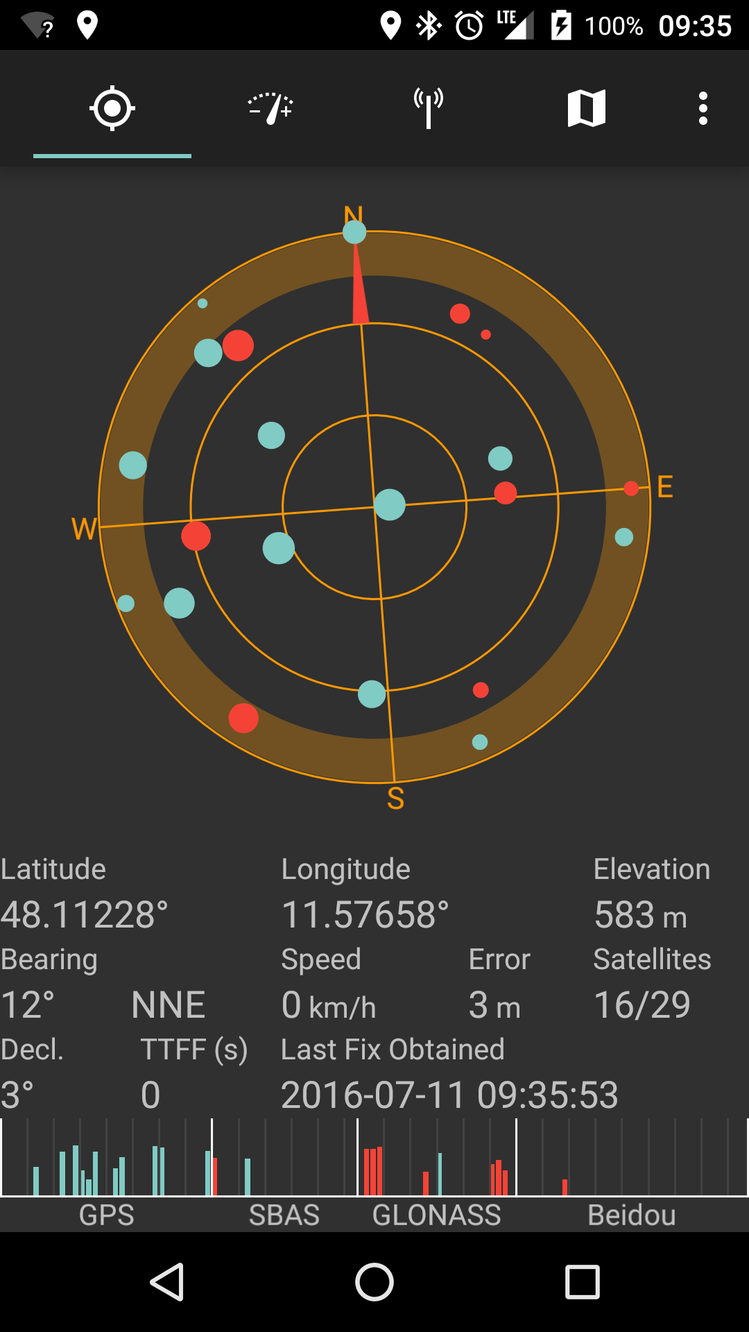
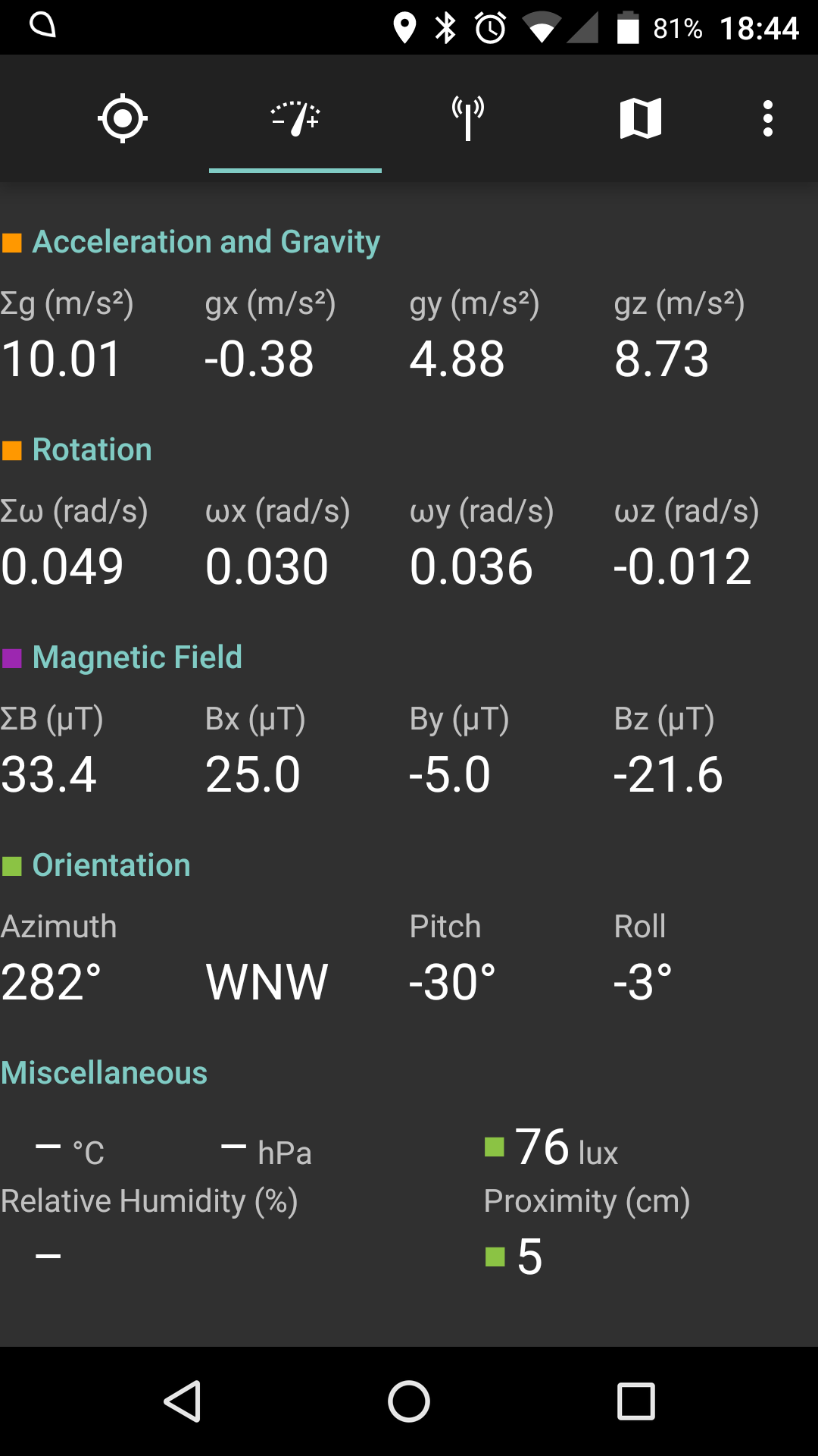
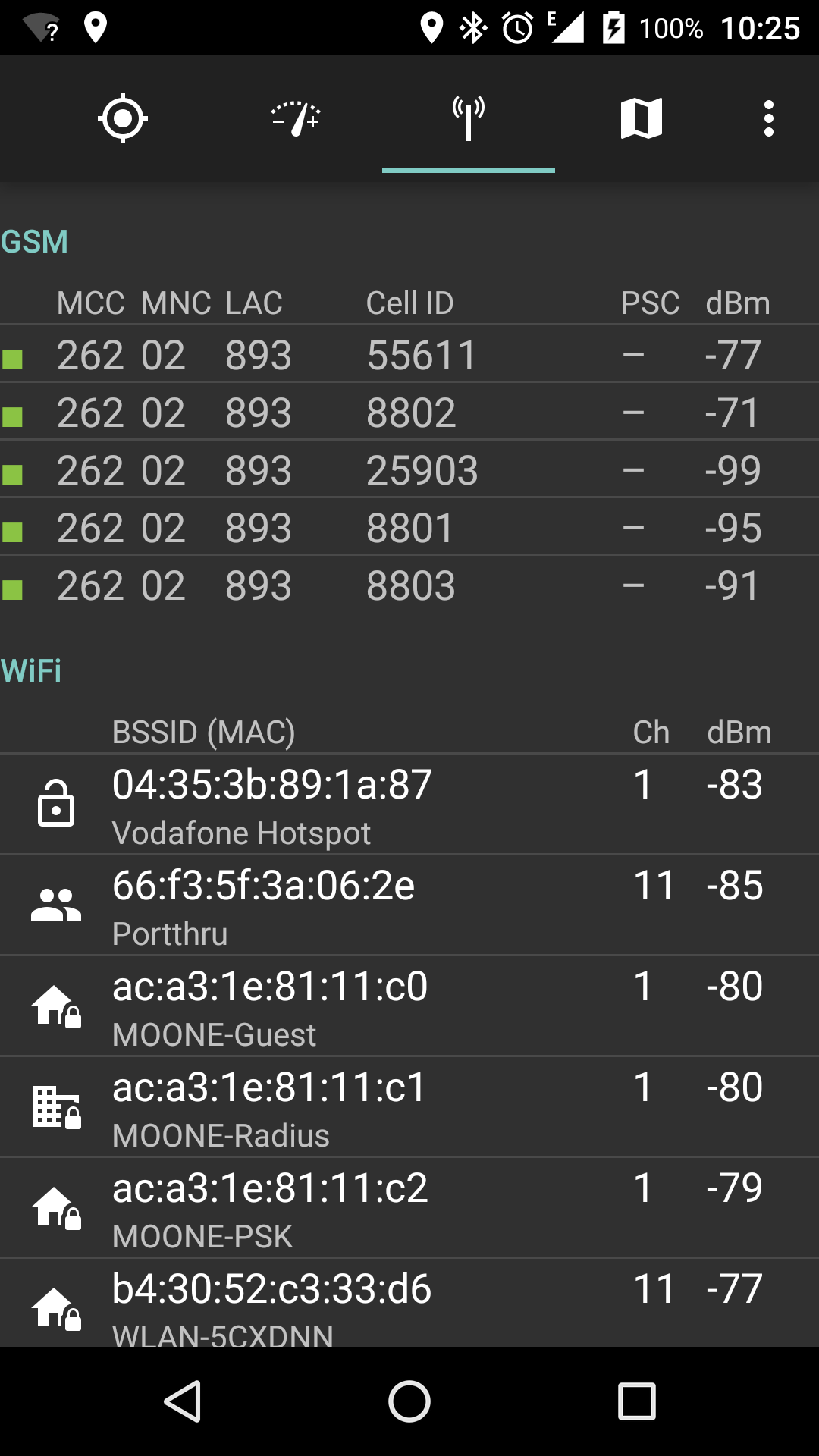
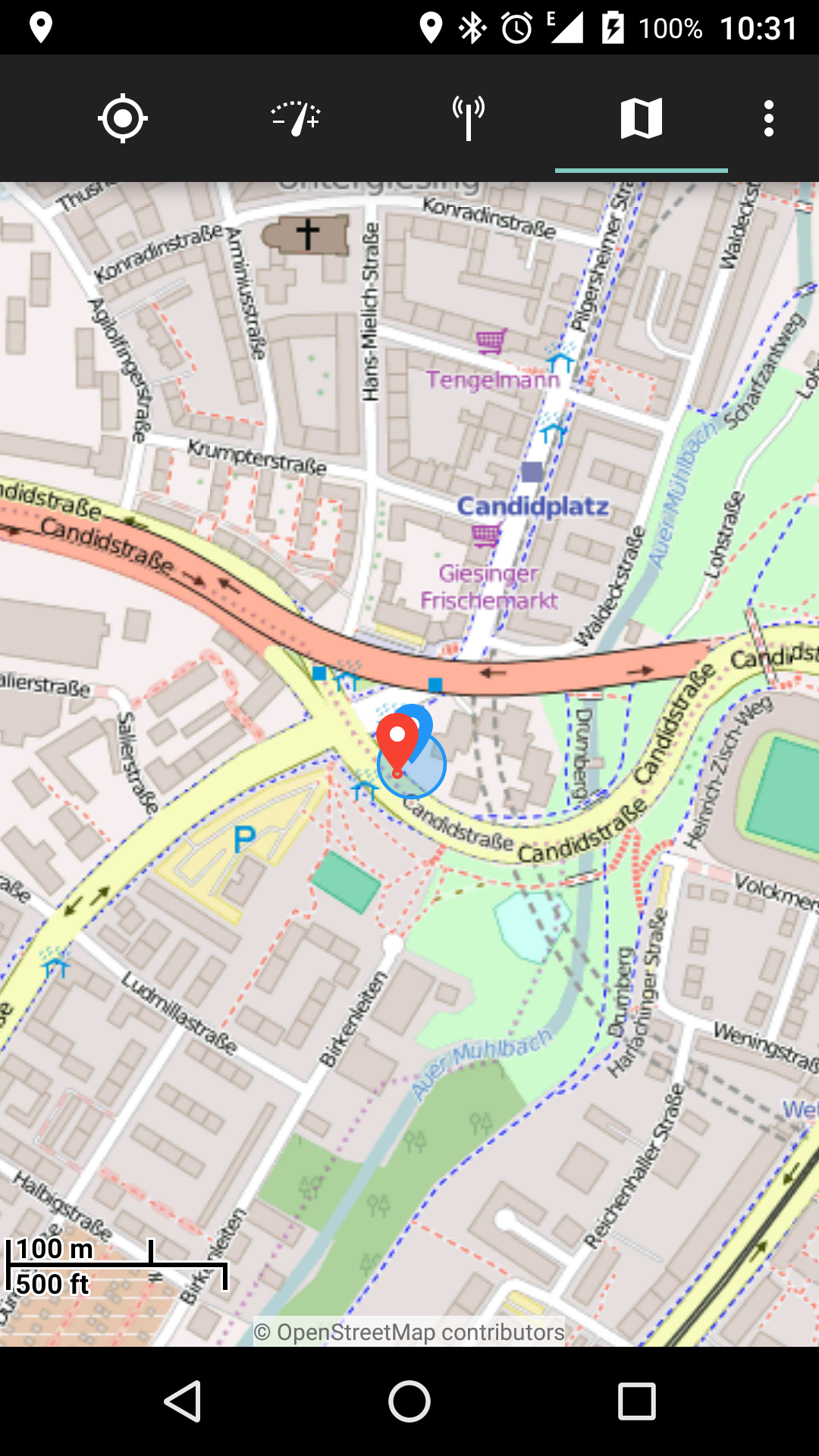
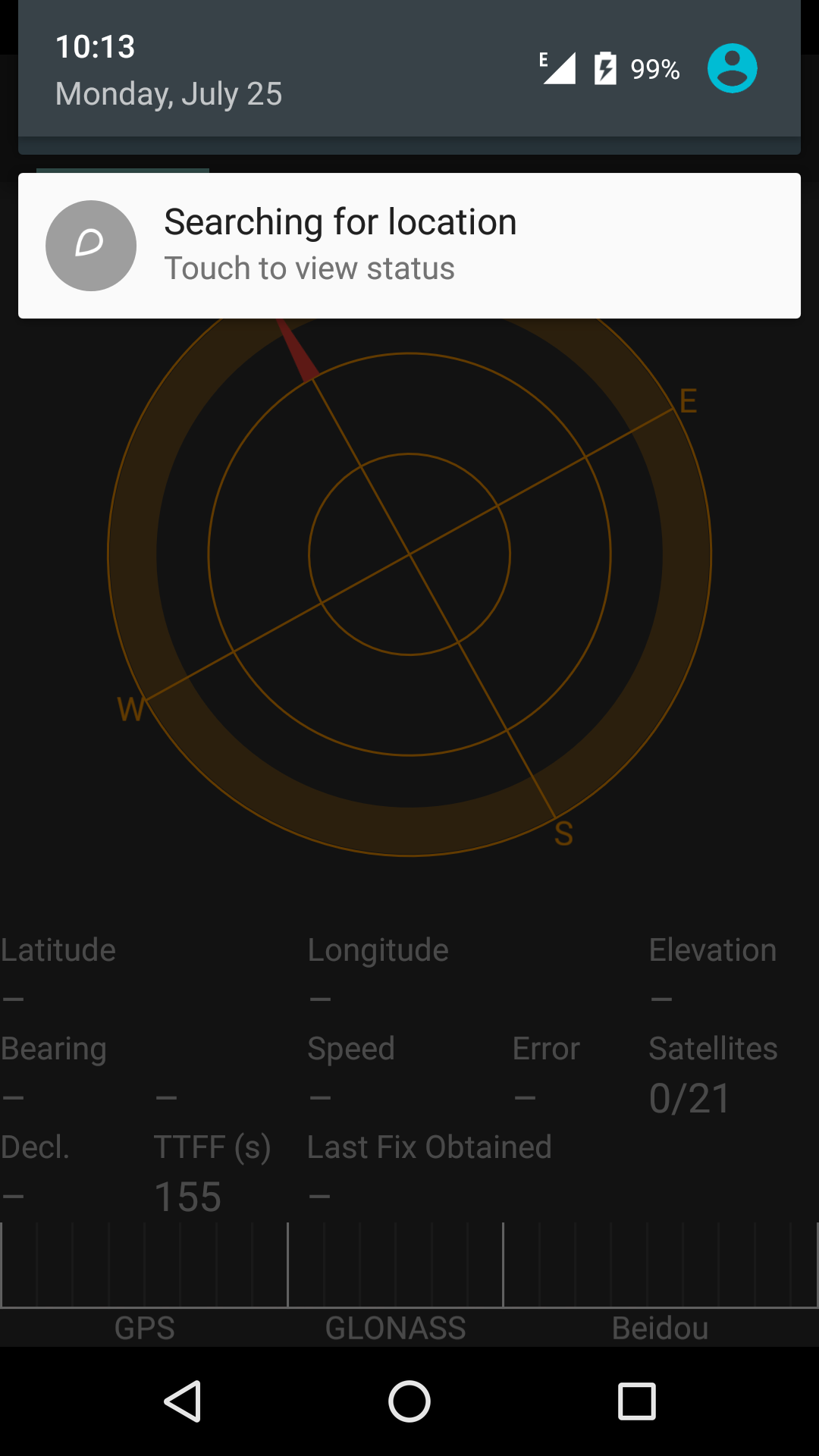
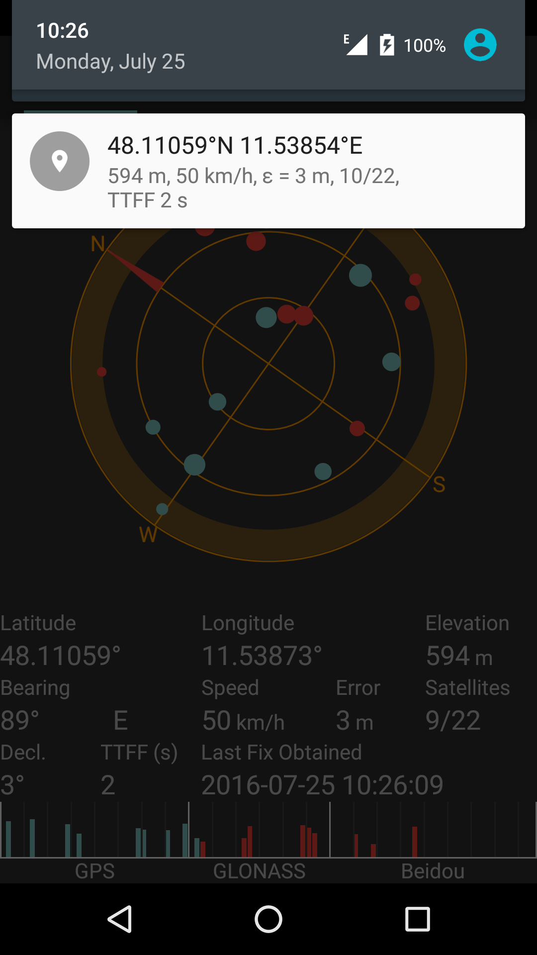 ================================================
FILE: build.gradle
================================================
buildscript {
repositories {
mavenCentral()
}
dependencies {
classpath 'com.android.tools.build:gradle:2.1.2'
}
}
apply plugin: 'com.android.application'
android {
compileSdkVersion 23
buildToolsVersion '25.0.0'
defaultConfig {
minSdkVersion 11
targetSdkVersion 23
}
packagingOptions {
exclude 'META-INF/LICENSE.txt'
exclude 'META-INF/NOTICE.txt'
}
sourceSets {
main {
manifest.srcFile 'AndroidManifest.xml'
java.srcDirs = ['src']
resources.srcDirs = ['src']
aidl.srcDirs = ['src']
renderscript.srcDirs = ['src']
res.srcDirs = ['res']
assets.srcDirs = ['assets']
}
}
lintOptions {
abortOnError false
}
repositories {
mavenCentral()
mavenLocal()
}
dependencies {
compile 'com.android.support:support-v4:23.2.1'
compile 'com.android.support:appcompat-v7:23.2.1'
compile 'com.android.support:design:23.2.1'
compile 'commons-net:commons-net:3.5'
compile 'org.mapsforge:mapsforge-core:0.9.1'
compile 'org.mapsforge:mapsforge-map:0.9.1'
compile 'org.mapsforge:mapsforge-map-reader:0.9.1'
compile 'org.mapsforge:mapsforge-themes:0.9.1'
compile 'org.mapsforge:mapsforge-map-android:0.9.1'
compile 'com.caverock:androidsvg:1.2.2-beta-1'
compile 'net.sf.kxml:kxml2:2.3.0'
}
}
================================================
FILE: metadata/en-US/changelogs/10.txt
================================================
Support for legacy (3.0+) Android versions (#1)
WiFi now displays channels (#2)
Sky plot now aligned correctly when display is rotated (#4)
================================================
FILE: metadata/en-US/changelogs/20.txt
================================================
AGPS data download
Support for 5 GHz WiFI frequencies (#9)
Tab navigation in action bar in addition to swiping
Prevent NPE when returning to main activity
Improved sizing for sky plot to avoid pushing vies off the screen (#6)
================================================
FILE: metadata/en-US/changelogs/2000.txt
================================================
Map view: new view to visualize reported locations
GPS view: display SNR bars for all known satellites (including Beidou and various SBAS systems)
Radio cell view: add support for LTE on Android versions that support it
Radio cell view: display neighboring cells correctly
Radio cell view: use CellInfo on Android versions that support it
Radio cell view: eliminate duplicate entries
Radio cell view: show PSC for UMTS cells
Radio cell view: display dashes instead of bogus values when data is missing
Notifications: animate icon while searching for location
Notifications: show correct TTFF
Notifications: update content after losing fix
About screen: show version
When crashing, write crash log file
Fix cases in which automatic AGPS download would fail silently (#38)
Update mobile network type even when no data connection is active (#30)
Fix screen orientation lock issue on landscape-default devices (#32)
Do not crash upon receiving location updates with NaN coordinates (#35)
Do not crash when radio is not connected
================================================
FILE: metadata/en-US/changelogs/2010.txt
================================================
Add option for metric vs. Imperial measurement units
Add option for UTC vs. local time for GPS timestamps
Add option to split UMTS/LTE cell IDs
Add options for various coordinate formats
Add Hungarian translations, thanks to kadarivan
Add legend for colors and symbols used
Size graphics depending on display density
Increase expiration delay for location providers
Target API 19
Introduce Material LAF
Include notice in AGPS message that success cannot be reported
RIL: use all available cell information sources
Preserve state of main activity when returning from another
Run media scanner on crash log files
Use friendly date and time for crash log files
RIL: display neighboring cells correctly
RIL: show correct signal strength
RIL: correctly separate LTE cells from GSM/UMTS cells
Fix Mapsforge crash
Fix color issue in Sensor view on Marshmallow
================================================
FILE: metadata/en-US/changelogs/2020.txt
================================================
Fix crashes when permissions are denied
Fix memory leak when stopping or destroying main Activity
================================================
FILE: metadata/en-US/changelogs/30.txt
================================================
Fix regression from 60b8bec pushing sky plot off screen in landscape
Log satellites with near-zero elevation/azimuth
================================================
FILE: metadata/en-US/changelogs/3000.txt
================================================
Support for offline maps, which can be shared with other Mapsforge apps (#65)
Add option to show both UMTS/LTE cell ID representations (#77)
Optionally show speed in knots (#74)
Label GNSS systems in satellite SNR bar graph (#64)
Different options to sort WiFis (#44)
Allow manual purging of map tile cache
Switch map tile provider from (discontinued) Mapquest to OSM (#86)
Fully support Android's new runtime permission model (#67)
Update to Mapsforge 0.6.1, now with proper persistent caching
Look and feel improvements
Fix faulty mph conversion in satellite view
Fix memory leak when rotating or leaving and re-entering map view
================================================
FILE: metadata/en-US/changelogs/3010.txt
================================================
Fix crash in Settings on API levels prior to 19 (#89)
Update French translation (thanks eliovir)
Use correct unit for speed in notification
================================================
FILE: metadata/en-US/changelogs/3020.txt
================================================
Update Portuguese translation
Fix crash in CDMA cell view
Fix nautic coordinate display
================================================
FILE: metadata/en-US/changelogs/3030.txt
================================================
Sky plot: make compass orientation work on devices with compass but no orientation sensor
Sky plot: add support for Galileo
Sky plot and notification: add support for UTM coordinates
Preferences: include a hint on map download source
Map download: keep notification after map download finishes
Map download: adapt to new directory layout on Mapsforge mirror server
Metadata: add feature graphics, icon and screenshots for F-Droid
Translations: updates for French and Hungarian
Bug fixes:
Sky plot: use Altitude consistently
Sky plot and notification: display negative coordinates correctly in non-decimal formats
Map view: fix crash caused by a rare race condition
Map download: do not crash if retrieving the map directory fails
Map download: correctly display map sizes above 2 GiB
Map download: display list correctly even after screen rotation
About screen: make links clickable
================================================
FILE: metadata/en-US/changelogs/40.txt
================================================
GPS status notification whenever an app accesses GPS (configurable)
Add signal-to-noise graph for GPS/GLONASS satellites
Translations: Catalan, German, Spanish, French, Italian, Lithuanian
Add NESW marks to sky plot
Lock display rotation when device is in near-horizontal position
Use sensor resolution to determine number of decimals displayed
Show build number in About screen
Fix dormant sizing bug in sky plot
================================================
FILE: metadata/en-US/changelogs/50.txt
================================================
Update AGPS data when connecting to a WiFi network (configurable)
Prevent crash when sensors report zero resolution
================================================
FILE: metadata/en-US/changelogs/60.txt
================================================
Prevent crash on AGPS update
================================================
FILE: metadata/en-US/changelogs/70.txt
================================================
Show cellular network type (#21)
Show type of WiFi encryption (#20)
Auto-refresh WiFi network list every second (#26)
Touch WiFi network to pin it to the top of the list (#26)
Hide empty cell list in network view
Choose from all available networks for AGPS auto-update (#18)
Check for captive portal before AGPS update attempt (#18)
Repeat AGPS auto-update each time the interval expires if a selected network is available (#18)
Fix minor screen real estate issue in German translation (#23)
Prevent crash upon switching to other activities (#27)
================================================
FILE: metadata/en-US/changelogs/80.txt
================================================
Fix time conversion error that could cause an endless AGPS update loop (#31)
Typo in French translation
Show TTFF in notification (experimental)
================================================
FILE: mkpng
================================================
#!/bin/bash
## Generates PNG drawables from all SVG files.
SVG_PATH=./extra
LDPI_PATH=./res/drawable-ldpi
MDPI_PATH=./res/drawable-mdpi
HDPI_PATH=./res/drawable-hdpi
XHDPI_PATH=./res/drawable-xhdpi
XXHDPI_PATH=./res/drawable-xxhdpi
# Android density bins are:
# LDPI: 120 dpi
# MDPI: 160 dpi
# HDPI: 240 dpi
# XHDPI: 320 dpi
# XXHDPI: 480 dpi
# Default for icons is 1 SVG user unit ("px") = 1 dp.
# However, both these units have their own conflicting definitions:
# - 1 SVG user units = 1 pixel at 90 dpi.
# - 1 dp = 1 pixel at MDPI (160 dpi).
# Therefore, SVG export needs to use the following dpi values:
LDPI_RES=67.5
MDPI_RES=90
HDPI_RES=135
XHDPI_RES=180
XXHDPI_RES=270
## Creates a single PNG file from a given input SVG file at the given DPI resolution.
##
## If the output file exists and is newer than the input file, no action is taken.
##
## @param $1 The input SVG filename (full path)
## @param $2 The output PNG filename (full path)
## @param $3 The resolution in DPI
function make_png_dpi {
if [[ -e $2 && $2 -nt $1 ]] ; then
echo Skipping $1 because $2 exists and is newer
else
echo inkscape --without-gui --export-area-page --export-dpi=$3 --export-png=$2 $1
inkscape --without-gui --export-area-page --export-dpi=$3 --export-png=$2 $1
fi
}
## Creates a single PNG file from a given input SVG file at the given width.
##
## If the output file exists and is newer than the input file, no action is taken.
##
## @param $1 The input SVG filename (full path)
## @param $2 The output PNG filename (full path)
## @param $3 The width in pixels
function make_png_width {
if [[ -e $2 && $2 -nt $1 ]] ; then
echo Skipping $1 because $2 exists and is newer
else
echo inkscape --without-gui --export-area-page --export-width=$3 --export-png=$2 $1
inkscape --without-gui --export-area-page --export-width=$3 --export-png=$2 $1
fi
}
## Converts a SVG icon to PNG drawables using the default of 1 px = 1 dip.
##
## @param $1 The input SVG filename (path stripped)
## @param $2 The output PNG filename (path stripped)
function convert_by_dpi {
baresvgfile=$1
barepngfile=$2
make_png_dpi $SVG_PATH/$baresvgfile $LDPI_PATH/$barepngfile $LDPI_RES
make_png_dpi $SVG_PATH/$baresvgfile $MDPI_PATH/$barepngfile $MDPI_RES
make_png_dpi $SVG_PATH/$baresvgfile $HDPI_PATH/$barepngfile $HDPI_RES
make_png_dpi $SVG_PATH/$baresvgfile $XHDPI_PATH/$barepngfile $XHDPI_RES
make_png_dpi $SVG_PATH/$baresvgfile $XXHDPI_PATH/$barepngfile $XXHDPI_RES
}
## Converts a SVG icon to PNG drawables using a specified width.
##
## @param $1 The input SVG filename (path stripped)
## @param $2 The output PNG filename (path stripped)
## @param $3 The width for the converted PNG files, in dip
function convert_by_width {
baresvgfile=$1
barepngfile=$2
width_mdpi=$3
# Derive other sizes from MDPI
# Ordered to do lossy operations (integer division) last
width_xhdpi=$(($width_mdpi * 2))
width_xxhdpi=$(($width_mdpi * 3))
width_hdpi=$(($width_xxhdpi / 2))
width_ldpi=$(($width_hdpi / 2))
make_png_width $SVG_PATH/$baresvgfile $LDPI_PATH/$barepngfile $width_ldpi
make_png_width $SVG_PATH/$baresvgfile $MDPI_PATH/$barepngfile $width_mdpi
make_png_width $SVG_PATH/$baresvgfile $HDPI_PATH/$barepngfile $width_hdpi
make_png_width $SVG_PATH/$baresvgfile $XHDPI_PATH/$barepngfile $width_xhdpi
make_png_width $SVG_PATH/$baresvgfile $XXHDPI_PATH/$barepngfile $width_xxhdpi
}
for svgfile in $SVG_PATH/*.svg
do
# strip path from file name
baresvgfile=${svgfile#$SVG_PATH/}
barepngfile=${baresvgfile%.svg}.png
case $baresvgfile in
ic_context_marker_*.svg)
convert_by_width $baresvgfile $barepngfile 32
;;
ic_launcher.svg|ic_launcher_oi_filemanager.svg)
convert_by_width $baresvgfile $barepngfile 48
;;
*)
convert_by_dpi $baresvgfile $barepngfile
esac
done
================================================
FILE: proguard-project.txt
================================================
# To enable ProGuard in your project, edit project.properties
# to define the proguard.config property as described in that file.
#
# Add project specific ProGuard rules here.
# By default, the flags in this file are appended to flags specified
# in ${sdk.dir}/tools/proguard/proguard-android.txt
# You can edit the include path and order by changing the ProGuard
# include property in project.properties.
#
# For more details, see
# http://developer.android.com/guide/developing/tools/proguard.html
# Add any project specific keep options here:
# If your project uses WebView with JS, uncomment the following
# and specify the fully qualified class name to the JavaScript interface
# class:
#-keepclassmembers class fqcn.of.javascript.interface.for.webview {
# public *;
#}
================================================
FILE: project.properties
================================================
# This file is automatically generated by Android Tools.
# Do not modify this file -- YOUR CHANGES WILL BE ERASED!
#
# This file must be checked in Version Control Systems.
#
# To customize properties used by the Ant build system edit
# "ant.properties", and override values to adapt the script to your
# project structure.
#
# To enable ProGuard to shrink and obfuscate your code, uncomment this (available properties: sdk.dir, user.home):
#proguard.config=${sdk.dir}/tools/proguard/proguard-android.txt:proguard-project.txt
# Project target.
target=android-23
android.library=false
android.library.reference.1=../../workspaces/satstat/libprojects/appcompat
android.library.reference.2=../../workspaces/satstat/libprojects/design
================================================
FILE: res/drawable/divider.xml
================================================
================================================
FILE: build.gradle
================================================
buildscript {
repositories {
mavenCentral()
}
dependencies {
classpath 'com.android.tools.build:gradle:2.1.2'
}
}
apply plugin: 'com.android.application'
android {
compileSdkVersion 23
buildToolsVersion '25.0.0'
defaultConfig {
minSdkVersion 11
targetSdkVersion 23
}
packagingOptions {
exclude 'META-INF/LICENSE.txt'
exclude 'META-INF/NOTICE.txt'
}
sourceSets {
main {
manifest.srcFile 'AndroidManifest.xml'
java.srcDirs = ['src']
resources.srcDirs = ['src']
aidl.srcDirs = ['src']
renderscript.srcDirs = ['src']
res.srcDirs = ['res']
assets.srcDirs = ['assets']
}
}
lintOptions {
abortOnError false
}
repositories {
mavenCentral()
mavenLocal()
}
dependencies {
compile 'com.android.support:support-v4:23.2.1'
compile 'com.android.support:appcompat-v7:23.2.1'
compile 'com.android.support:design:23.2.1'
compile 'commons-net:commons-net:3.5'
compile 'org.mapsforge:mapsforge-core:0.9.1'
compile 'org.mapsforge:mapsforge-map:0.9.1'
compile 'org.mapsforge:mapsforge-map-reader:0.9.1'
compile 'org.mapsforge:mapsforge-themes:0.9.1'
compile 'org.mapsforge:mapsforge-map-android:0.9.1'
compile 'com.caverock:androidsvg:1.2.2-beta-1'
compile 'net.sf.kxml:kxml2:2.3.0'
}
}
================================================
FILE: metadata/en-US/changelogs/10.txt
================================================
Support for legacy (3.0+) Android versions (#1)
WiFi now displays channels (#2)
Sky plot now aligned correctly when display is rotated (#4)
================================================
FILE: metadata/en-US/changelogs/20.txt
================================================
AGPS data download
Support for 5 GHz WiFI frequencies (#9)
Tab navigation in action bar in addition to swiping
Prevent NPE when returning to main activity
Improved sizing for sky plot to avoid pushing vies off the screen (#6)
================================================
FILE: metadata/en-US/changelogs/2000.txt
================================================
Map view: new view to visualize reported locations
GPS view: display SNR bars for all known satellites (including Beidou and various SBAS systems)
Radio cell view: add support for LTE on Android versions that support it
Radio cell view: display neighboring cells correctly
Radio cell view: use CellInfo on Android versions that support it
Radio cell view: eliminate duplicate entries
Radio cell view: show PSC for UMTS cells
Radio cell view: display dashes instead of bogus values when data is missing
Notifications: animate icon while searching for location
Notifications: show correct TTFF
Notifications: update content after losing fix
About screen: show version
When crashing, write crash log file
Fix cases in which automatic AGPS download would fail silently (#38)
Update mobile network type even when no data connection is active (#30)
Fix screen orientation lock issue on landscape-default devices (#32)
Do not crash upon receiving location updates with NaN coordinates (#35)
Do not crash when radio is not connected
================================================
FILE: metadata/en-US/changelogs/2010.txt
================================================
Add option for metric vs. Imperial measurement units
Add option for UTC vs. local time for GPS timestamps
Add option to split UMTS/LTE cell IDs
Add options for various coordinate formats
Add Hungarian translations, thanks to kadarivan
Add legend for colors and symbols used
Size graphics depending on display density
Increase expiration delay for location providers
Target API 19
Introduce Material LAF
Include notice in AGPS message that success cannot be reported
RIL: use all available cell information sources
Preserve state of main activity when returning from another
Run media scanner on crash log files
Use friendly date and time for crash log files
RIL: display neighboring cells correctly
RIL: show correct signal strength
RIL: correctly separate LTE cells from GSM/UMTS cells
Fix Mapsforge crash
Fix color issue in Sensor view on Marshmallow
================================================
FILE: metadata/en-US/changelogs/2020.txt
================================================
Fix crashes when permissions are denied
Fix memory leak when stopping or destroying main Activity
================================================
FILE: metadata/en-US/changelogs/30.txt
================================================
Fix regression from 60b8bec pushing sky plot off screen in landscape
Log satellites with near-zero elevation/azimuth
================================================
FILE: metadata/en-US/changelogs/3000.txt
================================================
Support for offline maps, which can be shared with other Mapsforge apps (#65)
Add option to show both UMTS/LTE cell ID representations (#77)
Optionally show speed in knots (#74)
Label GNSS systems in satellite SNR bar graph (#64)
Different options to sort WiFis (#44)
Allow manual purging of map tile cache
Switch map tile provider from (discontinued) Mapquest to OSM (#86)
Fully support Android's new runtime permission model (#67)
Update to Mapsforge 0.6.1, now with proper persistent caching
Look and feel improvements
Fix faulty mph conversion in satellite view
Fix memory leak when rotating or leaving and re-entering map view
================================================
FILE: metadata/en-US/changelogs/3010.txt
================================================
Fix crash in Settings on API levels prior to 19 (#89)
Update French translation (thanks eliovir)
Use correct unit for speed in notification
================================================
FILE: metadata/en-US/changelogs/3020.txt
================================================
Update Portuguese translation
Fix crash in CDMA cell view
Fix nautic coordinate display
================================================
FILE: metadata/en-US/changelogs/3030.txt
================================================
Sky plot: make compass orientation work on devices with compass but no orientation sensor
Sky plot: add support for Galileo
Sky plot and notification: add support for UTM coordinates
Preferences: include a hint on map download source
Map download: keep notification after map download finishes
Map download: adapt to new directory layout on Mapsforge mirror server
Metadata: add feature graphics, icon and screenshots for F-Droid
Translations: updates for French and Hungarian
Bug fixes:
Sky plot: use Altitude consistently
Sky plot and notification: display negative coordinates correctly in non-decimal formats
Map view: fix crash caused by a rare race condition
Map download: do not crash if retrieving the map directory fails
Map download: correctly display map sizes above 2 GiB
Map download: display list correctly even after screen rotation
About screen: make links clickable
================================================
FILE: metadata/en-US/changelogs/40.txt
================================================
GPS status notification whenever an app accesses GPS (configurable)
Add signal-to-noise graph for GPS/GLONASS satellites
Translations: Catalan, German, Spanish, French, Italian, Lithuanian
Add NESW marks to sky plot
Lock display rotation when device is in near-horizontal position
Use sensor resolution to determine number of decimals displayed
Show build number in About screen
Fix dormant sizing bug in sky plot
================================================
FILE: metadata/en-US/changelogs/50.txt
================================================
Update AGPS data when connecting to a WiFi network (configurable)
Prevent crash when sensors report zero resolution
================================================
FILE: metadata/en-US/changelogs/60.txt
================================================
Prevent crash on AGPS update
================================================
FILE: metadata/en-US/changelogs/70.txt
================================================
Show cellular network type (#21)
Show type of WiFi encryption (#20)
Auto-refresh WiFi network list every second (#26)
Touch WiFi network to pin it to the top of the list (#26)
Hide empty cell list in network view
Choose from all available networks for AGPS auto-update (#18)
Check for captive portal before AGPS update attempt (#18)
Repeat AGPS auto-update each time the interval expires if a selected network is available (#18)
Fix minor screen real estate issue in German translation (#23)
Prevent crash upon switching to other activities (#27)
================================================
FILE: metadata/en-US/changelogs/80.txt
================================================
Fix time conversion error that could cause an endless AGPS update loop (#31)
Typo in French translation
Show TTFF in notification (experimental)
================================================
FILE: mkpng
================================================
#!/bin/bash
## Generates PNG drawables from all SVG files.
SVG_PATH=./extra
LDPI_PATH=./res/drawable-ldpi
MDPI_PATH=./res/drawable-mdpi
HDPI_PATH=./res/drawable-hdpi
XHDPI_PATH=./res/drawable-xhdpi
XXHDPI_PATH=./res/drawable-xxhdpi
# Android density bins are:
# LDPI: 120 dpi
# MDPI: 160 dpi
# HDPI: 240 dpi
# XHDPI: 320 dpi
# XXHDPI: 480 dpi
# Default for icons is 1 SVG user unit ("px") = 1 dp.
# However, both these units have their own conflicting definitions:
# - 1 SVG user units = 1 pixel at 90 dpi.
# - 1 dp = 1 pixel at MDPI (160 dpi).
# Therefore, SVG export needs to use the following dpi values:
LDPI_RES=67.5
MDPI_RES=90
HDPI_RES=135
XHDPI_RES=180
XXHDPI_RES=270
## Creates a single PNG file from a given input SVG file at the given DPI resolution.
##
## If the output file exists and is newer than the input file, no action is taken.
##
## @param $1 The input SVG filename (full path)
## @param $2 The output PNG filename (full path)
## @param $3 The resolution in DPI
function make_png_dpi {
if [[ -e $2 && $2 -nt $1 ]] ; then
echo Skipping $1 because $2 exists and is newer
else
echo inkscape --without-gui --export-area-page --export-dpi=$3 --export-png=$2 $1
inkscape --without-gui --export-area-page --export-dpi=$3 --export-png=$2 $1
fi
}
## Creates a single PNG file from a given input SVG file at the given width.
##
## If the output file exists and is newer than the input file, no action is taken.
##
## @param $1 The input SVG filename (full path)
## @param $2 The output PNG filename (full path)
## @param $3 The width in pixels
function make_png_width {
if [[ -e $2 && $2 -nt $1 ]] ; then
echo Skipping $1 because $2 exists and is newer
else
echo inkscape --without-gui --export-area-page --export-width=$3 --export-png=$2 $1
inkscape --without-gui --export-area-page --export-width=$3 --export-png=$2 $1
fi
}
## Converts a SVG icon to PNG drawables using the default of 1 px = 1 dip.
##
## @param $1 The input SVG filename (path stripped)
## @param $2 The output PNG filename (path stripped)
function convert_by_dpi {
baresvgfile=$1
barepngfile=$2
make_png_dpi $SVG_PATH/$baresvgfile $LDPI_PATH/$barepngfile $LDPI_RES
make_png_dpi $SVG_PATH/$baresvgfile $MDPI_PATH/$barepngfile $MDPI_RES
make_png_dpi $SVG_PATH/$baresvgfile $HDPI_PATH/$barepngfile $HDPI_RES
make_png_dpi $SVG_PATH/$baresvgfile $XHDPI_PATH/$barepngfile $XHDPI_RES
make_png_dpi $SVG_PATH/$baresvgfile $XXHDPI_PATH/$barepngfile $XXHDPI_RES
}
## Converts a SVG icon to PNG drawables using a specified width.
##
## @param $1 The input SVG filename (path stripped)
## @param $2 The output PNG filename (path stripped)
## @param $3 The width for the converted PNG files, in dip
function convert_by_width {
baresvgfile=$1
barepngfile=$2
width_mdpi=$3
# Derive other sizes from MDPI
# Ordered to do lossy operations (integer division) last
width_xhdpi=$(($width_mdpi * 2))
width_xxhdpi=$(($width_mdpi * 3))
width_hdpi=$(($width_xxhdpi / 2))
width_ldpi=$(($width_hdpi / 2))
make_png_width $SVG_PATH/$baresvgfile $LDPI_PATH/$barepngfile $width_ldpi
make_png_width $SVG_PATH/$baresvgfile $MDPI_PATH/$barepngfile $width_mdpi
make_png_width $SVG_PATH/$baresvgfile $HDPI_PATH/$barepngfile $width_hdpi
make_png_width $SVG_PATH/$baresvgfile $XHDPI_PATH/$barepngfile $width_xhdpi
make_png_width $SVG_PATH/$baresvgfile $XXHDPI_PATH/$barepngfile $width_xxhdpi
}
for svgfile in $SVG_PATH/*.svg
do
# strip path from file name
baresvgfile=${svgfile#$SVG_PATH/}
barepngfile=${baresvgfile%.svg}.png
case $baresvgfile in
ic_context_marker_*.svg)
convert_by_width $baresvgfile $barepngfile 32
;;
ic_launcher.svg|ic_launcher_oi_filemanager.svg)
convert_by_width $baresvgfile $barepngfile 48
;;
*)
convert_by_dpi $baresvgfile $barepngfile
esac
done
================================================
FILE: proguard-project.txt
================================================
# To enable ProGuard in your project, edit project.properties
# to define the proguard.config property as described in that file.
#
# Add project specific ProGuard rules here.
# By default, the flags in this file are appended to flags specified
# in ${sdk.dir}/tools/proguard/proguard-android.txt
# You can edit the include path and order by changing the ProGuard
# include property in project.properties.
#
# For more details, see
# http://developer.android.com/guide/developing/tools/proguard.html
# Add any project specific keep options here:
# If your project uses WebView with JS, uncomment the following
# and specify the fully qualified class name to the JavaScript interface
# class:
#-keepclassmembers class fqcn.of.javascript.interface.for.webview {
# public *;
#}
================================================
FILE: project.properties
================================================
# This file is automatically generated by Android Tools.
# Do not modify this file -- YOUR CHANGES WILL BE ERASED!
#
# This file must be checked in Version Control Systems.
#
# To customize properties used by the Ant build system edit
# "ant.properties", and override values to adapt the script to your
# project structure.
#
# To enable ProGuard to shrink and obfuscate your code, uncomment this (available properties: sdk.dir, user.home):
#proguard.config=${sdk.dir}/tools/proguard/proguard-android.txt:proguard-project.txt
# Project target.
target=android-23
android.library=false
android.library.reference.1=../../workspaces/satstat/libprojects/appcompat
android.library.reference.2=../../workspaces/satstat/libprojects/design
================================================
FILE: res/drawable/divider.xml
================================================